 |
|
Location & QuickFacts
| FAA Information Effective: | 2008-09-25 |
| Airport Identifier: | 2H9 |
| Airport Status: | Operational |
| Longitude/Latitude: | 099-51-11.5170W/48-39-54.9980N
-99.853199/48.665277 (Estimated) |
| Elevation: | 1620 ft / 493.78 m (Estimated) |
| Land: | 47 acres |
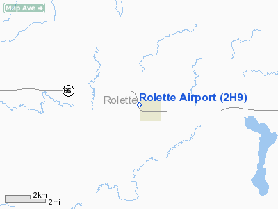
| From nearest city: | 1 nautical miles W of Rolette, ND |
| Location: | Rolette County, ND |
| Magnetic Variation: | 09E (1985) |
Owner & Manager
| Ownership: | Publicly owned |
| Owner: | Rolette Airport Authority |
| Address: | Box 399
Rolette, ND 58366 |
| Phone number: | 701-246-3700 |
| Manager: | Harlow Hageness
ADDNL CTC MARK MYHRE 701-246-3395/3317. |
| Address: | Box 399
Rolette, ND 58366 |
| Phone number: | 701-246-3700
ADL PHONE FOR MGR 1-800-437-2072 |
Airport Operations and Facilities
| Airport Use: | Open to public |
| Wind indicator: | Yes |
| Segmented Circle: | No |
| Control Tower: | No |
| Lighting Schedule: | RDO-CTL
ACTVT LIRL RY 15/33 - CTAF. |
| Landing fee charge: | No |
| Sectional chart: | Twin Cities |
| Region: | AGL - Great Lakes |
| Boundary ARTCC: | ZMP - Minneapolis |
| Tie-in FSS: | GFK - Grand Forks |
| FSS on Airport: | No |
| FSS Toll Free: | 1-800-WX-BRIEF |
| NOTAMs Facility: | GFK (NOTAM-d service avaliable) |
Airport Communications
Airport Services
| Airframe Repair: | NONE |
| Power Plant Repair: | NONE |
| Bottled Oxygen: | NONE |
| Bulk Oxygen: | NONE |
Runway Information
Runway 15/33
| Dimension: | 3700 x 40 ft / 1127.8 x 12.2 m |
| Surface: | ASPH, Good Condition |
| Weight Limit: | Single wheel: 8000 lbs. |
| Edge Lights: | Non-standard lighting system
LIRL NSTD SPACE 20 FT FROM RY EDGE & 2 FT HIGHER THAN RY ELEV. |
| |
Runway 15 |
Runway 33 |
| Longitude: | 099-51-17.0000W | 099-51-00.9600W |
| Latitude: | 48-40-10.0000N | 48-39-42.7900N |
| Elevation: | 1620.00 ft | 1620.00 ft |
| Traffic Pattern: | Left | Left |
| Markings: | Basic, Good Condition | Basic, Good Condition |
| Displaced threshold: | 0.00 ft | 300.00 ft |
| Obstruction: | 60 ft trees, 1600.0 ft from runway, 200 ft right of centerline, 23:1 slope to clear | 21 ft road, 200.0 ft from runway, 50 ft left of centerline
APCH RATIO 23:1 TO DSPLCD THLD.
+6 FT RD 180 FT FM THLD; 110 FT L OF EXTDD CNTRLN. |
|
Radio Navigation Aids
| ID |
Type |
Name |
Ch |
Freq |
Var |
Dist |
| RLL | NDB | Rolla | | 263.00 | 09E | 16.1 nm |
| RUG | NDB | Rugby | | 212.00 | 08E | 18.1 nm |
Remarks
- SNOW REMOVAL IREG; CONFIRM WINTER CONDITIONS WITH AMGR - CALL 701-246-3700.
- LOW FLYING MILITARY ACFT INVOF ARPT.
- RY 15 +21 FT ROAD VIOLATES TRANSITIONAL SFC ON W SIDE OF RY PROTECTION ZONE.
- WATERFOWL INVOF ARPT.
- PROVIDING IT MEETS 20:1 REQUIREMENT.
Images and information placed above are from
http://www.airport-data.com/airport/2H9/
We thank them for the data!
| General Info
|
| Country |
United States
|
| State |
NORTH DAKOTA
|
| FAA ID |
2H9
|
| Latitude |
48-39-54.998N
|
| Longitude |
099-51-11.517W
|
| Elevation |
1620 feet
|
| Near City |
ROLETTE
|
We don't guarantee the information is fresh and accurate. The data may
be wrong or outdated.
For more up-to-date information please refer to other sources.
|
|


