 |
|
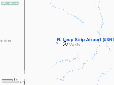
Location & QuickFacts
| FAA Information Effective: | 2008-09-25 |
| Airport Identifier: | 53ND |
| Airport Status: | Operational |
| Longitude/Latitude: | 099-56-49.4470W/47-32-52.9910N
-99.947069/47.548053 (Estimated) |
| Elevation: | 1894 ft / 577.29 m (Estimated) |
| Land: | 0 acres |
| From nearest city: | 7 nautical miles N of Hurdsfield, ND |
| Location: | Wells County, ND |
| Magnetic Variation: | 09E (1985) |
Owner & Manager
| Ownership: | Privately owned |
| Owner: | Betty Lou Wahl |
| Address: | 916 28th Ave Ne
Hurdsfield, ND 58451 |
| Phone number: | 701-324-4039 |
| Manager: | Betty Lou Wahl |
| Address: | 916 28th Ave Ne
Hurdsfield, ND 58451 |
| Phone number: | 701-324-4039 |
Airport Operations and Facilities
| Airport Use: | Private |
| Wind indicator: | No |
| Segmented Circle: | No |
| Control Tower: | No |
| Landing fee charge: | No |
| Sectional chart: | Twin Cities |
| Region: | AGL - Great Lakes |
| Boundary ARTCC: | ZMP - Minneapolis |
| Tie-in FSS: | GFK - Grand Forks |
| FSS on Airport: | No |
| FSS Toll Free: | 1-800-WX-BRIEF |
Runway Information
Runway 17/35
| Dimension: | 2000 x 75 ft / 609.6 x 22.9 m |
| Surface: | TURF, |
| |
Runway 17 |
Runway 35 |
| Traffic Pattern: | Left | Left |
|
Radio Navigation Aids
| ID |
Type |
Name |
Ch |
Freq |
Var |
Dist |
Remarks
- FILED FOR RECORD PURPOSES ONLY.
Images and information placed above are from
http://www.airport-data.com/airport/53ND/
We thank them for the data!
| General Info
|
| Country |
United States
|
| State |
NORTH DAKOTA
|
| FAA ID |
53ND
|
| Latitude |
47-32-52.991N
|
| Longitude |
099-56-49.447W
|
| Elevation |
1894 feet
|
| Near City |
HURDSFIELD
|
We don't guarantee the information is fresh and accurate. The data may
be wrong or outdated.
For more up-to-date information please refer to other sources.
|
|


