 |
|
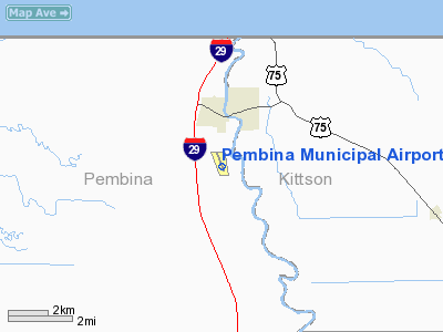
Location & QuickFacts
| FAA Information Effective: | 2008-09-25 |
| Airport Identifier: | PMB |
| Airport Status: | Operational |
| Longitude/Latitude: | 097-14-27.0000W/48-56-33.0000N
-97.240833/48.942500 (Estimated) |
| Elevation: | 795 ft / 242.32 m (Surveyed) |
| Land: | 225 acres |
| From nearest city: | 1 nautical miles S of Pembina, ND |
| Location: | Pembina County, ND |
| Magnetic Variation: | 06E (1985) |
Owner & Manager
| Ownership: | Publicly owned |
| Owner: | Pembina Airport Auth |
| Address: | 7753 Co Rd 4
Drayton, ND 58225 |
| Phone number: | 701-454-3997
CHMN ARPT AUTH; MARK HATLOY (701) 454-3875 OR 520-1841 |
| Manager: | Jon Fowler |
| Address: | Box 300
Warroad, MN 56763 |
| Phone number: | 218-843-2581 |
Airport Operations and Facilities
| Airport Use: | Open to public |
| Wind indicator: | Yes |
| Segmented Circle: | No |
| Control Tower: | No |
| Lighting Schedule: | RDO-CTL
ACTVT MIRL RY 15/33 & PAPI FOR RYS 15 & 33 - CTAF. |
| Landing fee charge: | No |
| Sectional chart: | Twin Cities |
| Region: | AGL - Great Lakes |
| Boundary ARTCC: | ZMP - Minneapolis |
| Tie-in FSS: | GFK - Grand Forks |
| FSS on Airport: | No |
| FSS Toll Free: | 1-800-WX-BRIEF |
| NOTAMs Facility: | GFK (NOTAM-d service avaliable) |
| Federal Agreements: | NGY |
Airport Communications
| CTAF: | 122.800 |
| Unicom: | 122.800 |
Airport Services
| Fuel available: | 100LLA
FUEL SERVICE 24 HOUR SELF SERVICE CREDIT CARD SYSTEM |
Runway Information
Runway 15/33
| Dimension: | 3800 x 75 ft / 1158.2 x 22.9 m
500 FT STOPWAY NORTH END. |
| Surface: | ASPH, Fair Condition |
| Weight Limit: | Single wheel: 12500 lbs. |
| Edge Lights: | Medium |
| |
Runway 15 |
Runway 33 |
| Longitude: | 097-14-36.0000W | 097-14-17.5000W |
| Latitude: | 48-56-51.0000N | 48-56-15.5000N |
| Elevation: | 0.00 ft | 794.00 ft |
| Alignment: | 127 | 127 |
| Traffic Pattern: | Left | Left |
| Markings: | Non-precision instrument, Good Condition | Non-precision instrument, Good Condition |
| Crossing Height: | 26.00 ft | 26.00 ft |
| VASI: | 2-light PAPI on left side | 2-light PAPI on left side |
| Visual Glide Angle: | 3.00° | 3.00° |
| Obstruction: | 15 ft road, 600.0 ft from runway, 250 ft left of centerline, 26:1 slope to clear | , 50:1 slope to clear |
|
Radio Navigation Aids
| ID |
Type |
Name |
Ch |
Freq |
Var |
Dist |
| LF | NDB | La Salle | | 336.00 | 08E | 42.1 nm |
| PFT | NDB | Piney Pinecreek | | 342.00 | 05E | 49.9 nm |
| HML | VORTAC | Humboldt | 071X | 112.40 | 09E | 6.6 nm |
Remarks
- CONFIRM WINTER CONDITIONS BEFORE USE WITH AMGR ON 218-843-5084 / 2581 OR MARK HATLOY 701-520-1841.
- RY 15/33 TWY TO APRON MARKED WITH NIGHT REFLECTOR POSTS.
- IRREGULAR SNOW REMOVAL
Images and information placed above are from
http://www.airport-data.com/airport/PMB/
We thank them for the data!
| General Info
|
| Country |
United States
|
| State |
NORTH DAKOTA
|
| FAA ID |
PMB
|
| Latitude |
48-56-33.000N
|
| Longitude |
097-14-27.000W
|
| Elevation |
795 feet
|
| Near City |
PEMBINA
|
We don't guarantee the information is fresh and accurate. The data may
be wrong or outdated.
For more up-to-date information please refer to other sources.
|
|


