 |
|
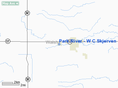
Park River - W C Skjerven Field Airport |
Location & QuickFacts
| FAA Information Effective: | 2008-09-25 |
| Airport Identifier: | Y37 |
| Airport Status: | Operational |
| Longitude/Latitude: | 097-46-50.8000W/48-23-38.7000N
-97.780778/48.394083 (Estimated) |
| Elevation: | 1104 ft / 336.50 m (Surveyed) |
| Land: | 171 acres |
| From nearest city: | 1 nautical miles W of Park River, ND |
| Location: | Walsh County, ND |
| Magnetic Variation: | 07E (1985) |
Owner & Manager
| Ownership: | Publicly owned |
| Owner: | Park River Airport Auth
GEORGE WALSTAD-CHRMN OF APT AUTH |
| Address: | 109 South Harris Ave
Park River, ND 58270 |
| Phone number: | 701-284-7893 |
| Manager: | Glen Wharam |
| Address: | Box 175
Park River, ND 58270 |
| Phone number: | 701-284-7303
MGRS HOME PHONE 701-284-7804 OR CELL 331-1110 |
Airport Operations and Facilities
| Airport Use: | Open to public |
| Wind indicator: | Yes |
| Segmented Circle: | Yes |
| Control Tower: | No |
| Lighting Schedule: | DUSK-DAWN
ACTVT MIRL RY 12/30 & PAPI RYS 12 & 30 - CTAF. |
| Beacon Color: | Clear-Green (lighted land airport)
ROTG BCN OTS INDEFLY. |
| Landing fee charge: | No |
| Sectional chart: | Twin Cities |
| Region: | AGL - Great Lakes |
| Boundary ARTCC: | ZMP - Minneapolis |
| Tie-in FSS: | GFK - Grand Forks |
| FSS on Airport: | No |
| FSS Toll Free: | 1-800-WX-BRIEF |
| NOTAMs Facility: | GFK (NOTAM-d service avaliable) |
| Federal Agreements: | NGY |
Airport Communications
| CTAF: | 122.800 |
| Unicom: | 122.800 |
Airport Services
| Fuel available: | 100LL
FOR FUEL CTC AMGR ON 701-284-7303 OR AFT HRS ON 701-284-7804 OR 331-1110 |
| Airframe Repair: | MAJOR |
| Power Plant Repair: | MAJOR |
| Bottled Oxygen: | NONE |
| Bulk Oxygen: | NONE |
Runway Information
Runway 03/21
| Dimension: | 2500 x 100 ft / 762.0 x 30.5 m |
| Surface: | TURF, Fair Condition |
| |
Runway 03 |
Runway 21 |
| Longitude: | 097-47-03.1506W | 097-46-38.1469W |
| Latitude: | 48-23-32.1618N | 48-23-50.3653N |
| Elevation: | 1103.00 ft | 1087.00 ft |
| Alignment: | 42 | 127 |
| Traffic Pattern: | Left | Left |
| Obstruction: | 40 ft trees, 600.0 ft from runway, 50 ft right of centerline, 15:1 slope to clear | 12 ft road, 130.0 ft from runway, 10:1 slope to clear |
|
Runway 12/30
| Dimension: | 3100 x 60 ft / 944.9 x 18.3 m |
| Surface: | ASPH, Fair Condition |
| Weight Limit: | Single wheel: 12000 lbs. |
| Edge Lights: | Medium |
| |
Runway 12 |
Runway 30 |
| Longitude: | 097-47-07.4232W | 097-46-34.2849W |
| Latitude: | 48-23-47.2282N | 48-23-26.0436N |
| Elevation: | 1104.00 ft | 1086.00 ft |
| Alignment: | 127 | 127 |
| Traffic Pattern: | Left | Left |
| Markings: | Basic, Good Condition | Basic, Good Condition |
| Crossing Height: | 25.00 ft | 25.00 ft |
| VASI: | 2-light PAPI on left side | 2-light PAPI on left side |
| Visual Glide Angle: | 3.00° | 3.00° |
| Obstruction: | 25 ft road, 750.0 ft from runway, 180 ft left of centerline, 22:1 slope to clear | 55 ft trees, 1150.0 ft from runway, 210 ft right of centerline, 17:1 slope to clear |
|
Radio Navigation Aids
| ID |
Type |
Name |
Ch |
Freq |
Var |
Dist |
| RDR | TACAN | Red River | 111X | | 06E | 30.3 nm |
| GFK | VOR/DME | Grand Forks | 090X | 114.30 | 09E | 35.6 nm |
| DVL | VOR/DME | Devils Lake | 047X | 111.00 | 07E | 48.3 nm |
| HML | VORTAC | Humboldt | 071X | 112.40 | 09E | 38.9 nm |
Remarks
- DEER ON & INVOF ARPT.
- RY 03/21 CLSD WINTER MONTHS DUE TO LACK OF SNOW REMOVAL.
- CONFIRM WINTER CONDS AFT MAJOR STORM WITH AMGR ON 701-284-7303/7804/6644/6755 OR 331-1110.
- ROTG BCN OTS INDEFLY.
Images and information placed above are from
http://www.airport-data.com/airport/Y37/
We thank them for the data!
| General Info
|
| Country |
United States
|
| State |
NORTH DAKOTA
|
| FAA ID |
Y37
|
| Latitude |
48-23-38.280N
|
| Longitude |
097-46-50.781W
|
| Elevation |
1103 feet
|
| Near City |
PARK RIVER
|
We don't guarantee the information is fresh and accurate. The data may
be wrong or outdated.
For more up-to-date information please refer to other sources.
|
|


