 |
|
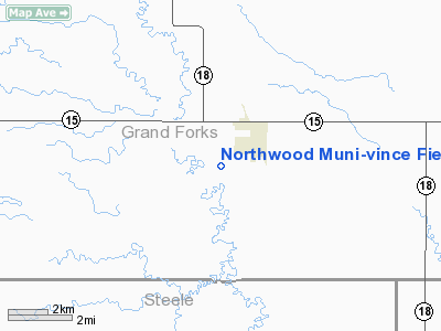
Northwood Muni-vince Field Airport |
Location & QuickFacts
| FAA Information Effective: | 2008-09-25 |
| Airport Identifier: | 4V4 |
| Airport Status: | Operational |
| Longitude/Latitude: | 097-35-25.5200W/47-43-27.2400N
-97.590422/47.724233 (Estimated) |
| Elevation: | 1117 ft / 340.46 m (Surveyed) |
| Land: | 52 acres |
| From nearest city: | 1 nautical miles SW of Northwood, ND |
| Location: | Grand Forks County, ND |
| Magnetic Variation: | 07E (1985) |
Owner & Manager
| Ownership: | Publicly owned |
| Owner: | Northwood Airport Authority
AIRPORT AUTHORITY CLERK. |
| Address: | Box 397
Northwood, ND 58267
CLERK OF AIRPORT AUTHORITY MARCIE DOUGLAS |
| Phone number: | 701-587-5370 |
| Manager: | Rich Altendorf |
| Address: | Box 521
Northwood, ND 58267 |
| Phone number: | 701-587-5171
AIRPORT MANAGERS HOME PHONE 701-587-6014 OR CELL 218-779-1242 |
Airport Operations and Facilities
| Airport Use: | Open to public |
| Wind indicator: | Yes |
| Segmented Circle: | Yes |
| Control Tower: | No |
| Lighting Schedule: | DUSK-DAWN
ACTVT MIRL RY 08/26 & PAPI RYS 08 & 26 - CTAF. |
| Beacon Color: | Clear-Green (lighted land airport) |
| Landing fee charge: | No |
| Sectional chart: | Twin Cities |
| Region: | AGL - Great Lakes |
| Boundary ARTCC: | ZMP - Minneapolis |
| Tie-in FSS: | GFK - Grand Forks |
| FSS on Airport: | No |
| FSS Toll Free: | 1-800-WX-BRIEF |
| NOTAMs Facility: | GFK (NOTAM-d service avaliable) |
| Federal Agreements: | NGY |
Airport Communications
| CTAF: | 122.800 |
| Unicom: | 122.800 |
Airport Services
| Fuel available: | 100LL |
| Airframe Repair: | MAJOR |
| Power Plant Repair: | MAJOR |
| Bottled Oxygen: | NONE |
| Bulk Oxygen: | NONE |
Runway Information
Runway 08/26
| Dimension: | 3160 x 60 ft / 963.2 x 18.3 m |
| Surface: | ASPH, Good Condition |
| Weight Limit: | Single wheel: 12500 lbs. |
| Edge Lights: | Medium |
| |
Runway 08 |
Runway 26 |
| Longitude: | 097-35-48.6200W | 097-35-02.4000W |
| Latitude: | 47-43-27.0500N | 47-43-27.4400N |
| Elevation: | 1116.00 ft | 1116.00 ft |
| Alignment: | 89 | 127 |
| Traffic Pattern: | Right | Left |
| Markings: | Basic, Fair Condition | Basic, Fair Condition |
| Crossing Height: | 26.00 ft | 28.00 ft |
| VASI: | 2-light PAPI on left side | 2-light PAPI on left side |
| Visual Glide Angle: | 3.00° | 3.00° |
| Runway End Identifier: | No | No |
| Centerline Lights: | No | No |
| Touchdown Lights: | No | No |
| Obstruction: | 42 ft trees, 1300.0 ft from runway, 26:1 slope to clear | 15 ft road, 500.0 ft from runway, 20:1 slope to clear |
|
Radio Navigation Aids
| ID |
Type |
Name |
Ch |
Freq |
Var |
Dist |
| CKN | NDB | Crookston | | 400.00 | 07E | 40.0 nm |
| RDR | TACAN | Red River | 111X | | 06E | 15.9 nm |
| GFK | VOR/DME | Grand Forks | 090X | 114.30 | 09E | 21.4 nm |
Remarks
- RY 08/26 MAY BE SNOW COVERED DURG WINTER MONTHS. CONFIRM WINTER CONDS WITH AMGR; 701-587-5171/CELL 218-779-1242.
- TWY REFLECTORS ONLY.
Images and information placed above are from
http://www.airport-data.com/airport/4V4/
We thank them for the data!
| General Info
|
| Country |
United States
|
| State |
NORTH DAKOTA
|
| FAA ID |
4V4
|
| Latitude |
47-43-27.240N
|
| Longitude |
097-35-25.520W
|
| Elevation |
1117 feet
|
| Near City |
NORTHWOOD
|
We don't guarantee the information is fresh and accurate. The data may
be wrong or outdated.
For more up-to-date information please refer to other sources.
|
|


