 |
|
Coordinates: 48°15′34″N 101°16′49″W / 48.25944°N 101.28028°W / 48.25944; -101.28028
| Minot International Airport |
| IATA: MOT – ICAO: KMOT – FAA LID: MOT |
| Summary |
| Airport type |
Public |
| Operator |
City of Minot |
| Location |
Minot, North Dakota |
| Elevation AMSL |
1,716 ft / 523 m |
| Website |
web.ci.minot.nd.us/airport/ |
| Runways |
| Direction |
Length |
Surface |
| ft |
m |
| 13/31 |
7,700 |
2,347 |
Concrete |
| 8/26 |
6,350 |
1,935 |
Asphalt |
| Statistics (2007) |
| Aircraft operations |
42,474 |
| Source: FAA and airport web site |
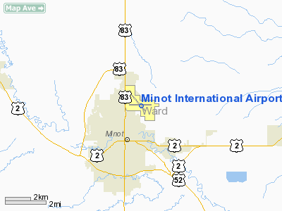
Minot International Airport (IATA: MOT, ICAO: KMOT, FAA LID: MOT) is a public airport located two miles (3 km) north of the central business district of Minot, a city in Ward County, North Dakota, United States. It is owned by the City of Minot.
Scheduled passenger service to the airport is currently provided by Delta Air Lines, with five flights to and from Minneapolis-Saint Paul International Airport and two flights to and from Salt Lake City International Airport. United Airlines became the airport's second airline beginning in June with service to Denver International Airport.
Customs service is available for aircraft arriving from Canada and other countries. Minot International has no scheduled passenger airline service out of the country but receives its international title (like many other airports) because of this customs service. The TSA fully searches all passengers and carry-on luggage prior to boarding, rather than using a selective process as is the case at major airports. Facilities and aircraft
Minot International Airport covers an area of 1,430 acres (579 ha) which contains two runways: 13/31 with a 7,700 x 150 ft (2,347 x 46 m) concrete surface and 8/26 with a 6,350 x 100 ft (1,935 x 30 m) asphalt surface. For the 12-month period ending September 30, 2007, the airport had 42,474 aircraft operations, an average of 116 per day: 70% general aviation, 14% air taxi, 11% military and 5% scheduled commercial.
Pietsch Aviation and Bessette Aviation are based at the airport, both offer flight training and general aircraft services. There is a BP-branded fueling station. The City of Minot operates a general aviation terminal with flight service operations.
Airlines and destinations
| Airlines |
Destinations |
| Delta Connection operated by Compass Airlines |
Minneapolis/St. Paul |
| Delta Connection operated by SkyWest Airlines |
Salt Lake City [ends October 4], Minneapolis/St. Paul |
| United Express operated by SkyWest Airlines |
Denver |
| Allegiant Air |
Las Vegas [begins October 22] |
The above content comes from Wikipedia and is published under free licenses – click here to read more.
Location & QuickFacts
| FAA Information Effective: | 2008-09-25 |
| Airport Identifier: | MOT |
| Airport Status: | Operational |
| Longitude/Latitude: | 101-16-40.9000W/48-15-27.5000N
-101.278028/48.257639 (Estimated) |
| Elevation: | 1716 ft / 523.04 m (Surveyed) |
| Land: | 1430 acres |
| From nearest city: | 2 nautical miles N of Minot, ND |
| Location: | Ward County, ND |
| Magnetic Variation: | 10E (1990) |
Owner & Manager
| Ownership: | Publicly owned |
| Owner: | City Of Minot |
| Address: | 25 Airport Rd
Minot, ND 58703 |
| Phone number: | 701-857-4724 |
| Manager: | Patrick Dame |
| Address: | 25 Airport Rd
Minot, ND 58703 |
| Phone number: | 701-857-4724 |
Airport Operations and Facilities
| Airport Use: | Open to public |
| Wind indicator: | Yes |
| Segmented Circle: | Yes |
| Control Tower: | Yes |
| Lighting Schedule: | DUSK-DAWN
WHEN ATCT IS CLSD ACTVT HIRL RYS 08/26 & 13/31; REIL RYS 08,26 ; MALSR RY 31 - CTAF. PAPI RYS 08, 26 & 13 OPER 24 HRS. |
| Beacon Color: | Clear-Green (lighted land airport) |
| Landing fee charge: | Yes
LANDING FEE FOR ACFT OVER 12500 LBS. |
| Sectional chart: | Billings |
| Region: | AGL - Great Lakes |
| Boundary ARTCC: | ZMP - Minneapolis |
| Tie-in FSS: | GFK - Grand Forks |
| FSS on Airport: | No |
| FSS Toll Free: | 1-800-WX-BRIEF |
| NOTAMs Facility: | MOT (NOTAM-d service avaliable) |
| Certification type/date: | I B S 05/1973
CLSD TO UNSKED ACR OPNS WITH MORE THAN 30 PSGR SEATS EXCP PPR CALL AMGR 701-857-4724. |
| Federal Agreements: | NGY3 |
Airport Communications
| CTAF: | 118.200 |
| Unicom: | 122.950 |
Airport Services
| Fuel available: | 100LLA |
| Airframe Repair: | MAJOR |
| Power Plant Repair: | MAJOR |
| Bottled Oxygen: | HIGH |
Runway Information
Runway 08/26
| Dimension: | 6351 x 100 ft / 1935.8 x 30.5 m |
| Surface: | ASPH, Fair Condition |
| Surface Treatment: | Saw-cut or plastic Grooved |
| Weight Limit: | Single wheel: 120000 lbs.
Dual wheel: 150000 lbs.
Dual tandem wheel: 240000 lbs. |
| Edge Lights: | High |
| |
Runway 08 |
Runway 26 |
| Longitude: | 101-17-26.8602W | 101-15-53.0144W |
| Latitude: | 48-15-28.9520N | 48-15-28.6834N |
| Elevation: | 1716.00 ft | 1658.00 ft |
| Alignment: | 90 | 127 |
| Traffic Pattern: | Left | Left |
| Markings: | Non-precision instrument, Good Condition | Non-precision instrument, Good Condition |
| Crossing Height: | 49.00 ft | 50.00 ft |
| Displaced threshold: | 393.00 ft | 0.00 ft |
| VASI: | 4-light PAPI on left side | 4-light PAPI on left side |
| Visual Glide Angle: | 3.00° | 3.00° |
| Runway End Identifier: | Yes | Yes |
| Centerline Lights: | No | No |
| Touchdown Lights: | No | No |
| Obstruction: | 81 ft trees, 1764.0 ft from runway, 616 ft left of centerline, 19:1 slope to clear
RWY 08 APCH RATIO 24:1 FM DSPLCD THLD. | , 50:1 slope to clear |
|
Runway 13/31
| Dimension: | 7700 x 150 ft / 2347.0 x 45.7 m |
| Surface: | CONC, Good Condition |
| Surface Treatment: | Saw-cut or plastic Grooved |
| Weight Limit: | Single wheel: 120000 lbs.
Dual wheel: 150000 lbs.
Dual tandem wheel: 240000 lbs. |
| Edge Lights: | High |
| |
Runway 13 |
Runway 31 |
| Longitude: | 101-17-19.4627W | 101-16-03.9122W |
| Latitude: | 48-15-54.8982N | 48-14-58.0873N |
| Elevation: | 1702.00 ft | 1657.00 ft |
| Alignment: | 127 | 127 |
| ILS Type: | | ILS/DME
|
| Traffic Pattern: | Left | Left |
| Markings: | Precision instrument, Good Condition | Precision instrument, Good Condition |
| VASI: | 4-light PAPI on left side | |
| RVR Equipment: | | touchdown |
| Approach lights: | | MALSR |
| Runway End Identifier: | No | No |
| Centerline Lights: | No | No |
| Touchdown Lights: | No | No |
|
Radio Navigation Aids
| ID |
Type |
Name |
Ch |
Freq |
Var |
Dist |
| HBC | NDB | Mohall | | 350.00 | 11E | 32.1 nm |
| PSH | NDB | Parshall | | 379.00 | 11E | 39.5 nm |
| MIB | TACAN | Deering | 096X | | 10E | 10.1 nm |
| MOT | VORTAC | Minot | 118X | 117.10 | 13E | 0.4 nm |
Remarks
- DEER & BIRDS ON & INVOF ARPT.
- TWYS D/E/B2 RESTRICTED TO 12500 LBS OR LESS & ARE MARKED WITH EDGE REFLECTORS.
- CUSTOMS SVC AVBL 24 HRS; FOR CUSTOMS CALL 701-838-6704.
- TWYS D/E/B2 NOT AVBL FOR ACR OPNS WITH MORE THAN 30 PSGR SEATS.
- MINOT AFB (MIB) ASR OTS FOR PREVENTIVE MAINTENANCE FRIDAYS 0700-0900 & ALTN TUESDAYS 0630-0830.
- (DSPL THR ELEV DATUM, RWY 08) CONVERTED TO NAVD88 ON 18 OCT 2002 USING VERTCON FM NGS.
Images and information placed above are from
http://www.airport-data.com/airport/MOT/
We thank them for the data!
| General Info
|
| Country |
United States
|
| State |
NORTH DAKOTA
|
| FAA ID |
MOT
|
| Latitude |
48-15-33.760N
|
| Longitude |
101-16-49.202W
|
| Elevation |
1716 feet
|
| Near City |
MINOT
|
We don't guarantee the information is fresh and accurate. The data may
be wrong or outdated.
For more up-to-date information please refer to other sources.
|
|


