 |
|
Location & QuickFacts
| FAA Information Effective: | 2008-09-25 |
| Airport Identifier: | 8M6 |
| Airport Status: | Operational |
| Longitude/Latitude: | 098-11-11.3550W/47-46-58.9840N
-98.186487/47.783051 (Estimated) |
| Elevation: | 1473 ft / 448.97 m (Estimated) |
| Land: | 90 acres |
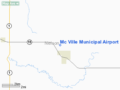
| From nearest city: | 1 nautical miles NW of Mc Ville, ND |
| Location: | Nelson County, ND |
| Magnetic Variation: | 07E (1985) |
Owner & Manager
| Ownership: | Publicly owned |
| Owner: | City Of Mc Ville |
| Address: | Box 275
Mc Ville, ND 58254 |
| Phone number: | 701-322-4372
CITY HALL OR CONTACT CITY AUDITOR 701-322-4392. |
| Manager: | Mike Schindele |
| Address: | Box 116
Tolna, ND 58380 |
| Phone number: | 701-262-4927
ADDL ARPT AUTH CONTACTS 701-326-4205 OR 322-5515 OR 262-4927. |
Airport Operations and Facilities
| Airport Use: | Open to public |
| Wind indicator: | Yes |
| Segmented Circle: | No |
| Control Tower: | No |
| Lighting Schedule: | PHONE REQ
FOR LIRL RY 13/31 CALL 701-322-4372/4392. |
| Landing fee charge: | No |
| Sectional chart: | Twin Cities |
| Region: | AGL - Great Lakes |
| Boundary ARTCC: | ZMP - Minneapolis |
| Tie-in FSS: | GFK - Grand Forks |
| FSS on Airport: | No |
| FSS Toll Free: | 1-800-WX-BRIEF |
| NOTAMs Facility: | GFK (NOTAM-d service avaliable) |
Airport Communications
Airport Services
| Airframe Repair: | NONE |
| Power Plant Repair: | NONE |
| Bottled Oxygen: | NONE |
| Bulk Oxygen: | NONE |
Runway Information
Runway 13/31
| Dimension: | 2230 x 100 ft / 679.7 x 30.5 m
200 FT TURF STWY ON NW END & 500 FT TURF STWY ON SE END; RYS 13/31 & 18/36 GRASS CUT INFREQUENTLY WITH POSSIBLE HIGH GROWTH. |
| Surface: | TURF, Fair Condition
TURF SFC ROLLING. |
| Edge Lights: | Non-standard lighting system
NSTD LIRL RY 13/31, NOT FAA APPROVED L-800 SERIES. LIRL RY 13/31 OTS INDEFLY. |
| |
Runway 13 |
Runway 31 |
| Longitude: | 098-11-22.2800W | 098-11-03.5600W |
| Latitude: | 47-46-22.3800N | 47-46-04.3500N |
| Elevation: | 1461.00 ft | 1463.00 ft |
| Alignment: | 127 | 127 |
| Traffic Pattern: | Left | Left |
| Markings: | None, | None, |
| Runway End Identifier: | No | No |
| Centerline Lights: | No | No |
| Touchdown Lights: | No | No |
| Obstruction: | 20 ft road, 200.0 ft from runway, 10:1 slope to clear | 50 ft poles, 700.0 ft from runway, 14:1 slope to clear |
|
Runway 18/36
| Dimension: | 2500 x 90 ft / 762.0 x 27.4 m
200 FT TURF STWY ON NW END & 500 FT TURF STWY ON SE END; RYS 13/31 & 18/36 GRASS CUT INFREQUENTLY WITH POSSIBLE HIGH GROWTH. |
| Surface: | TURF, Fair Condition
TURF SFC ROLLING. |
| |
Runway 18 |
Runway 36 |
| Longitude: | 098-10-59.3600W | 098-10-59.3600W |
| Latitude: | 47-46-24.9800N | 47-46-00.3100N |
| Elevation: | 1473.00 ft | 1473.00 ft |
| Traffic Pattern: | Left | Left |
| Markings: | None, | None, |
| Runway End Identifier: | No | No |
| Centerline Lights: | No | No |
| Touchdown Lights: | No | No |
| Obstruction: | 19 ft road, 80.0 ft from runway, 4:1 slope to clear | 18 ft road, 90.0 ft from runway, 5:1 slope to clear |
|
Radio Navigation Aids
| ID |
Type |
Name |
Ch |
Freq |
Var |
Dist |
| RDR | TACAN | Red River | 111X | | 06E | 33.2 nm |
| DVL | VOR/DME | Devils Lake | 047X | 111.00 | 07E | 35.4 nm |
| GFK | VOR/DME | Grand Forks | 090X | 114.30 | 09E | 41.7 nm |
Remarks
- RY18/36 & RY 13/31 NO SNOW REMOVAL. CTC AMGR 701-322-4372 PRIOR TO USE.
- WINDSOCK PENETRATES 20:1 APCH CLEARANCE RY 31.
- RWY 18/36: +3'ROAD PENETRATES TRSN SFC 7:1 RATIO.
- LIRL 13/31 OTS INDEFLY.
- PRVDD AN OBSTN-FREE PRIM SFC 125' EACH SIDE OF RWY CNTRLN IS ESTABD. IF THERE ARE OBSTNS IN THE APCH AREAS THAT CANNOT BE LOWERED OR REMOVED; THE RWY THRS ARE LCTD SO AS TO PRVD 20:1 CLEARANCE OVER ALL OBSTNS.
Images and information placed above are from
http://www.airport-data.com/airport/8M6/
We thank them for the data!
| General Info
|
| Country |
United States
|
| State |
NORTH DAKOTA
|
| FAA ID |
8M6
|
| Latitude |
47-46-58.984N
|
| Longitude |
098-11-11.355W
|
| Elevation |
1473 feet
|
| Near City |
MC VILLE
|
We don't guarantee the information is fresh and accurate. The data may
be wrong or outdated.
For more up-to-date information please refer to other sources.
|
|


