 |
|
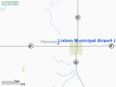
Location & QuickFacts
| FAA Information Effective: | 2008-09-25 |
| Airport Identifier: | 6L3 |
| Airport Status: | Operational |
| Longitude/Latitude: | 097-43-41.7655W/46-26-47.7893N
-97.728268/46.446608 (Estimated) |
| Elevation: | 1232 ft / 375.51 m (Surveyed) |
| Land: | 130 acres |
| From nearest city: | 2 nautical miles W of Lisbon, ND |
| Location: | Ransom County, ND |
| Magnetic Variation: | 07E (1985) |
Owner & Manager
| Ownership: | Publicly owned |
| Owner: | Lisbon Airport Authority
CHAIRMAN OF APT AUTHORITY NANCY SITZ 701-680-9176 |
| Address: | Po Box 1079
Lisbon, ND 58054 |
| Phone number: | 701-683-4140
CITY HALL OF LISBON |
| Manager: | Anthony Anderson |
| Address: | 12004 71 Street Southeast
Englevale, ND 58033 |
| Phone number: | 701-680-0725
AIRPORT TERMINAL PHONE 701-683-5501 |
Airport Operations and Facilities
| Airport Use: | Open to public |
| Wind indicator: | Yes |
| Segmented Circle: | No |
| Control Tower: | No |
| Lighting Schedule: | DUSK-DAWN
ACTVT MIRL RY 14/32 & PAPI RYS 14 & 32 - CTAF. |
| Beacon Color: | Clear-Green (lighted land airport) |
| Landing fee charge: | No |
| Sectional chart: | Twin Cities |
| Region: | AGL - Great Lakes |
| Boundary ARTCC: | ZMP - Minneapolis |
| Tie-in FSS: | GFK - Grand Forks |
| FSS on Airport: | No |
| FSS Toll Free: | 1-800-WX-BRIEF |
| NOTAMs Facility: | GFK (NOTAM-d service avaliable) |
Airport Communications
Airport Services
Runway Information
Runway 03/21
| Dimension: | 1820 x 100 ft / 554.7 x 30.5 m |
| Surface: | TURF, Good Condition |
| |
Runway 03 |
Runway 21 |
| Longitude: | 097-43-50.1800W | 097-43-37.2000W |
| Latitude: | 46-26-31.4500N | 46-26-47.0000N |
| Elevation: | 1240.00 ft | 1220.00 ft |
| Traffic Pattern: | Left | Left |
| Markings: | None,
DALGT CORNER MARKER. | None, |
| Runway End Identifier: | No | No |
| Centerline Lights: | No | No |
| Touchdown Lights: | No | No |
| Obstruction: | 18 ft road, 235.0 ft from runway, 150 ft right of centerline, 13:1 slope to clear | , 50:1 slope to clear |
|
Runway 14/32
| Dimension: | 3399 x 60 ft / 1036.0 x 18.3 m |
| Surface: | ASPH, Good Condition |
| Weight Limit: | Single wheel: 12500 lbs. |
| Edge Lights: | Medium |
| |
Runway 14 |
Runway 32 |
| Longitude: | 097-43-52.8650W | 097-43-28.6245W |
| Latitude: | 46-27-06.9150N | 46-26-37.8508N |
| Elevation: | 1232.00 ft | 1225.00 ft |
| Traffic Pattern: | Left | Left |
| Markings: | Non-precision instrument, Good Condition | Non-precision instrument, Good Condition |
| Crossing Height: | 25.00 ft | 25.00 ft |
| VASI: | 2-light PAPI on left side | 2-light PAPI on left side |
| Visual Glide Angle: | 3.00° | 3.00° |
| Runway End Identifier: | | No |
| Centerline Lights: | | No |
| Touchdown Lights: | | No |
| Obstruction: | , 50:1 slope to clear | 20 ft road, 670.0 ft from runway, 15 ft right of centerline, 23:1 slope to clear |
|
Radio Navigation Aids
| ID |
Type |
Name |
Ch |
Freq |
Var |
Dist |
| GWR | NDB | Gwinner | | 278.00 | 07E | 13.9 nm |
| VCY | NDB | Valley City | | 382.00 | 07E | 27.0 nm |
| BTN | NDB | Britton | | 386.00 | 06E | 37.7 nm |
| BWP | NDB | Breckenridge-wahpeton | | 233.00 | 05E | 48.2 nm |
| JMS | VOR/DME | Jamestown | 092X | 114.50 | 10E | 48.9 nm |
| FAR | VORTAC | Fargo | 109X | 116.20 | 09E | 40.6 nm |
Remarks
- CTC AMGR BEFORE USE AFTER WINTER STORM DUE TO IREG SNOW REMOVAL; CALL 701-680-0725 OR CITY SHOP MON-FRI 0800-1700 701-683-4525.
- ULTRALIGHT ACTIVITY ON OR NEAR VICINITY OF AIRPORT.
- RY 03/21 CLSD WINTER MONTHS DUE TO LACK OF SNOW REMOVAL.
- 4 FT TETRAHEDRON WITHIN 7:1 LATERAL CLNC ON RY 14/32.
- WEST ASPHALT APRON SFC POOR DUE TO SOFT AREAS & RUTS; ACFT WEIGHT ON APRON LIMITED TO 2000 LBS. NEW CONCRETE EAST APRON GOOD CONDITION AND SWL RATING 12,500 POUNDS.
- EXISTED PRIOR TO 1959.
Images and information placed above are from
http://www.airport-data.com/airport/6L3/
We thank them for the data!
| General Info
|
| Country |
United States
|
| State |
NORTH DAKOTA
|
| FAA ID |
6L3
|
| Latitude |
46-26-47.885N
|
| Longitude |
097-43-38.360W
|
| Elevation |
1240 feet
|
| Near City |
LISBON
|
We don't guarantee the information is fresh and accurate. The data may
be wrong or outdated.
For more up-to-date information please refer to other sources.
|
|


