 |
|
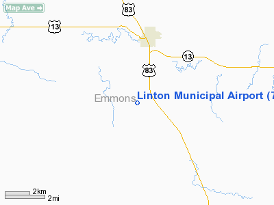
Location & QuickFacts
| FAA Information Effective: | 2008-09-25 |
| Airport Identifier: | 7L2 |
| Airport Status: | Operational |
| Longitude/Latitude: | 100-14-44.2459W/46-13-14.3072N
-100.245624/46.220641 (Estimated) |
| Elevation: | 1779 ft / 542.24 m (Surveyed) |
| Land: | 190 acres |
| From nearest city: | 3 nautical miles S of Linton, ND |
| Location: | Emmons County, ND |
| Magnetic Variation: | 09E (1985) |
Owner & Manager
| Ownership: | Publicly owned |
| Owner: | Linton Arpt Auth |
| Address: | Po Box 301
Linton, ND 58552
CLERK OF ARPT AUTH. |
| Phone number: | 701-782-4236
ARPT OFFICE PHONE 701-254-5449. |
| Manager: | Mike Gunia |
| Address: | 7390 4th Ave Se
Linton, ND 58552 |
| Phone number: | 701-254-5449
ADDNL PHONE 701-254-4155 OR MGR HOME PHONE 701-782-4236. |
Airport Operations and Facilities
| Airport Use: | Open to public |
| Wind indicator: | Yes |
| Segmented Circle: | Yes |
| Control Tower: | No |
| Lighting Schedule: | RDO-CTL
ACTVT MIRL RY 09/27 - CTAF. |
| Landing fee charge: | No |
| Sectional chart: | Twin Cities |
| Region: | AGL - Great Lakes |
| Boundary ARTCC: | ZMP - Minneapolis |
| Tie-in FSS: | GFK - Grand Forks |
| FSS on Airport: | No |
| FSS Toll Free: | 1-800-WX-BRIEF |
| NOTAMs Facility: | GFK (NOTAM-d service avaliable) |
| Federal Agreements: | NGY |
Airport Communications
Airport Services
| Fuel available: | 100LL
SELF SERVICE 24 HOUR CREDIT CARD FUEL SYSTEM AVAILABLE. |
| Airframe Repair: | MAJOR |
| Power Plant Repair: | MAJOR |
| Bottled Oxygen: | NONE |
| Bulk Oxygen: | NONE |
Runway Information
Runway 09/27
| Dimension: | 3700 x 60 ft / 1127.8 x 18.3 m |
| Surface: | ASPH, Good Condition |
| Weight Limit: | Single wheel: 12500 lbs. |
| Edge Lights: | Medium |
| |
Runway 09 |
Runway 27 |
| Longitude: | 100-15-09.5125W | 100-14-18.9792W |
| Latitude: | 46-13-19.3921N | 46-13-09.2223N |
| Elevation: | 1765.00 ft | 1778.00 ft |
| Traffic Pattern: | Left | Left |
| Markings: | Non-precision instrument, Good Condition | Non-precision instrument, Good Condition |
| Crossing Height: | 25.00 ft | 25.00 ft |
| VASI: | 2-light PAPI on left side | 2-light PAPI on left side |
| Visual Glide Angle: | 3.00° | 3.00° |
| Runway End Identifier: | No | No |
| Centerline Lights: | No | No |
| Touchdown Lights: | No | No |
| Obstruction: | , 50:1 slope to clear | 34 ft trees, 1000.0 ft from runway, 20 ft right of centerline, 23:1 slope to clear |
|
Radio Navigation Aids
| ID |
Type |
Name |
Ch |
Freq |
Var |
Dist |
| BI | NDB | Jadan | | 230.00 | 11E | 33.2 nm |
| RVB | NDB | Riverbend | | 407.00 | 09E | 40.9 nm |
| BIS | VOR/DME | Bismarck | 112X | 116.50 | 12E | 36.9 nm |
Remarks
- CONFIRM WINTER COND WITH AMGR ON 701-782-4236 OR 701-254-5449.
- DEER ON & INVOF ARPT.
Images and information placed above are from
http://www.airport-data.com/airport/7L2/
We thank them for the data!
| General Info
|
| Country |
United States
|
| State |
NORTH DAKOTA
|
| FAA ID |
7L2
|
| Latitude |
46-13-05.897N
|
| Longitude |
100-14-42.010W
|
| Elevation |
1778 feet
|
| Near City |
LINTON
|
We don't guarantee the information is fresh and accurate. The data may
be wrong or outdated.
For more up-to-date information please refer to other sources.
|
|


