 |
|
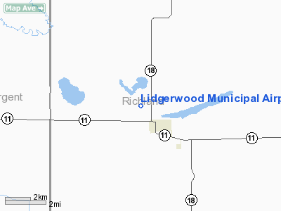
Location & QuickFacts
| FAA Information Effective: | 2008-09-25 |
| Airport Identifier: | 4N4 |
| Airport Status: | Operational |
| Longitude/Latitude: | 097-09-59.3200W/46-05-20.8570N
-97.166478/46.089127 (Estimated) |
| Elevation: | 1081 ft / 329.49 m (Estimated) |
| Land: | 20 acres |
| From nearest city: | 1 nautical miles NW of Lidgerwood, ND |
| Location: | Richland County, ND |
| Magnetic Variation: | 06E (1985) |
Owner & Manager
| Ownership: | Publicly owned |
| Owner: | Lidgerwood Arpt Auth
CHAIRMAN OF ARPT AUTH. - AL NELSON. |
| Address: | 320 Ne 1st
Lidgerwood, ND 58053 |
| Phone number: | 701-538-7444 |
| Manager: | Unknown
LOCAL CTC DAVE OHM 701-538-4571/4995. |
| Address: |
|
Airport Operations and Facilities
| Airport Use: | Open to public |
| Wind indicator: | Yes |
| Segmented Circle: | No |
| Control Tower: | No |
| Sectional chart: | Twin Cities |
| Region: | AGL - Great Lakes |
| Boundary ARTCC: | ZMP - Minneapolis |
| Tie-in FSS: | GFK - Grand Forks |
| FSS on Airport: | No |
| FSS Toll Free: | 1-800-WX-BRIEF |
| NOTAMs Facility: | GFK (NOTAM-d service avaliable) |
Airport Communications
Airport Services
Runway Information
Runway 17/35
| Dimension: | 2600 x 100 ft / 792.5 x 30.5 m |
| Surface: | TURF, Fair Condition |
| |
Runway 17 |
Runway 35 |
| Longitude: | 097-10-00.3200W | 097-10-00.3200W |
| Latitude: | 46-05-33.0600N | 46-05-07.3900N |
| Elevation: | 1084.00 ft | 1086.00 ft |
| Traffic Pattern: | Left | Left |
| Obstruction: | 15 ft road, 50.0 ft from runway, 3:1 slope to clear | 25 ft trees, 950.0 ft from runway, 38:1 slope to clear |
|
Radio Navigation Aids
| ID |
Type |
Name |
Ch |
Freq |
Var |
Dist |
| GWR | NDB | Gwinner | | 278.00 | 07E | 21.4 nm |
| BWP | NDB | Breckenridge-wahpeton | | 233.00 | 05E | 25.2 nm |
| BTN | NDB | Britton | | 386.00 | 06E | 29.1 nm |
| ETH | NDB | Wheaton | | 326.00 | 05E | 31.8 nm |
| FFM | VOR/DME | Fergus Falls | 041X | 110.40 | 05E | 43.7 nm |
| FAR | VORTAC | Fargo | 109X | 116.20 | 09E | 42.0 nm |
Remarks
- RWY SFC SOFT WHEN WET.
- CFM WINTER COND BEFORE USE DUE TO NO SNOW REMOVAL CALL 701-538-7444/4622/4571/4995.
- BIRDS ON & INVOF ARPT.
- PRVDD THRS ARE LCTD OR DSPLCD TO PRVD 20:1 APCH SFC SLOPE.
Images and information placed above are from
http://www.airport-data.com/airport/4N4/
We thank them for the data!
| General Info
|
| Country |
United States
|
| State |
NORTH DAKOTA
|
| FAA ID |
4N4
|
| Latitude |
46-05-20.857N
|
| Longitude |
097-09-59.320W
|
| Elevation |
1081 feet
|
| Near City |
LIDGERWOOD
|
We don't guarantee the information is fresh and accurate. The data may
be wrong or outdated.
For more up-to-date information please refer to other sources.
|
|


