 |
|
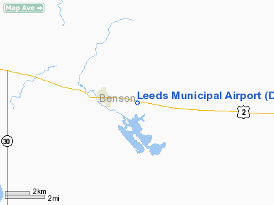
Location & QuickFacts
| FAA Information Effective: | 2008-09-25 |
| Airport Identifier: | D31 |
| Airport Status: | Operational |
| Longitude/Latitude: | 099-24-12.4870W/48-17-05.9960N
-99.403469/48.284999 (Estimated) |
| Elevation: | 1508 ft / 459.64 m (Surveyed) |
| Land: | 40 acres |
| From nearest city: | 2 nautical miles E of Leeds, ND |
| Location: | Benson County, ND |
| Magnetic Variation: | 09E (1985) |
Owner & Manager
| Ownership: | Publicly owned |
| Owner: | Leeds Muni Airport Auth.
BUD LARSON, CHRMN OF ARPT AUTH - HOME PHONE 701-466-2219. |
| Address: | Box 129
Leeds, ND 58346 |
| Phone number: | 701-466-2253 |
| Manager: | Bud Larson |
| Address: | Box 129
Leeds, ND 58346 |
| Phone number: | 701-466-2253
ADDL CTC JOHN BROSSART 701-466-2003/2480. |
Airport Operations and Facilities
| Airport Use: | Open to public |
| Wind indicator: | Yes |
| Segmented Circle: | Yes |
| Control Tower: | No |
| Lighting Schedule: | DUSK-DAWN
ACTVT LIRL RY 09/27 - CTAF. |
| Beacon Color: | Clear-Green (lighted land airport) |
| Sectional chart: | Twin Cities |
| Region: | AGL - Great Lakes |
| Boundary ARTCC: | ZMP - Minneapolis |
| Tie-in FSS: | GFK - Grand Forks |
| FSS Toll Free: | 1-800-WX-BRIEF |
| NOTAMs Facility: | GFK (NOTAM-d service avaliable) |
Airport Communications
Airport Services
Runway Information
Runway 09/27
| Dimension: | 3000 x 50 ft / 914.4 x 15.2 m
HAS 600 FT LGTD TURF STWY W END. |
| Surface: | ASPH, Good Condition |
| Weight Limit: | Single wheel: 7000 lbs. |
| Edge Lights: | Non-standard lighting system
NSTD LIRL; SPACING OFFSET 15 FT FM RY EDGE; RY 09 THLD LGTS ARE LCTD AT BEGINNING OF TURF STWY 600 FT IN FRONT OF ASPH RY THLD. |
| |
Runway 09 |
Runway 27 |
| Longitude: | 099-24-29.9600W | 099-23-46.5000W |
| Latitude: | 48-17-09.9300N | 48-17-04.0000N |
| Elevation: | 1500.00 ft | 1500.00 ft |
| Traffic Pattern: | Left | Left |
| Markings: | Basic, Good Condition | Basic, Good Condition |
| Obstruction: | 110 ft bldg, 2950.0 ft from runway, 200 ft left of centerline, 25:1 slope to clear | 11 ft road, 360.0 ft from runway, 14:1 slope to clear |
|
Radio Navigation Aids
| ID |
Type |
Name |
Ch |
Freq |
Var |
Dist |
| RUG | NDB | Rugby | | 212.00 | 08E | 25.7 nm |
| RLL | NDB | Rolla | | 263.00 | 09E | 36.8 nm |
| DVL | VOR/DME | Devils Lake | 047X | 111.00 | 07E | 22.2 nm |
Remarks
- CONFIRM WINTER CONDS & SNOW REMOVAL CALL 701-466-2253/2003 OR 701-466-2219.
- MIGRATORY WATERFOWL ON AND INVOF ARPT APR-MAY AND SEP-OCT.
- RY 27 SAFETY AREA 200 FT OUT IS ROUGH WITH CLUMPY GRASS.
- RY 09 -5 FT DROPOFF 30 FT FM STOP END OF TURF.
- RY 09/27 LIRL OTS INDEFLY.
Images and information placed above are from
http://www.airport-data.com/airport/D31/
We thank them for the data!
| General Info
|
| Country |
United States
|
| State |
NORTH DAKOTA
|
| FAA ID |
D31
|
| Latitude |
48-17-05.996N
|
| Longitude |
099-24-12.487W
|
| Elevation |
1508 feet
|
| Near City |
LEEDS
|
We don't guarantee the information is fresh and accurate. The data may
be wrong or outdated.
For more up-to-date information please refer to other sources.
|
|


