 |
|
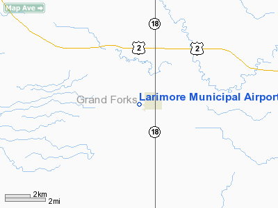
Location & QuickFacts
| FAA Information Effective: | 2008-09-25 |
| Airport Identifier: | 2L1 |
| Airport Status: | Operational |
| Longitude/Latitude: | 097-38-26.3140W/47-54-24.9640N
-97.640643/47.906934 (Estimated) |
| Elevation: | 1130 ft / 344.42 m (Estimated) |
| Land: | 15 acres |
| From nearest city: | 1 nautical miles W of Larimore, ND |
| Location: | Grand Forks County, ND |
| Magnetic Variation: | 07E (1985) |
Owner & Manager
| Ownership: | Publicly owned |
| Owner: | Larimore Arpt Authority
CHRMN ARPT AUTH. ROGER THOMPSON. |
| Address: | 3475 18th Ave Ne
Larimore, ND 58251 |
| Phone number: | 701-343-6273 |
| Manager: | Jesse Morten
ADDL CTC JOHN MORTEN 701-343-6211. |
| Address: | 1546 37th St Ne
Larimore, ND 58251 |
| Phone number: | 701-343-2065
ADL MGRS PHONE CELL 218-779-4244 |
Airport Operations and Facilities
| Airport Use: | Open to public |
| Wind indicator: | Yes |
| Segmented Circle: | No |
| Control Tower: | No |
| Lighting Schedule: | DUSK-DAWN |
| Landing fee charge: | No |
| Sectional chart: | Twin Cities |
| Region: | AGL - Great Lakes |
| Boundary ARTCC: | ZMP - Minneapolis |
| Tie-in FSS: | GFK - Grand Forks |
| FSS on Airport: | No |
| FSS Toll Free: | 1-800-WX-BRIEF |
| NOTAMs Facility: | GFK (NOTAM-d service avaliable) |
Airport Communications
Airport Services
| Airframe Repair: | NONE |
| Power Plant Repair: | NONE |
| Bottled Oxygen: | NONE |
| Bulk Oxygen: | NONE |
Runway Information
Runway 12/30
| Dimension: | 2800 x 50 ft / 853.4 x 15.2 m |
| Surface: | ASPH, Fair Condition |
| Weight Limit: | Single wheel: 4000 lbs. |
| Edge Lights: | Low |
| |
Runway 12 |
Runway 30 |
| Longitude: | 097-38-43.3100W | 097-38-12.3100W |
| Latitude: | 47-54-34.5000N | 47-54-13.4600N |
| Elevation: | 1130.00 ft | 1130.00 ft |
| Traffic Pattern: | Right | Left |
| Markings: | Nonstandard, Fair Condition
& 30 NSTD DSPLCD THLD PAINTED YELLOW; BSC MARKINGS FADED. | Nonstandard, Fair Condition |
| Displaced threshold: | 0.00 ft | 200.00 ft |
| Runway End Identifier: | No | No |
| Centerline Lights: | No | No |
| Touchdown Lights: | No | No |
| Obstruction: | 80 ft trees, 800.0 ft from runway, 100 ft right of centerline, 7:1 slope to clear | 17 ft road, 200.0 ft from runway, 100 ft left of centerline
APCH RATIO 23:1 TO DSPLCD THR.
+15' PKD ACFT 150' FM THR 50' R, ON APRON AREA; +17' ROAD AT THR 100' L. |
|
Radio Navigation Aids
| ID |
Type |
Name |
Ch |
Freq |
Var |
Dist |
| CKN | NDB | Crookston | | 400.00 | 07E | 41.5 nm |
| RDR | TACAN | Red River | 111X | | 06E | 9.9 nm |
| GFK | VOR/DME | Grand Forks | 090X | 114.30 | 09E | 18.6 nm |
Remarks
- SNOW REMOVAL IREG OCT THRU MAY. FOR CONDITIONS REPORT CONTACT AMGR AT 701-343-2065 OR CELL 218-779-4244
- RY 12 CULTIVATED FLD 10' FM THR OUTBOARD.
- RY 12/30 HAS SOFT SHOULDERS AFT RAINS & DURG SPRING THAW.
Images and information placed above are from
http://www.airport-data.com/airport/2L1/
We thank them for the data!
| General Info
|
| Country |
United States
|
| State |
NORTH DAKOTA
|
| FAA ID |
2L1
|
| Latitude |
47-54-24.964N
|
| Longitude |
097-38-26.314W
|
| Elevation |
1130 feet
|
| Near City |
LARIMORE
|
We don't guarantee the information is fresh and accurate. The data may
be wrong or outdated.
For more up-to-date information please refer to other sources.
|
|


