 |
|
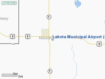
Location & QuickFacts
| FAA Information Effective: | 2008-09-25 |
| Airport Identifier: | 5L0 |
| Airport Status: | Operational |
| Longitude/Latitude: | 098-19-31.0500W/48-01-45.8500N
-98.325292/48.029403 (Estimated) |
| Elevation: | 1512 ft / 460.86 m (Estimated) |
| Land: | 186 acres |
| From nearest city: | 1 nautical miles SE of Lakota, ND |
| Location: | Nelson County, ND |
| Magnetic Variation: | 07E (1985) |
Owner & Manager
| Ownership: | Publicly owned |
| Owner: | Lakota Arpt Authority
CHRM OF ARPT AUTH; DOUG MANBECK. |
| Address: | Box 533
Lakota, ND 58344 |
| Phone number: | 701-247-2400 |
| Manager: | Norris Severtson
CITY MAINTENANCE MANAGER |
| Address: | Box 505
Lakota, ND 58344 |
| Phone number: | 701-247-2561
APT MGRS HOME PHONE 701-247-2704 OR CELL 701-247-3289 |
Airport Operations and Facilities
| Airport Use: | Open to public |
| Wind indicator: | Yes |
| Segmented Circle: | Yes |
| Control Tower: | No |
| Lighting Schedule: | DUSK-DAWN
HIRL RY 15/33 PRESET MED INTST DUSK TO 0000 OT ACTVT - CTAF. PAPI RYS 15 & 33 OPR DUSK TO 0000 OT ACTVT - CTAF. |
| Beacon Color: | Clear-Green (lighted land airport) |
| Landing fee charge: | No |
| Sectional chart: | Twin Cities |
| Region: | AGL - Great Lakes |
| Boundary ARTCC: | ZMP - Minneapolis |
| Tie-in FSS: | GFK - Grand Forks |
| FSS on Airport: | No |
| FSS Toll Free: | 1-800-WX-BRIEF |
| NOTAMs Facility: | GFK (NOTAM-d service avaliable) |
| Federal Agreements: | N |
Airport Communications
Airport Services
| Airframe Repair: | NONE |
| Power Plant Repair: | NONE |
| Bottled Oxygen: | NONE |
| Bulk Oxygen: | NONE |
Runway Information
Runway 15/33
| Dimension: | 3500 x 60 ft / 1066.8 x 18.3 m |
| Surface: | ASPH, Good Condition |
| Weight Limit: | Single wheel: 12500 lbs. |
| Edge Lights: | Medium |
| |
Runway 15 |
Runway 33 |
| Longitude: | 098-19-37.7100W | 098-19-24.3900W |
| Latitude: | 48-02-02.5400N | 48-01-29.1700N |
| Elevation: | 1512.00 ft | 1510.00 ft |
| Traffic Pattern: | Left | Left |
| Markings: | Non-precision instrument, Good Condition | Non-precision instrument, Good Condition |
| Crossing Height: | 25.00 ft | 25.00 ft |
| VASI: | 2-light PAPI on left side | 2-light PAPI on left side |
| Visual Glide Angle: | 3.00° | 3.00° |
| Runway End Identifier: | No | No |
| Centerline Lights: | No | No |
| Touchdown Lights: | No | No |
| Obstruction: | 16 ft road, 580.0 ft from runway, 160L/ ft right of centerline, 23:1 slope to clear | , 50:1 slope to clear |
|
Radio Navigation Aids
| ID |
Type |
Name |
Ch |
Freq |
Var |
Dist |
| RDR | TACAN | Red River | 111X | | 06E | 37.2 nm |
| DVL | VOR/DME | Devils Lake | 047X | 111.00 | 07E | 24.1 nm |
| GFK | VOR/DME | Grand Forks | 090X | 114.30 | 09E | 46.1 nm |
Remarks
- CONFIRM SNOW REMOVAL & WINTER COND WITH CITY PLANT - CALL 701-247-2561/2704/3289 OR 701-351-2775.
- RY 15/33 HAS SOFT SHOULDERS.
- RY 15/33 LACKS 200 FT GRASS SAFETY AREA.
- ARPT CLSD SS-SR AND FOR NIGHT OPNS.
- 32 FT PLINE MARKED WITH ORANGE BALLS 1/2 NM FROM RY 33 THLD ON CTRLN.
- PRVDD RWY 15 THR IS DSPLCD TO PRVD A CLEAR APCH OVR THE ROAD TO THE NORTH.
Images and information placed above are from
http://www.airport-data.com/airport/5L0/
We thank them for the data!
| General Info
|
| Country |
United States
|
| State |
NORTH DAKOTA
|
| FAA ID |
5L0
|
| Latitude |
48-01-52.995N
|
| Longitude |
098-19-40.372W
|
| Elevation |
1515 feet
|
| Near City |
LAKOTA
|
We don't guarantee the information is fresh and accurate. The data may
be wrong or outdated.
For more up-to-date information please refer to other sources.
|
|


