 |
|
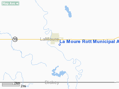
La Moure Rott Muni Airport |
Location & QuickFacts
| FAA Information Effective: | 2008-09-25 |
| Airport Identifier: | 4F9 |
| Airport Status: | Operational |
| Longitude/Latitude: | 098-17-01.3560W/46-20-47.8880N
-98.283710/46.346636 (Estimated) |
| Elevation: | 1310 ft / 399.29 m (Estimated) |
| Land: | 30 acres |
| From nearest city: | 1 nautical miles S of La Moure, ND |
| Location: | La Moure County, ND |
| Magnetic Variation: | 07E (1985) |
Owner & Manager
| Ownership: | Privately owned |
| Owner: | James Bitz |
| Address: | 7381 County Road 60
Lamoure, ND 58458 |
| Phone number: | 701-883-5968 |
| Manager: | Brian Robert |
| Address: | Box 706
Lamoure, ND 58458 |
| Phone number: | 701-883-5127
ADDITIONAL CTC: BLAINE ROBERTS 701-883-5047 |
Airport Operations and Facilities
| Airport Use: | Open to public |
| Wind indicator: | Yes |
| Segmented Circle: | No |
| Control Tower: | No |
| Lighting Schedule: | RDO-CTL
ACTVT NSTD LIRL RY 16/34 - CTAF. |
| Landing fee charge: | No |
| Sectional chart: | Twin Cities |
| Region: | AGL - Great Lakes |
| Boundary ARTCC: | ZMP - Minneapolis |
| Tie-in FSS: | GFK - Grand Forks |
| FSS on Airport: | No |
| FSS Toll Free: | 1-800-WX-BRIEF |
| NOTAMs Facility: | GFK (NOTAM-d service avaliable) |
| Federal Agreements: | N |
Airport Communications
Airport Services
| Airframe Repair: | NONE |
| Power Plant Repair: | NONE |
| Bottled Oxygen: | NONE |
| Bulk Oxygen: | NONE |
Runway Information
Runway 16/34
| Dimension: | 3750 x 50 ft / 1143.0 x 15.2 m |
| Surface: | ASPH, Good Condition |
| Edge Lights: | Non-standard lighting system
ONLY GREEN THR LGTS. |
| |
Runway 16 |
Runway 34 |
| Longitude: | 098-17-00.4000W | 098-16-47.7600W |
| Latitude: | 46-21-11.0000N | 46-20-35.0300N |
| Elevation: | 1310.00 ft | 1305.00 ft |
| Traffic Pattern: | Left | Left |
| Markings: | Basic, Good Condition | Basic, Good Condition |
| Obstruction: | 40 ft pline, 800.0 ft from runway, 15:1 slope to clear | 15 ft road, 700.0 ft from runway, 33:1 slope to clear |
|
Radio Navigation Aids
| ID |
Type |
Name |
Ch |
Freq |
Var |
Dist |
| GWR | NDB | Gwinner | | 278.00 | 07E | 27.6 nm |
| VCY | NDB | Valley City | | 382.00 | 07E | 35.4 nm |
| BTN | NDB | Britton | | 386.00 | 06E | 38.8 nm |
| JMS | VOR/DME | Jamestown | 092X | 114.50 | 10E | 38.8 nm |
Remarks
- IRRIGATION SPRINKLER PIVOT SYSTEM 120'E CNTRLN VIOLATES TRANS SFC.
- CONFIRM WINTER CONDITION & SNOW REMOVAL WITH AMGR 701-883-5127/5047.
- FOR ATTENDANT OT CALL 701-883-5127/5047
- RY 16/34 CULTIVATED FLD 40 FT L & R OF CNTRLN AND 30 FT FROM BOTH THRS.
- IRRIGATOR 15 FT AGL 200 FT EAST OF NORTH END OF RY 16/34.
Images and information placed above are from
http://www.airport-data.com/airport/4F9/
We thank them for the data!
| General Info
|
| Country |
United States
|
| State |
NORTH DAKOTA
|
| FAA ID |
4F9
|
| Latitude |
46-20-47.888N
|
| Longitude |
098-17-01.356W
|
| Elevation |
1310 feet
|
| Near City |
LA MOURE
|
We don't guarantee the information is fresh and accurate. The data may
be wrong or outdated.
For more up-to-date information please refer to other sources.
|
|


