 |
|
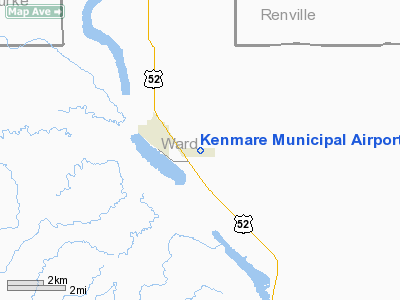
Location & QuickFacts
| FAA Information Effective: | 2008-09-25 |
| Airport Identifier: | 7K5 |
| Airport Status: | Operational |
| Longitude/Latitude: | 102-02-51.3400W/48-40-03.2980N
-102.047594/48.667583 (Estimated) |
| Elevation: | 1962 ft / 598.02 m (Surveyed) |
| Land: | 158 acres |
| From nearest city: | 1 nautical miles SE of Kenmare, ND |
| Location: | Ward County, ND |
| Magnetic Variation: | 10E (2000) |
Owner & Manager
| Ownership: | Publicly owned |
| Owner: | Kenmare Arpt Auth
JIM ACKERMAN, CITY CLERK. |
| Address: | Box 816
Kenmare, ND 58746 |
| Phone number: | 701-385-4232 |
| Manager: | Hank Bodmer |
| Address: | Box 326
Kenmare, ND 58746 |
| Phone number: | 701-385-4029
ADDITONAL PHONE PAUL CARLSON 701-385-4961/4257. |
Airport Operations and Facilities
| Airport Use: | Open to public |
| Wind indicator: | Yes |
| Segmented Circle: | Yes |
| Control Tower: | No |
| Lighting Schedule: | DUSK-DAWN
ACTVT MIRL RY 08/26 & PAPI RYS 08 & 26 - CTAF. |
| Beacon Color: | Clear-Green (lighted land airport) |
| Landing fee charge: | No |
| Sectional chart: | Billings |
| Region: | AGL - Great Lakes |
| Boundary ARTCC: | ZMP - Minneapolis |
| Tie-in FSS: | GFK - Grand Forks |
| FSS on Airport: | No |
| FSS Toll Free: | 1-800-WX-BRIEF |
| NOTAMs Facility: | GFK (NOTAM-d service avaliable) |
| Federal Agreements: | NGY |
Airport Communications
Airport Services
| Fuel available: | 100LL
24-HR SELF- SERVICE FUEL AVBL WITH CREDIT CARD. |
| Bottled Oxygen: | NONE |
| Bulk Oxygen: | NONE |
Runway Information
Runway 08/26
| Dimension: | 3700 x 60 ft / 1127.8 x 18.3 m |
| Surface: | ASPH, Good Condition |
| Weight Limit: | Single wheel: 12000 lbs. |
| Edge Lights: | Medium |
| |
Runway 08 |
Runway 26 |
| Longitude: | 102-03-18.9000W | 102-02-23.7800W |
| Latitude: | 48-40-03.3000N | 48-40-03.2960N |
| Elevation: | 1962.00 ft | 1955.00 ft |
| Alignment: | 90 | 127 |
| Traffic Pattern: | Left | Left |
| Markings: | Non-precision instrument, Good Condition | Non-precision instrument, Good Condition |
| Crossing Height: | 25.00 ft | 25.00 ft |
| VASI: | 2-light PAPI on left side | 2-light PAPI on left side |
| Visual Glide Angle: | 3.00° | 3.00° |
| Obstruction: | 40 ft pole, 1260.0 ft from runway, 50 ft left of centerline, 26:1 slope to clear | 10 ft road, 360.0 ft from runway, 16:1 slope to clear |
|
Radio Navigation Aids
| ID |
Type |
Name |
Ch |
Freq |
Var |
Dist |
| HBC | NDB | Mohall | | 350.00 | 11E | 21.1 nm |
| PSH | NDB | Parshall | | 379.00 | 11E | 44.1 nm |
| MIB | TACAN | Deering | 096X | | 10E | 31.1 nm |
| MOT | VORTAC | Minot | 118X | 117.10 | 13E | 39.0 nm |
Remarks
- CONFIRM WINTER CONDITIONS & SNOW REMOVAL WITH AMGR 701-385-4029.
- WILDLIFE REFUGE LCTD 3500 FT W.
- WATERFOWL ON OR INVOF ARPT.
Images and information placed above are from
http://www.airport-data.com/airport/7K5/
We thank them for the data!
| General Info
|
| Country |
United States
|
| State |
NORTH DAKOTA
|
| FAA ID |
7K5
|
| Latitude |
48-40-03.298N
|
| Longitude |
102-02-51.340W
|
| Elevation |
1962 feet
|
| Near City |
KENMARE
|
We don't guarantee the information is fresh and accurate. The data may
be wrong or outdated.
For more up-to-date information please refer to other sources.
|
|


