 |
|
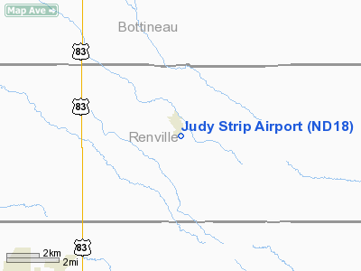
Location & QuickFacts
| FAA Information Effective: | 2008-09-25 |
| Airport Identifier: | ND18 |
| Airport Status: | Operational |
| Longitude/Latitude: | 101-13-00.5690W/48-30-23.0670N
-101.216825/48.506408 (Estimated) |
| Elevation: | 1570 ft / 478.54 m (Estimated) |
| Land: | 15 acres |
| From nearest city: | 0 nautical miles S of Glenburn, ND |
| Location: | Renville County, ND |
| Magnetic Variation: | 10E (1985) |
Owner & Manager
| Ownership: | Privately owned |
| Owner: | Lynn Stevens |
| Address: | Po Box 193
Glenburn, ND 58740 |
| Phone number: | 701-362-7419 |
| Manager: | Lynn Stevens |
| Address: | Po Box 193
Glenburn, ND 58740 |
| Phone number: | 701-362-7419
HOME PHONE 362-7525. |
Airport Operations and Facilities
| Airport Use: | Private |
| Wind indicator: | Yes |
| Segmented Circle: | No |
| Control Tower: | No |
| Landing fee charge: | No |
| Sectional chart: | Billings |
| Region: | AGL - Great Lakes |
| Boundary ARTCC: | ZMP - Minneapolis |
| Tie-in FSS: | GFK - Grand Forks |
| FSS on Airport: | No |
| FSS Toll Free: | 1-800-WX-BRIEF |
Airport Services
| Airframe Repair: | NONE |
| Power Plant Repair: | NONE |
| Bottled Oxygen: | NONE |
| Bulk Oxygen: | NONE |
Runway Information
Runway 12/30
| Dimension: | 2500 x 100 ft / 762.0 x 30.5 m |
| Surface: | TURF, Fair Condition
SFC ROLLING; GRASS CLUMPS. |
| |
Runway 12 |
Runway 30 |
| Longitude: | 101-13-09.1200W | 101-12-44.5000W |
| Latitude: | 48-30-31.4700N | 48-30-13.0000N |
| Elevation: | 1570.00 ft | 1563.00 ft |
| Traffic Pattern: | Left | Left |
| Obstruction: | 120 ft twr, 2000.0 ft from runway, 300 ft left of centerline, 16:1 slope to clear | 40 ft pole, 140.0 ft from runway, 150 ft right of centerline, 3:1 slope to clear |
|
Radio Navigation Aids
| ID |
Type |
Name |
Ch |
Freq |
Var |
Dist |
| HBC | NDB | Mohall | | 350.00 | 11E | 20.0 nm |
| RUG | NDB | Rugby | | 212.00 | 08E | 48.0 nm |
| MIB | TACAN | Deering | 096X | | 10E | 8.1 nm |
| MOT | VORTAC | Minot | 118X | 117.10 | 13E | 15.1 nm |
Remarks
- ARPT CLSD WINTER MONTHS (NOV-APR).
- RY 30 -2' DITCH 15' FM THR & PERPENDICULAR TO CNTRLN.
- +10' MACHINERY 100' INBOARD RY 12 THR & 150' R OF CNTRLN.
Images and information placed above are from
http://www.airport-data.com/airport/ND18/
We thank them for the data!
| General Info
|
| Country |
United States
|
| State |
NORTH DAKOTA
|
| FAA ID |
ND18
|
| Latitude |
48-30-23.067N
|
| Longitude |
101-13-00.569W
|
| Elevation |
1570 feet
|
| Near City |
GLENBURN
|
We don't guarantee the information is fresh and accurate. The data may
be wrong or outdated.
For more up-to-date information please refer to other sources.
|
|


