 |
|
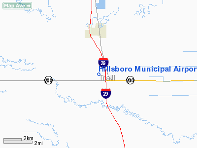
Location & QuickFacts
| FAA Information Effective: | 2008-09-25 |
| Airport Identifier: | 3H4 |
| Airport Status: | Operational |
| Longitude/Latitude: | 097-03-37.4990W/47-21-33.8680N
-97.060416/47.359408 (Estimated) |
| Elevation: | 905 ft / 275.84 m (Surveyed) |
| Land: | 55 acres |
| From nearest city: | 3 nautical miles S of Hillsboro, ND |
| Location: | Traill County, ND |
| Magnetic Variation: | 05E (2000) |
Owner & Manager
| Ownership: | Publicly owned |
| Owner: | Hillsboro Muni Arpt Auth |
| Address: | Box 242
Hillsboro, ND 58045 |
| Phone number: | 701-436-4039 |
| Manager: | Larry Mueller
CHAIRMAN ARPT AUTH. |
| Address: | Box 242
Hillsboro, ND 58045 |
| Phone number: | 701-436-4039
ADL PHONE FOR MGR 701-430-1444 OR CHAD HANSON 701-400-1113 |
Airport Operations and Facilities
| Airport Use: | Open to public |
| Wind indicator: | Yes |
| Segmented Circle: | Yes |
| Control Tower: | No |
| Lighting Schedule: | DUSK-DAWN
ACTVT MIRLRY 16/34 & PAPI ON RYS 16 & 34 - CTAF. |
| Beacon Color: | Clear-Green (lighted land airport) |
| Landing fee charge: | No |
| Sectional chart: | Twin Cities |
| Region: | AGL - Great Lakes |
| Boundary ARTCC: | ZMP - Minneapolis |
| Tie-in FSS: | GFK - Grand Forks |
| FSS on Airport: | No |
| FSS Toll Free: | 1-800-WX-BRIEF |
| NOTAMs Facility: | GFK (NOTAM-d service avaliable) |
| Federal Agreements: | NGY |
Airport Communications
Airport Services
| Fuel available: | 100LL
24 HOUR SELF SERVICE CREDIT CARD FUEL AVBL. |
| Airframe Repair: | MAJOR |
| Power Plant Repair: | MAJOR |
Runway Information
Runway 16/34
| Dimension: | 3300 x 60 ft / 1005.8 x 18.3 m |
| Surface: | ASPH, Good Condition |
| Weight Limit: | Single wheel: 16500 lbs. |
| Edge Lights: | Medium |
| |
Runway 16 |
Runway 34 |
| Longitude: | 097-03-41.3660W | 097-03-33.6320W |
| Latitude: | 47-21-49.9430N | 47-21-17.7940N |
| Elevation: | 904.00 ft | 904.00 ft |
| Alignment: | 127 | 127 |
| Traffic Pattern: | Left | Left |
| Markings: | Non-precision instrument, Good Condition | Non-precision instrument, Good Condition |
| Crossing Height: | 25.00 ft | 25.00 ft |
| VASI: | 2-light PAPI on left side | 2-light PAPI on left side |
| Visual Glide Angle: | 3.00° | 3.00° |
| Runway End Identifier: | No | No |
| Centerline Lights: | No | No |
| Touchdown Lights: | No | No |
| Obstruction: | , 50:1 slope to clear | 18 ft road, 700.0 ft from runway, 300 ft left of centerline, 27:1 slope to clear |
|
Radio Navigation Aids
| ID |
Type |
Name |
Ch |
Freq |
Var |
Dist |
| AA | NDB | Kenie | | 365.00 | 06E | 23.3 nm |
| CKN | NDB | Crookston | | 400.00 | 07E | 34.0 nm |
| VCY | NDB | Valley City | | 382.00 | 07E | 45.4 nm |
| RDR | TACAN | Red River | 111X | | 06E | 38.6 nm |
| GFK | VOR/DME | Grand Forks | 090X | 114.30 | 09E | 36.1 nm |
| FAR | VORTAC | Fargo | 109X | 116.20 | 09E | 37.4 nm |
Remarks
- FOR SNOW REMOVAL OR WINTER CONDS CALL ARPT 701-436-4039 OR 430-1444
- AERIAL SPRAYING OPNS MAY-AUG INVOF ARPT.
- AIRSPACE CASE 74-RM-182-NRA.
Images and information placed above are from
http://www.airport-data.com/airport/3H4/
We thank them for the data!
| General Info
|
| Country |
United States
|
| State |
NORTH DAKOTA
|
| FAA ID |
3H4
|
| Latitude |
47-21-33.868N
|
| Longitude |
097-03-37.499W
|
| Elevation |
905 feet
|
| Near City |
HILLSBORO
|
We don't guarantee the information is fresh and accurate. The data may
be wrong or outdated.
For more up-to-date information please refer to other sources.
|
|


