|
|
Coordinates: 46°55′14″N 096°48′57″W / 46.92056°N 96.81583°W / 46.92056; -96.81583
| Hector International Airport |
| IATA: none – ICAO: none – FAA LID: FAR |
| Summary |
| Airport type |
Public |
| Operator |
City of Fargo Municipal Airport Authority |
| Serves |
Fargo, North Dakota |
| Location |
Fargo, North Dakota |
| Elevation AMSL |
902 ft / 275 m |
| Website |
www.FargoAirport.com |
| Runways |
| Direction |
Length |
Surface |
| ft |
m |
| 18/36 |
9,000 |
2,743 |
Concrete |
| 9/27 |
6,300 |
1,920 |
Concrete |
| 13/31 |
3,800 |
1,158 |
Asphalt/Concrete |
| Statistics (2006) |
| Aircraft operations |
74,209 |
| Based aircraft |
210 |
| Source: FAA and airport web site |
Hector International Airport (IATA: FAR, ICAO: KFAR, FAA LID: FAR) is a joint civil-military public airport located three miles (5 km) northwest of the central business district of Fargo, a city in Cass County, North Dakota, United States. It is owned by the City of Fargo Municipal Airport Authority.
The airport was named after Martin Hector, who donated the land the airport is situated on. Customs service is available for aircraft arriving from Canada and other countries. Hector International has no scheduled passenger airline service out of the country but receives its international title (like many other airports) because of this customs service.
The airport is also home to the Happy Hooligans of the 119th Wing (119 WG), a unit of the North Dakota Air National Guard that operates the C-21A Lear Jet and MQ-1 Predator.
The airport was the intended destination for the airplane carrying Buddy Holly, Ritchie Valens, and J.P. Richardson on February 3, 1959. The airplane crashed shortly after takeoff from Clear Lake, Iowa, killing the 3 musicians and the pilot. Facilities and aircraft
Hector International Airport covers an area of 2,500 acres (1,012 ha) which contains three runways: 18/36 measuring 9,000 x 150 ft (2,743 x 46 m), 9/27 measuring 6,300 x 100 ft (1,920 x 30 m), and 13/31 measuring 3,800 x 150 ft (1,158 x 46 m). Hector International has the longest public runway in North Dakota and can receive Boeing 747s since it is over 8,000 ft (2,400 m)
For the 12-month period ending June 30, 2006, the airport had 74,209 aircraft operations, an average of 203 per day: 60% general aviation, 21% air taxi, 10% military and 9% scheduled commercial.
In 2008 the airport completed the passenger terminal expansion and update project that started in October 2006. The project updated the existing terminal building and added an additional gate, an additional baggage claim and expanded the security checkpoint area.
Airlines and destinations
| Airlines |
Destinations |
| Allegiant Air |
Las Vegas, Los Angeles , Orlando-Sanford, Phoenix/Mesa |
| American Eagle |
Chicago-O'Hare |
| Delta Air Lines |
Minneapolis/St. Paul |
| Delta Connection operated by Shuttle America |
Minneapolis/St. Paul |
| Delta Connection operated by Compass Airlines |
Minneapolis/St. Paul |
| Delta Connection operated by Pinnacle Airlines |
Minneapolis/St. Paul |
| Delta Connection operated by SkyWest Airlines |
Minneapolis/St. Paul, Salt Lake City |
| United Express operated by SkyWest Airlines |
Chicago-O'Hare, Denver |
| United Express operated by ExpressJet Airlines |
Chicago-O'Hare |
Cargo
- DHL Express
- FedEx Express
- UPS Airlines
The above content comes from Wikipedia and is published under free licenses – click here to read more.
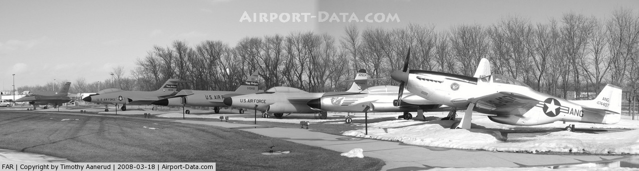
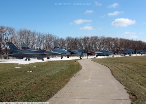
 |
(Click on the photo to enlarge) |
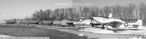
 |
(Click on the photo to enlarge) |
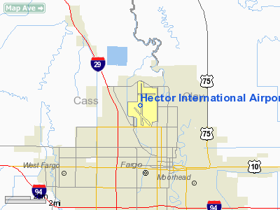
Location & QuickFacts
| FAA Information Effective: | 2008-09-25 |
| Airport Identifier: | FAR |
| Airport Status: | Operational |
| Longitude/Latitude: | 096-48-56.7500W/46-55-14.3400N
-96.815764/46.920650 (Estimated) |
| Elevation: | 902 ft / 274.93 m (Surveyed) |
| Land: | 2500 acres |
| From nearest city: | 3 nautical miles NW of Fargo, ND |
| Location: | Cass County, ND |
| Magnetic Variation: | 04E (2005) |
Owner & Manager
| Ownership: | Publicly owned |
| Owner: | City Of Fargo Muni Arpt Auth |
| Address: | Po Box 2845
Fargo, ND 58108 |
| Phone number: | 701-241-1501 |
| Manager: | Shawn Dobberstein |
| Address: | Po Box 2845
Fargo, ND 58108 |
| Phone number: | 701-241-1501 |
Airport Operations and Facilities
| Airport Use: | Open to public |
| Wind indicator: | Yes |
| Segmented Circle: | No |
| Control Tower: | Yes |
| Lighting Schedule: | DUSK-DAWN |
| Beacon Color: | Clear-Green (lighted land airport) |
| Landing fee charge: | No |
| Sectional chart: | Twin Cities |
| Region: | AGL - Great Lakes |
| Boundary ARTCC: | ZMP - Minneapolis |
| Tie-in FSS: | GFK - Grand Forks |
| FSS on Airport: | No |
| FSS Toll Free: | 1-800-WX-BRIEF |
| NOTAMs Facility: | FAR (NOTAM-d service avaliable) |
| Certification type/date: | I C S 05/1973 |
| Federal Agreements: | NGPY3 |
Airport Communications
Airport Services
| Fuel available: | 100LLA
J8 FUEL AVBL. |
| Airframe Repair: | MAJOR |
| Power Plant Repair: | MAJOR |
| Bottled Oxygen: | HIGH/LOW |
| Bulk Oxygen: | HIGH/LOW |
Runway Information
Runway 09/27
| Dimension: | 6300 x 100 ft / 1920.2 x 30.5 m |
| Surface: | CONC, Good Condition |
| Surface Treatment: | Saw-cut or plastic Grooved |
| Weight Limit: | Single wheel: 60000 lbs.
Dual wheel: 100000 lbs.
AUW-847 |
| Edge Lights: | Medium |
| |
Runway 09 |
Runway 27 |
| Longitude: | 096-49-38.3530W | 096-48-07.5880W |
| Latitude: | 46-55-37.6880N | 46-55-37.1790N |
| Elevation: | 896.00 ft | 897.00 ft |
| Alignment: | 90 | 127 |
| Traffic Pattern: | Left | Left |
| Markings: | Basic, Good Condition | Basic, Good Condition |
| Crossing Height: | 42.00 ft | 26.00 ft |
| VASI: | 4-light PAPI on left side | 4-light PAPI on left side |
| Visual Glide Angle: | 3.00° | 3.00° |
| Runway End Identifier: | Yes | Yes |
| Obstruction: | , 50:1 slope to clear | 25 ft pole, 1086.0 ft from runway, 468 ft left of centerline, 35:1 slope to clear |
|
Runway 13/31
| Dimension: | 3800 x 150 ft / 1158.2 x 45.7 m |
| Surface: | ASPH-CONC, Good Condition |
| Weight Limit: | Single wheel: 26000 lbs.
Dual wheel: 35000 lbs.
AUW-847 |
| Edge Lights: | Medium |
| |
Runway 13 |
Runway 31 |
| Longitude: | 096-49-17.3368W | 096-48-40.2384W |
| Latitude: | 46-54-50.8623N | 46-54-23.2630N |
| Elevation: | 902.00 ft | 899.00 ft |
| Alignment: | 127 | 127 |
| Traffic Pattern: | Left | Left |
| Markings: | Non-precision instrument, Good Condition | Non-precision instrument, Good Condition |
| Crossing Height: | 61.00 ft | 0.00 ft |
| VASI: | 4-box on left side | |
| Visual Glide Angle: | 3.00° | 0.00° |
| Obstruction: | 7 ft road, 550.0 ft from runway, 180 ft right of centerline, 47:1 slope to clear | 8 ft road, 432.0 ft from runway, 147 ft left of centerline, 29:1 slope to clear |
|
Runway 18/36
| Dimension: | 9000 x 150 ft / 2743.2 x 45.7 m |
| Surface: | CONC, Good Condition |
| Surface Treatment: | Saw-cut or plastic Grooved |
| Weight Limit: | Single wheel: 100000 lbs.
Dual wheel: 200000 lbs.
Dual tandem wheel: 400000 lbs.
AUW-847 |
| Edge Lights: | High |
| |
Runway 18 |
Runway 36 |
| Longitude: | 096-48-57.9846W | 096-48-59.0521W |
| Latitude: | 46-55-58.3245N | 46-54-29.4886N |
| Elevation: | 900.00 ft | 899.00 ft |
| Alignment: | 127 | 0 |
| ILS Type: | ILS
| ILS
|
| Traffic Pattern: | Left | Left |
| Markings: | Precision instrument, Good Condition | Precision instrument, Good Condition |
| Crossing Height: | 68.00 ft | 71.00 ft |
| VASI: | 4-light PAPI on left side | 4-light PAPI on right side |
| Visual Glide Angle: | 3.00° | 3.00° |
| RVR Equipment: | | touchdown |
| Approach lights: | MALSR | MALSR |
|
Radio Navigation Aids
| ID |
Type |
Name |
Ch |
Freq |
Var |
Dist |
| AA | NDB | Kenie | | 365.00 | 06E | 5.3 nm |
| BWP | NDB | Breckenridge-wahpeton | | 233.00 | 05E | 41.6 nm |
| VCY | NDB | Valley City | | 382.00 | 07E | 45.2 nm |
| DTL | VOR/DME | Detroit Lakes | 049X | 111.20 | 05E | 38.6 nm |
| FFM | VOR/DME | Fergus Falls | 041X | 110.40 | 05E | 46.7 nm |
| FAR | VORTAC | Fargo | 109X | 116.20 | 09E | 10.2 nm |
Remarks
- EAST TWY PARALLELING RY 18/36 CLSD TO ACFT OVR 130000 LBS.
- ANG: TRAN ACFT MAY NOT BE SVC WHEN WIND CHILL EXCEEDS OR IS FCST TO EXCEED -25 DEGREES F.
- BIRD HAZ PHASE II 01 MAR THRU 31 MAY; AND 01 AUG THRU 30 NOV, CTC BASE OPS FOR INFO.
- FLIGHT NOTIFICATION SERVICE (ADCUS) AVAILABLE MON-FRI 0830-1700.
- RY 13/31 NOT AVBL FOR ACR OPNS WITH 10 OR MORE PSGR SEATS.
- ANG OFFL BUS ONLY CTC COMMAND POST DSN 362-8508, C701-451-2508 OPR 1300-2230Z++; OTHER TRAN ACFT CTC JET CENTER C701-235-3600; CUSTOMS AVBL 24 HRS. RCR AVBL FR ANG OPS 262.0. CONVL TFC PAT 1600'; JET TFC PAT 2500'. OBO AVBL 1500-2130Z++ WKD, CLSD WDEND
- BIRDS ON AND INVOF ARPT.
- MILITARY REMARKS: OFFL BUS ONLY CTC COMD POST DSN 362-8511, C701-451-2511. COMD POST HRS 1200-2359Z++.
- ANG: MAINT OR SVC ON OFFL BUS ONLY ACFT OTHER THAN C-21A ACFT LTD TO ASST ACFT CREW.
Images and information placed above are from
http://www.airport-data.com/airport/FAR/
We thank them for the data!
| General Info
|
| Country |
United States
|
| State |
NORTH DAKOTA
|
| FAA ID |
FAR
|
| Latitude |
46-55-12.324N
|
| Longitude |
096-48-56.883W
|
| Elevation |
900 feet
|
| Near City |
FARGO
|
We don't guarantee the information is fresh and accurate. The data may
be wrong or outdated.
For more up-to-date information please refer to other sources.
|
|