 |
|
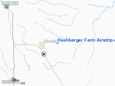
Hashbarger Farm Airstrip Airport |
Location & QuickFacts
| FAA Information Effective: | 2008-09-25 |
| Airport Identifier: | 8NA9 |
| Airport Status: | Operational |
| Longitude/Latitude: | 097-40-44.3440W/47-19-40.9560N
-97.678984/47.328043 (Estimated) |
| Elevation: | 1195 ft / 364.24 m (Estimated) |
| Land: | 10 acres |
| From nearest city: | 2 nautical miles E of Hope, ND |
| Location: | Steele County, ND |
| Magnetic Variation: | 08E (1980) |
Owner & Manager
| Ownership: | Privately owned |
| Owner: | Neil Hashbarger |
| Address: | 555 40th St. S., #321
Fargo, ND 58103 |
| Phone number: | 701-298-3097 |
| Manager: | Joel Hashbarger |
| Address: | 13396 6th St. Se
Hope, ND 58046-9065 |
| Phone number: | 701-945-2687 |
Airport Operations and Facilities
| Airport Use: | Private |
| Wind indicator: | Yes |
| Segmented Circle: | No |
| Control Tower: | No |
| Sectional chart: | Twin Cities |
| Region: | AGL - Great Lakes |
| Boundary ARTCC: | ZMP - Minneapolis |
| Tie-in FSS: | GFK - Grand Forks |
| FSS Toll Free: | 1-800-WX-BRIEF |
Runway Information
Runway 08/26
| Dimension: | 2000 x 40 ft / 609.6 x 12.2 m |
| Surface: | TURF, |
| |
Runway 08 |
Runway 26 |
| Traffic Pattern: | Left | Left |
| Obstruction: | 15 ft trees, 500.0 ft from runway | 40 ft trees, 80.0 ft from runway |
|
Runway 17/35
| Dimension: | 2500 x 80 ft / 762.0 x 24.4 m |
| Surface: | TURF, |
| Edge Lights: | Medium |
| |
Runway 17 |
Runway 35 |
| Traffic Pattern: | Left | Left |
|
Radio Navigation Aids
| ID |
Type |
Name |
Ch |
Freq |
Var |
Dist |
| VCY | NDB | Valley City | | 382.00 | 07E | 28.7 nm |
| AA | NDB | Kenie | | 365.00 | 06E | 40.2 nm |
| RDR | TACAN | Red River | 111X | | 06E | 39.4 nm |
| GFK | VOR/DME | Grand Forks | 090X | 114.30 | 09E | 42.7 nm |
| JMS | VOR/DME | Jamestown | 092X | 114.50 | 10E | 47.3 nm |
| FAR | VORTAC | Fargo | 109X | 116.20 | 09E | 48.4 nm |
Remarks
- FILED FOR RECORD PURPOSES ONLY.
Images and information placed above are from
http://www.airport-data.com/airport/8NA9/
We thank them for the data!
| General Info
|
| Country |
United States
|
| State |
NORTH DAKOTA
|
| FAA ID |
8NA9
|
| Latitude |
47-19-40.956N
|
| Longitude |
097-40-44.344W
|
| Elevation |
1195 feet
|
| Near City |
HOPE
|
We don't guarantee the information is fresh and accurate. The data may
be wrong or outdated.
For more up-to-date information please refer to other sources.
|
|


