 |
|
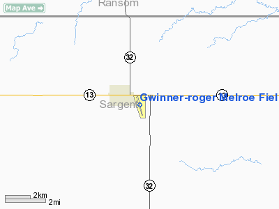
Gwinner-roger Melroe Field Airport |
| Gwinner-Roger Melroe Field |
| IATA: GWR – ICAO: KGWR – FAA LID: GWR |
| Summary |
| Airport type |
Public |
| Owner |
Gwinner Airport Authority |
| Serves |
Gwinner, North Dakota |
| Elevation AMSL |
1,266 ft / 386 m |
| Coordinates |
46°13′07″N 097°38′37″W / 46.21861°N 97.64361°W / 46.21861; -97.64361 |
| Runways |
| Direction |
Length |
Surface |
| ft |
m |
| 16/34 |
4,986 |
1,520 |
Asphalt |
| 6/24 |
2,950 |
899 |
Turf |
| Statistics (2007) |
| Aircraft operations |
4,120 |
| Based aircraft |
13 |
| Source: Federal Aviation Administration |
Gwinner-Roger Melroe Field (IATA: GWR, ICAO: KGWR, FAA LID: GWR) is a public use airport located one nautical mile (2 km) southeast of the central business district of Gwinner, a city in Sargent County, North Dakota, United States. It is owned by the Gwinner Airport Authority. It is also referred to as Gwinner Municipal Airfield. History
In 1967, the Gwinner Municipal Airport Authority proposed to construct a new municipal airport, which was completed in 1969. At the time it had a 3,600 foot lighted asphalt runway and an unlighted 2,500 foot turf strip. In 1975 the asphalt runway was extended from to 5000 feet in length. The airport was rededicated "Roger Melroe Field" in 1986.
Facilities and aircraft
The airport covers an area of 120 acres (49 ha) at an elevation of 1,266 feet (386 m) above mean sea level. It has two runways: 16/34 is 4,986 by 60 feet (1,520 x 18 m) with an asphalt pavement; 6/24 is 2,950 by 100 feet (899 x 30 m) with an turf surface.
For the 12-month period ending December 31, 2007, the airport had 4,120 aircraft operations, an average of 11 per day: 51% air taxi, 49% general aviation, <1% military. At that time there were 13 aircraft based at this airport: 85% single-engine and 15% multi-engine.
The above content comes from Wikipedia and is published under free licenses – click here to read more.
Location & QuickFacts
| FAA Information Effective: | 2008-09-25 |
| Airport Identifier: | GWR |
| Airport Status: | Operational |
| Longitude/Latitude: | 097-38-35.7000W/46-13-07.4000N
-97.643250/46.218722 (Estimated) |
| Elevation: | 1266 ft / 385.88 m (Surveyed) |
| Land: | 120 acres |
| From nearest city: | 1 nautical miles SE of Gwinner, ND |
| Location: | Sargent County, ND |
| Magnetic Variation: | 07E (1985) |
Owner & Manager
| Ownership: | Publicly owned |
| Owner: | Gwinner Arpt Auth
APT AUTHORITY CHRMN GROVE RIEBE |
| Address: | Rr 1 Box 130
Gwinner, ND 58040 |
| Phone number: | 701-678-6371
ADL PHONE 701-678-3505 |
| Manager: | Rick Hoistad |
| Address: | Box 221
Gwinner, ND 58040 |
| Phone number: | 701-680-8000 |
Airport Operations and Facilities
| Airport Use: | Open to public |
| Wind indicator: | Yes |
| Segmented Circle: | Yes |
| Control Tower: | No |
| Lighting Schedule: | DUSK-DAWN
ACTVT MIRL RY 16/34; PAPI & REIL RY 34 - CTAF. |
| Beacon Color: | Clear-Green (lighted land airport) |
| Landing fee charge: | No |
| Sectional chart: | Twin Cities |
| Region: | AGL - Great Lakes |
| Boundary ARTCC: | ZMP - Minneapolis |
| Tie-in FSS: | GFK - Grand Forks |
| FSS on Airport: | No |
| FSS Toll Free: | 1-800-WX-BRIEF |
| NOTAMs Facility: | GFK (NOTAM-d service avaliable) |
| Federal Agreements: | NGY |
Airport Communications
| CTAF: | 122.700 |
| Unicom: | 122.700 |
Airport Services
| Fuel available: | 100LL
FOR FUEL CALL 701-680-8000. |
| Airframe Repair: | NONE |
| Power Plant Repair: | NONE |
| Bottled Oxygen: | NONE |
| Bulk Oxygen: | NONE |
Runway Information
Runway 06/24
| Dimension: | 3000 x 100 ft / 914.4 x 30.5 m |
| Surface: | TURF, Fair Condition |
| |
Runway 06 |
Runway 24 |
| Longitude: | 097-39-00.3000W | 097-38-22.3000W |
| Latitude: | 46-13-07.9000N | 46-13-21.9000N |
| Elevation: | 1266.00 ft | 1251.00 ft |
| Traffic Pattern: | Left | Left |
| Obstruction: | 75 ft ant, 2000.0 ft from runway, 400 ft left of centerline, 26:1 slope to clear | 40 ft pline, 1350.0 ft from runway, 300 ft right of centerline, 33:1 slope to clear |
|
Runway 16/34
| Dimension: | 5000 x 60 ft / 1524.0 x 18.3 m |
| Surface: | ASPH, Good Condition |
| Weight Limit: | Single wheel: 14000 lbs.
Dual wheel: 19000 lbs. |
| Edge Lights: | Medium |
| |
Runway 16 |
Runway 34 |
| Longitude: | 097-38-43.3000W | 097-38-23.3000W |
| Latitude: | 46-13-27.9000N | 46-12-39.9000N |
| Elevation: | 1255.00 ft | 1254.00 ft |
| Traffic Pattern: | Left | Left |
| Markings: | Non-precision instrument, Good Condition | Non-precision instrument, Good Condition |
| Crossing Height: | 0.00 ft | 25.00 ft |
| VASI: | | 2-light PAPI on left side |
| Visual Glide Angle: | 0.00° | 3.00° |
| Runway End Identifier: | | Yes |
| Obstruction: | 15 ft road, 500.0 ft from runway, 175 ft left of centerline, 20:1 slope to clear | , 50:1 slope to clear |
|
Radio Navigation Aids
| ID |
Type |
Name |
Ch |
Freq |
Var |
Dist |
| GWR | NDB | Gwinner | | 278.00 | 07E | 0.3 nm |
| BTN | NDB | Britton | | 386.00 | 06E | 24.4 nm |
| VCY | NDB | Valley City | | 382.00 | 07E | 41.1 nm |
| BWP | NDB | Breckenridge-wahpeton | | 233.00 | 05E | 43.3 nm |
| FAR | VORTAC | Fargo | 109X | 116.20 | 09E | 45.9 nm |
Remarks
- RY 06/24 CLSD WINTER MONTHS.
- CFM WINTER CONDS & RY 16/34 SNOW REMOVAL WITH AMGR 701-680-8000 OR CITY MAINTENANCE 701-678-2548
- RY 16 +480 FT LGTD TOWER 17500 FT FM THLD 3000 FT R OF EXTDD CNTRLN.
Images and information placed above are from
http://www.airport-data.com/airport/GWR/
We thank them for the data!
| General Info
|
| Country |
United States
|
| State |
NORTH DAKOTA
|
| FAA ID |
GWR
|
| Latitude |
46-13-07.400N
|
| Longitude |
097-38-35.700W
|
| Elevation |
1266 feet
|
| Near City |
GWINNER
|
We don't guarantee the information is fresh and accurate. The data may
be wrong or outdated.
For more up-to-date information please refer to other sources.
|
|


