 |
|
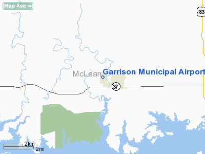
| Garrison Municipal Airport |
| IATA: none – ICAO: none – FAA LID: D05 |
| Summary |
| Airport type |
Public |
| Owner |
Garrison Airport Authority |
| Location |
Garrison, North Dakota |
| Elevation AMSL |
1935 ft / 590.0 m |
| Coordinates |
47°39′21″N 101°26′14″W / 47.65583°N 101.43722°W / 47.65583; -101.43722 |
| Runways |
| Direction |
Length |
Surface |
| ft |
m |
| 13/31 |
3,700 |
1,128 |
Asphalt |
| 3/21 |
2,900 |
884 |
Turf |
| Statistics (2007) |
| Aircraft operations |
4,220 |
| Source: Federal Aviation Administration |
Garrison Municipal Airport (FAA LID: D05) is a public airport located one mile (1.6 km) west of the central business district of Garrison, in McLean County, North Dakota, United States. It is owned by the Garrison Municipal Airport Authority.
Facilities and aircraft
Garrison Municipal Airport covers an area of 205 acres (83 ha) which contains two runways:
- Runway 13/31: 3,700 x 60 ft (1,128 x 18 m), Surface: Asphalt
- Runway 3/21: 2,900 x 120 ft (884 x 37 m), Surface: Turf
For the 12-month period ending July 31, 2007, the airport had 4,220 aircraft operations: 95% general aviation, 5% air taxi, and less than 1% military.
The above content comes from Wikipedia and is published under free licenses – click here to read more.
Location & QuickFacts
| FAA Information Effective: | 2008-09-25 |
| Airport Identifier: | D05 |
| Airport Status: | Operational |
| Longitude/Latitude: | 101-26-14.0000W/47-39-21.4000N
-101.437222/47.655944 (Estimated) |
| Elevation: | 1935 ft / 589.79 m (Estimated) |
| Land: | 205 acres |
| From nearest city: | 1 nautical miles W of Garrison, ND |
| Location: | Mc Lean County, ND |
| Magnetic Variation: | 09E (2000) |
Owner & Manager
| Ownership: | Publicly owned |
| Owner: | Garrison Arpt Authority
VERNON OSTBY , CHRM ARPT AUTH; HOME PHONE 701-463-2775 |
| Address: | Box 459
Garrison, ND 58540 |
| Phone number: | 701-463-2600
CITY AUDITOR. |
| Manager: | Brian Klabunde |
| Address: | West Aero Drive-box 5
Garrison, ND 58540 |
| Phone number: | 701-337-2294
ADDL CONTACT CITY 701-463-2600 |
Airport Operations and Facilities
| Airport Use: | Open to public |
| Wind indicator: | Yes |
| Segmented Circle: | Yes |
| Control Tower: | No |
| Lighting Schedule: | RDO-CTL
LIRL RY 13/31 & PAPI RYS 13 & 31 OPER DUSK-2300.AFTER 2300 ACTVT - CTAF. |
| Landing fee charge: | No |
| Sectional chart: | Billings |
| Region: | AGL - Great Lakes |
| Boundary ARTCC: | ZMP - Minneapolis |
| Tie-in FSS: | GFK - Grand Forks |
| FSS on Airport: | No |
| FSS Toll Free: | 1-800-WX-BRIEF |
| NOTAMs Facility: | GFK (NOTAM-d service avaliable) |
| Federal Agreements: | N |
Airport Communications
Airport Services
| Fuel available: | 100LL
24 HR SELF SVC CREDIT CARD FUEL AVBL. |
| Bottled Oxygen: | NONE |
| Bulk Oxygen: | NONE |
Runway Information
Runway 03/21
| Dimension: | 2900 x 120 ft / 883.9 x 36.6 m |
| Surface: | TURF, Good Condition |
| |
Runway 03 |
Runway 21 |
| Longitude: | 101-26-25.6000W | 101-25-59.6000W |
| Latitude: | 47-39-12.9000N | 47-39-35.5000N |
| Elevation: | 1926.00 ft | 1932.00 ft |
| Alignment: | 38 | 127 |
| Traffic Pattern: | Left | Left |
| Markings: | Nonstandard,
03/21 RED/WHITE DAYLIGHT MARKERS ONLY. | , |
| Runway End Identifier: | No | No |
| Centerline Lights: | No | No |
| Touchdown Lights: | No | No |
| Obstruction: | 13 ft road, 60.0 ft from runway, 125 ft left of centerline, 4:1 slope to clear
+4' TRAIL 400' FM THR ON CL. | 30 ft trees, 700.0 ft from runway, 50 ft left of centerline, 23:1 slope to clear |
|
Runway 13/31
| Dimension: | 3700 x 60 ft / 1127.8 x 18.3 m |
| Surface: | ASPH, Good Condition |
| Weight Limit: | Single wheel: 12500 lbs. |
| Edge Lights: | Low |
| |
Runway 13 |
Runway 31 |
| Longitude: | 101-26-32.6000W | 101-25-57.7000W |
| Latitude: | 47-39-33.2000N | 47-39-05.3000N |
| Elevation: | 1935.00 ft | 1906.00 ft |
| Alignment: | 127 | 127 |
| Traffic Pattern: | Left | Left |
| Markings: | Non-precision instrument, Good Condition | Non-precision instrument, Good Condition |
| Crossing Height: | 29.00 ft | 29.00 ft |
| VASI: | 2-light PAPI on left side | 2-light PAPI on left side |
| Visual Glide Angle: | 3.00° | 3.00° |
| Runway End Identifier: | No | No |
| Centerline Lights: | No | No |
| Touchdown Lights: | No | No |
| Obstruction: | 19 ft road, 600.0 ft from runway, 250 ft left of centerline, 21:1 slope to clear | , 50:1 slope to clear |
|
Radio Navigation Aids
| ID |
Type |
Name |
Ch |
Freq |
Var |
Dist |
| PSH | NDB | Parshall | | 379.00 | 11E | 32.9 nm |
| MIB | TACAN | Deering | 096X | | 10E | 45.7 nm |
| MOT | VORTAC | Minot | 118X | 117.10 | 13E | 36.8 nm |
Remarks
- TO CFM SNOW REMOVAL AFTER MAJOR STORMS CALL MANAGER (701) 337-2294 OR 463-2600 CITY HALL.
- WILDLIFE AND BIRDS ON AND INVOF ARPT.
Images and information placed above are from
http://www.airport-data.com/airport/D05/
We thank them for the data!
| General Info
|
| Country |
United States
|
| State |
NORTH DAKOTA
|
| FAA ID |
D05
|
| Latitude |
47-39-21.400N
|
| Longitude |
101-26-14.000W
|
| Elevation |
1935 feet
|
| Near City |
GARRISON
|
We don't guarantee the information is fresh and accurate. The data may
be wrong or outdated.
For more up-to-date information please refer to other sources.
|
|


