 |
|
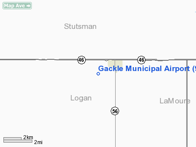
Location & QuickFacts
| FAA Information Effective: | 2008-09-25 |
| Airport Identifier: | 9G9 |
| Airport Status: | Operational |
| Longitude/Latitude: | 099-10-01.3950W/46-36-59.9190N
-99.167054/46.616644 (Estimated) |
| Elevation: | 1904 ft / 580.34 m (Estimated) |
| Land: | 20 acres |
| From nearest city: | 1 nautical miles SW of Gackle, ND |
| Location: | Logan County, ND |
| Magnetic Variation: | 08E (1985) |
Owner & Manager
| Ownership: | Publicly owned |
| Owner: | Town Of Gackle
CITY MAYOR GEORE ELHARD. |
| Address: | P.o. Box 57
Gackle, ND 58442 |
| Phone number: | 701-485-3331 |
| Manager: | Ardell Schmidt
CITY MAINTENANCE PERSON. |
| Address: | P O Box 57
Gackle, ND 58442 |
| Phone number: | 701-485-3331
MGRS HOME PHONE 701-485-3655 |
Airport Operations and Facilities
| Airport Use: | Open to public |
| Wind indicator: | No |
| Segmented Circle: | No |
| Control Tower: | No |
| Landing fee charge: | No |
| Sectional chart: | Twin Cities |
| Region: | AGL - Great Lakes |
| Boundary ARTCC: | ZMP - Minneapolis |
| Tie-in FSS: | GFK - Grand Forks |
| FSS on Airport: | No |
| FSS Toll Free: | 1-800-WX-BRIEF |
| NOTAMs Facility: | GFK (NOTAM-d service avaliable) |
Airport Communications
Airport Services
| Airframe Repair: | NONE |
| Power Plant Repair: | NONE |
Runway Information
Runway 08/26
| Dimension: | 2000 x 60 ft / 609.6 x 18.3 m |
| Surface: | TURF, Fair Condition
& RY 08/26 TURF SFC ROLLING; GRASS CLUMPY & POSSIBLE HOLES. |
| |
Runway 08 |
Runway 26 |
| Longitude: | 099-10-11.6500W | 099-09-43.0000W |
| Latitude: | 46-37-20.6000N | 46-37-20.6000N |
| Elevation: | 1904.00 ft | 1892.00 ft |
| Traffic Pattern: | Left | Left |
|
Runway 17/35
| Dimension: | 2000 x 40 ft / 609.6 x 12.2 m |
| Surface: | TURF, Fair Condition
& RY 08/26 TURF SFC ROLLING; GRASS CLUMPY & POSSIBLE HOLES. |
| |
Runway 17 |
Runway 35 |
| Longitude: | 099-09-43.0000W | 099-09-43.0000W |
| Latitude: | 46-37-28.5000N | 46-37-08.7600N |
| Elevation: | 1887.00 ft | 1900.00 ft |
| Traffic Pattern: | Left | Left |
| Obstruction: | 15 ft road | 10 ft road, 10.0 ft from runway, 1:1 slope to clear |
|
Radio Navigation Aids
| ID |
Type |
Name |
Ch |
Freq |
Var |
Dist |
| JMS | VOR/DME | Jamestown | 092X | 114.50 | 10E | 27.7 nm |
Remarks
- +10'HILL 600'RGT OF AER 8 & -30'DROP ON AER 8.
- PILOTS AT END OF RWY CANNOT SEE ACFT AT OPPOSITE END DUE TO RWY GRADIENT.
- ARPT CLSD WINTER DUE TO LACK OF SNOW REMOVAL.
- DIRT TRAIL/ROAD 100'W--PARALLEL TO RWY 17/35 CL VIOLS 7:1 TRNSL CLRNC.
- BIRDS ON & INVOF ARPT MAY-OCT.
- BE ALERT, RY 8 FIRST 200' RISE AT 5% SLOPE.
- SOME ANIMAL HOLES POSSIBLE BOTH RYS.
- TRAIL CROSSING LCTD 60' INBOARD RY 26.
Images and information placed above are from
http://www.airport-data.com/airport/9G9/
We thank them for the data!
| General Info
|
| Country |
United States
|
| State |
NORTH DAKOTA
|
| FAA ID |
9G9
|
| Latitude |
46-36-59.919N
|
| Longitude |
099-10-01.395W
|
| Elevation |
1904 feet
|
| Near City |
GACKLE
|
We don't guarantee the information is fresh and accurate. The data may
be wrong or outdated.
For more up-to-date information please refer to other sources.
|
|


