 |
|
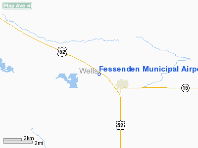
Location & QuickFacts
| FAA Information Effective: | 2008-09-25 |
| Airport Identifier: | D24 |
| Airport Status: | Operational |
| Longitude/Latitude: | 099-39-39.4400W/47-39-35.0060N
-99.660956/47.659724 (Estimated) |
| Elevation: | 1619 ft / 493.47 m (Surveyed) |
| Land: | 44 acres |
| From nearest city: | 3 nautical miles NW of Fessenden, ND |
| Location: | Wells County, ND |
| Magnetic Variation: | 09E (1985) |
Owner & Manager
| Ownership: | Publicly owned |
| Owner: | Fessenden Muni Arpt Authority
ARPT AUTH CHAIRMAN - BRYCE STREIBEL. |
| Address: | Po Box 467
Fessenden, ND 58438 |
| Phone number: | 701-547-3280 |
| Manager: | Mark Nelson |
| Address: | 414 North Second
Fessenden, ND 58438 |
| Phone number: | 701-547-3731
AFTER 1700 HOURS MON-FRI & DURG SAT-SUN CTC AMGR 701-547-3619. |
Airport Operations and Facilities
| Airport Use: | Open to public |
| Wind indicator: | Yes |
| Segmented Circle: | No |
| Control Tower: | No |
| Lighting Schedule: | RDO-CTL
ACTVT LIRL RY 08/26 - CTAF. |
| Landing fee charge: | No |
| Sectional chart: | Twin Cities |
| Region: | AGL - Great Lakes |
| Boundary ARTCC: | ZMP - Minneapolis |
| Tie-in FSS: | GFK - Grand Forks |
| FSS on Airport: | No |
| FSS Toll Free: | 1-800-WX-BRIEF |
| NOTAMs Facility: | GFK (NOTAM-d service avaliable) |
Airport Communications
Airport Services
Runway Information
Runway 08/26
| Dimension: | 2940 x 120 ft / 896.1 x 36.6 m
RY 08 HAS LGTD 300' STWY & RY 26 HAS 550' LGTD STWY. |
| Surface: | TURF, Good Condition |
| Edge Lights: | Low |
| |
Runway 08 |
Runway 26 |
| Longitude: | 099-40-12.5000W | 099-39-29.5500W |
| Latitude: | 47-39-34.0000N | 47-39-34.0000N |
| Elevation: | 1612.00 ft | 1610.00 ft |
| Traffic Pattern: | Left | Left |
| Obstruction: | 17 ft road, 340.0 ft from runway, 20:1 slope to clear | 50 ft trees, 1000.0 ft from runway, 225 ft right of centerline, 20:1 slope to clear |
|
Radio Navigation Aids
| ID |
Type |
Name |
Ch |
Freq |
Var |
Dist |
| RUG | NDB | Rugby | | 212.00 | 08E | 46.2 nm |
| DVL | VOR/DME | Devils Lake | 047X | 111.00 | 07E | 40.7 nm |
Remarks
- NO SNOW REMOVAL AVBL - CONFIRM COND PRIOR TO USE OCT-APR.
- WATERFOWL ON OR INVOF ARPT DURING MIGRATORY SEASON.
- THRS LCTD & MKD TO PROVIDE 20:1 APCH CLNC 125' EITHER SIDE OF CNTRLN MUST BE CLEAR OF OBSTNS; PUBLISHED LENGTH WILL BE 2940'; RY EDGE THR MARKINGS WILL BE INSTALLED.
Images and information placed above are from
http://www.airport-data.com/airport/D24/
We thank them for the data!
| General Info
|
| Country |
United States
|
| State |
NORTH DAKOTA
|
| FAA ID |
D24
|
| Latitude |
47-39-35.006N
|
| Longitude |
099-39-39.440W
|
| Elevation |
1619 feet
|
| Near City |
FESSENDEN
|
We don't guarantee the information is fresh and accurate. The data may
be wrong or outdated.
For more up-to-date information please refer to other sources.
|
|


