 |
|
Location & QuickFacts
| FAA Information Effective: | 2008-09-25 |
| Airport Identifier: | 4E7 |
| Airport Status: | Operational |
| Longitude/Latitude: | 098-30-46.3640W/46-00-44.8990N
-98.512879/46.012472 (Estimated) |
| Elevation: | 1455 ft / 443.48 m (Estimated) |
| Land: | 158 acres |
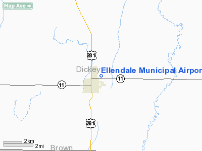
| From nearest city: | 1 nautical miles NE of Ellendale, ND |
| Location: | Dickey County, ND |
| Magnetic Variation: | 07E (1985) |
Owner & Manager
| Ownership: | Publicly owned |
| Owner: | Ellendale Arpt Auth
TOM ULMER, CHRMN ARPT AUTH. |
| Address: | Box 82
Ellendale, ND 58436 |
| Phone number: | 701-349-6151 |
| Manager: | John Lefforge |
| Address: | Box 491
Ellendale, ND 58436 |
| Phone number: | 701-349-3239 |
Airport Operations and Facilities
| Airport Use: | Open to public |
| Wind indicator: | Yes |
| Segmented Circle: | Yes |
| Control Tower: | No |
| Lighting Schedule: | DUSK-DAWN
ACTVT LIRL RY 13/31 - CTAF. |
| Beacon Color: | Clear-Green (lighted land airport) |
| Landing fee charge: | No |
| Sectional chart: | Twin Cities |
| Region: | AGL - Great Lakes |
| Boundary ARTCC: | ZMP - Minneapolis |
| Tie-in FSS: | GFK - Grand Forks |
| FSS on Airport: | No |
| FSS Toll Free: | 1-800-WX-BRIEF |
| NOTAMs Facility: | GFK (NOTAM-d service avaliable) |
| Federal Agreements: | NGY |
Airport Communications
Airport Services
| Airframe Repair: | NONE |
| Power Plant Repair: | NONE |
| Bottled Oxygen: | NONE |
| Bulk Oxygen: | NONE |
Runway Information
Runway 13/31
| Dimension: | 3500 x 60 ft / 1066.8 x 18.3 m |
| Surface: | ASPH, Good Condition
TURF SFC HAS CLUMPY GRASS AND GOPHER HOLES. |
| Weight Limit: | Single wheel: 12500 lbs. |
| Edge Lights: | Low |
| |
Runway 13 |
Runway 31 |
| Traffic Pattern: | Left | Left |
| Markings: | Basic, Good Condition | Basic, Good Condition |
| Obstruction: | 50 ft trees, 1600.0 ft from runway, 100 ft left of centerline, 28:1 slope to clear | 30 ft pline, 1600.0 ft from runway, 46:1 slope to clear |
|
Runway 17/35
| Dimension: | 2600 x 50 ft / 792.5 x 15.2 m |
| Surface: | TURF, Poor Condition
TURF SFC HAS CLUMPY GRASS AND GOPHER HOLES. |
| |
Runway 17 |
Runway 35 |
| Traffic Pattern: | Left | Left |
| Obstruction: | 70 ft tree, 2200.0 ft from runway, 100 ft right of centerline, 31:1 slope to clear | 30 ft pline, 900.0 ft from runway, 30:1 slope to clear |
|
Radio Navigation Aids
| ID |
Type |
Name |
Ch |
Freq |
Var |
Dist |
| BTN | NDB | Britton | | 386.00 | 06E | 34.1 nm |
| GWR | NDB | Gwinner | | 278.00 | 07E | 38.4 nm |
| ABR | VOR/DME | Aberdeen | 077X | 113.00 | 07E | 36.3 nm |
Remarks
- RY 31 +50 FT ANT 1800 FT FM THLD 400 FT L OF EXTDD CNTRLN.
- RY 13/31 VIS TO RY 35 OBSTD BY TREES.
- RY 17/35 CLSD DURG WINTER MONTHS DUE TO LACK OF SNOW REMOVAL.
- FOR RY CONDITIONS DURING WINTER MONTHS CALL AMGR ON (701) 349-3215/3239/3210.
- PRVDD FENCES DO NO EXCEED OBSTN STDS OF PART 77.
Images and information placed above are from
http://www.airport-data.com/airport/4E7/
We thank them for the data!
| General Info
|
| Country |
United States
|
| State |
NORTH DAKOTA
|
| FAA ID |
4E7
|
| Latitude |
46-00-44.899N
|
| Longitude |
098-30-46.364W
|
| Elevation |
1455 feet
|
| Near City |
ELLENDALE
|
We don't guarantee the information is fresh and accurate. The data may
be wrong or outdated.
For more up-to-date information please refer to other sources.
|
|


