 |
|
| Carrington Municipal Airport |
| IATA: none – ICAO: none – FAA LID: 46D |
| Summary |
| Airport type |
Public |
| Owner |
Carrington Airport Authority |
| Location |
Carrington, North Dakota |
| Elevation AMSL |
1,604 ft / 488.9 m |
| Coordinates |
47°27′04″N 99°09′04″W / 47.45111°N 99.15111°W / 47.45111; -99.15111 |
| Runways |
| Direction |
Length |
Surface |
| ft |
m |
| 13/31 |
4,200 |
1,280 |
Asphalt |
| Statistics (2007) |
| Aircraft operations |
2,410 |
| Source: Federal Aviation Administration |
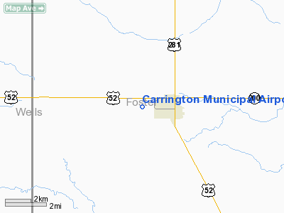
Carrington Municipal Airport (FAA LID: 46D) is a public airport located one mile (1.6 km) west of the central business district of Carrington, in Foster County, North Dakota, United States. It is owned by the Carrington Airport Authority.
Facilities and aircraft
Carrington Municipal Airport covers an area of 244 acres (99 ha) which contains one runway:
- Runway 13/31: 4,200 x 75 ft (1,280 x 23 m), Surface: Asphalt
For the 12-month period ending July 31, 2007, the airport had 2,410 aircraft operations: 87% general aviation, 12% air taxi, and less than 1% military.
The above content comes from Wikipedia and is published under free licenses – click here to read more.
Location & QuickFacts
| FAA Information Effective: | 2008-09-25 |
| Airport Identifier: | 46D |
| Airport Status: | Operational |
| Longitude/Latitude: | 099-09-04.0000W/47-27-04.0000N
-99.151111/47.451111 (Estimated) |
| Elevation: | 1604 ft / 488.90 m (Surveyed) |
| Land: | 244 acres |
| From nearest city: | 1 nautical miles W of Carrington, ND |
| Location: | Foster County, ND |
| Magnetic Variation: | 07E (2000) |
Owner & Manager
| Ownership: | Publicly owned |
| Owner: | Carrington Arpt Authority |
| Address: | Box 473
Carrington, ND 58421 |
| Phone number: | 701-652-2443
BETTY BOLD - ARPT AUTH CLERK. |
| Manager: | Jay Bauer
ADDL CTC: CITY PUBLICS WORKS 701-652-2911 |
| Address: | 923 S 1st, Po Box 139
Carrington, ND 58421 |
| Phone number: | 701-652-2801
AMGR'S HOME PHONE 701-652-2059 |
Airport Operations and Facilities
| Airport Use: | Open to public |
| Wind indicator: | Yes |
| Segmented Circle: | Yes |
| Control Tower: | No |
| Lighting Schedule: | DUSK-DAWN
MIRL RY 13/31 OPER DUSK-0000, AFT 0000 ACTVT MIRL RY 13/31 & PAPI RYS 13 & 31 - CTAF. |
| Beacon Color: | Clear-Green (lighted land airport) |
| Landing fee charge: | No |
| Sectional chart: | Twin Cities |
| Region: | AGL - Great Lakes |
| Boundary ARTCC: | ZMP - Minneapolis |
| Tie-in FSS: | GFK - Grand Forks |
| FSS on Airport: | No |
| FSS Toll Free: | 1-800-WX-BRIEF |
| NOTAMs Facility: | GFK (NOTAM-d service avaliable) |
| Federal Agreements: | N1 |
Airport Communications
Airport Services
| Fuel available: | 100LL
SELF SVC 24 HR CREDIT CARD FUEL AVBL. |
| Airframe Repair: | NONE |
| Power Plant Repair: | NONE |
| Bottled Oxygen: | NONE |
| Bulk Oxygen: | NONE |
Runway Information
Runway 13/31
| Dimension: | 4200 x 75 ft / 1280.2 x 22.9 m |
| Surface: | ASPH, Good Condition |
| Edge Lights: | Medium |
| |
Runway 13 |
Runway 31 |
| Longitude: | 099-09-24.0000W | 099-08-44.0000W |
| Latitude: | 47-27-20.0000N | 47-26-48.0000N |
| Elevation: | 1604.00 ft | 1604.00 ft |
| Traffic Pattern: | Left | Left |
| Markings: | Non-precision instrument, Good Condition | Non-precision instrument, Good Condition |
| Crossing Height: | 25.00 ft | 25.00 ft |
| VASI: | 2-light PAPI on left side | 2-light PAPI on left side |
| Visual Glide Angle: | 3.00° | 3.00° |
| Obstruction: | 13 ft road, 780.0 ft from runway, 175 ft left of centerline, 44:1 slope to clear | 65 ft trees, 2200.0 ft from runway, 150 ft right of centerline, 30:1 slope to clear |
|
Radio Navigation Aids
| ID |
Type |
Name |
Ch |
Freq |
Var |
Dist |
| JMS | VOR/DME | Jamestown | 092X | 114.50 | 10E | 36.6 nm |
| DVL | VOR/DME | Devils Lake | 047X | 111.00 | 07E | 41.1 nm |
Remarks
- FOR SNOW REMOVAL INFO; CTC CITY HALL 701-652-2911.
- N APRON CLSD TO ACFT OVER 1000 LBS.
- RY 13 HAS - 6 FT DITCH 120 FT L OF EXTDD CNTRLN OUTBOUND FM THLD.
- EXISTED PRIOR TO 1959.
Images and information placed above are from
http://www.airport-data.com/airport/46D/
We thank them for the data!
| General Info
|
| Country |
United States
|
| State |
NORTH DAKOTA
|
| FAA ID |
46D
|
| Latitude |
47-27-04.000N
|
| Longitude |
099-09-04.000W
|
| Elevation |
1604 feet
|
| Near City |
CARRINGTON
|
We don't guarantee the information is fresh and accurate. The data may
be wrong or outdated.
For more up-to-date information please refer to other sources.
|
|


