 |
|
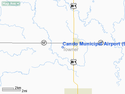
| Cando Municipal Airport |
| IATA: none – ICAO: none – FAA LID: 9D7 |
| Summary |
| Airport type |
Public |
| Owner |
Cando Airport Authority |
| Location |
Cando, North Dakota |
| Elevation AMSL |
1,481 ft / 451.4 m |
| Coordinates |
48°21′48.1″N 99°14′11.0″W / 48.363361°N 99.23639°W / 48.363361; -99.23639 |
| Runways |
| Direction |
Length |
Surface |
| ft |
m |
| 16/34 |
3,500 |
1,067 |
Asphalt |
| Statistics (1998) |
| Aircraft operations |
3,550 |
| Source: Federal Aviation Administration |
Cando Municipal Airport (FAA LID: 9D7) is a public airport located one mile (1.6 km) west of the central business district of Bowman, in Towner County, North Dakota, United States. It is owned by the Cando Airport Authority.
Facilities and aircraft
Cando Municipal Airport covers an area of 205 acres (83 ha) which contains one runway:
- Runway 16/34: 3,500 x 60 ft (1,067 x 18 m), Surface: Asphalt
For the 12-month period ending July 8, 1998, the airport had 3,550 aircraft operations: 99% general aviation and 1% air taxi.
The above content comes from Wikipedia and is published under free licenses – click here to read more.
Location & QuickFacts
| FAA Information Effective: | 2008-09-25 |
| Airport Identifier: | 9D7 |
| Airport Status: | Operational |
| Longitude/Latitude: | 099-14-11.0000W/48-28-48.1000N
-99.236389/48.480028 (Estimated) |
| Elevation: | 1481 ft / 451.41 m (Surveyed) |
| Land: | 205 acres |
| From nearest city: | 1 nautical miles W of Cando, ND |
| Location: | Towner County, ND |
| Magnetic Variation: | 06E (1985) |
Owner & Manager
| Ownership: | Publicly owned |
| Owner: | Cando Arpt Auth
SEC CHRMN ARPT AUTH. |
| Address: | 1108 5th Ave
Cando, ND 58324 |
| Phone number: | 701-968-3736 |
| Manager: | Robert Curl |
| Address: | 1108 5th Ave
Cando, ND 58324 |
| Phone number: | 701-968-3736
PHONE INFO ROBERT CURL SEC OF ARPT AUTH (701) 968-3736. |
Airport Operations and Facilities
| Airport Use: | Open to public |
| Wind indicator: | Yes |
| Segmented Circle: | No |
| Control Tower: | No |
| Lighting Schedule: | DUSK-DAWN
MIRL RY 16/34 OPERS DUSK-2200; AFT 2200 ACTVT - CTAF. |
| Beacon Color: | Clear-Green (lighted land airport) |
| Landing fee charge: | No |
| Sectional chart: | Twin Cities |
| Region: | AGL - Great Lakes |
| Boundary ARTCC: | ZMP - Minneapolis |
| Tie-in FSS: | GFK - Grand Forks |
| FSS on Airport: | No |
| FSS Toll Free: | 1-800-WX-BRIEF |
| NOTAMs Facility: | GFK (NOTAM-d service avaliable) |
| Federal Agreements: | N1 |
Airport Communications
Airport Services
| Airframe Repair: | NONE |
| Power Plant Repair: | NONE |
| Bottled Oxygen: | NONE |
| Bulk Oxygen: | NONE |
Runway Information
Runway 16/34
| Dimension: | 3500 x 60 ft / 1066.8 x 18.3 m |
| Surface: | ASPH, Good Condition |
| Edge Lights: | Medium |
| |
Runway 16 |
Runway 34 |
| Longitude: | 099-14-17.1987W | 099-14-04.7308W |
| Latitude: | 48-29-04.8990N | 48-28-31.3702N |
| Elevation: | 1480.00 ft | 1481.00 ft |
| Alignment: | 127 | 127 |
| Traffic Pattern: | Left | Left |
| Crossing Height: | 25.00 ft | 25.00 ft |
| VASI: | 2-light PAPI on left side | 2-light PAPI on left side |
| Visual Glide Angle: | 3.00° | 3.00° |
|
Radio Navigation Aids
| ID |
Type |
Name |
Ch |
Freq |
Var |
Dist |
| RLL | NDB | Rolla | | 263.00 | 09E | 28.4 nm |
| RUG | NDB | Rugby | | 212.00 | 08E | 32.0 nm |
| DVL | VOR/DME | Devils Lake | 047X | 111.00 | 07E | 25.5 nm |
Remarks
- IREG SNOW REMOVAL WINTER MONTHS; CONFIRM WINTER CONDS PRIOR TO USE WITH ARPT MGR.
- MIGRATORY WATERFOWL INVOF ARPT MAR-APR & SEP-OCT.
- EXISTED PRIOR TO 1959.
Images and information placed above are from
http://www.airport-data.com/airport/9D7/
We thank them for the data!
| General Info
|
| Country |
United States
|
| State |
NORTH DAKOTA
|
| FAA ID |
9D7
|
| Latitude |
48-29-03.003N
|
| Longitude |
099-14-12.494W
|
| Elevation |
1485 feet
|
| Near City |
CANDO
|
We don't guarantee the information is fresh and accurate. The data may
be wrong or outdated.
For more up-to-date information please refer to other sources.
|
|


