 |
|
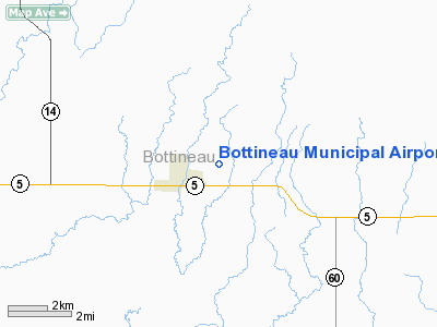
| Bottineau Municipal Airport |
| IATA: none – ICAO: none – FAA LID: D09 |
| Summary |
| Airport type |
Public |
| Owner |
Bottineau Airport Authority |
| Location |
Bottineau, North Dakota |
| Elevation AMSL |
1,679 ft / 512 m |
| Coordinates |
48°49′49″N 100°25′02″W / 48.83028°N 100.41722°W / 48.83028; -100.41722 |
| Runways |
| Direction |
Length |
Surface |
| ft |
m |
| 13/31 |
3,700 |
1,128 |
Asphalt |
| 3/21 |
2,000 |
610 |
Turf |
| Statistics (2007) |
| Aircraft operations |
4,720 |
| Source: Federal Aviation Administration |
Bottineau Municipal Airport (FAA LID: D09) is a public airport located one mile (1.6 km) east of the central business district of Bottineau, in Bottineau County, North Dakota, United States. It is owned by the Bottineau Airport Authority.
Facilities and aircraft
Bottineau Municipal Airport covers an area of 188 acres (76 ha) which contains two runways:
- Runway 13/31: 3,700 x 60 ft (1,128 x 18 m), Surface: Asphalt
- Runway 3/21: 2,000 x 150 ft (610 x 46 m), Surface: Turf
For the 12-month period ending July 23, 2007, the airport had 4,720 aircraft operations: 93% general aviation, 5% air taxi, and 2% military.
The above content comes from Wikipedia and is published under free licenses – click here to read more.
Location & QuickFacts
| FAA Information Effective: | 2008-09-25 |
| Airport Identifier: | D09 |
| Airport Status: | Operational |
| Longitude/Latitude: | 100-25-01.6900W/48-49-49.4100N
-100.417136/48.830392 (Estimated) |
| Elevation: | 1679 ft / 511.76 m (Surveyed) |
| Land: | 188 acres |
| From nearest city: | 1 nautical miles E of Bottineau, ND |
| Location: | Bottineau County, ND |
| Magnetic Variation: | 08E (2000) |
Owner & Manager
| Ownership: | Publicly owned |
| Owner: | Bottineau Airport Auth |
| Address: | 617 E. 5th St
Bottineau, ND 58318 |
| Phone number: | 701-228-3703
SEC/TREAS OF ARPT AUTH; JIM CHRISTIANSON 701-228-3987 (HOME PHONE). |
| Manager: | Curt Aalund |
| Address: | 9770 13th Ave Ne
Bottineau, ND 58318 |
| Phone number: | 701-228-5265 |
Airport Operations and Facilities
| Airport Use: | Open to public |
| Wind indicator: | Yes |
| Segmented Circle: | Yes |
| Control Tower: | No |
| Lighting Schedule: | DUSK-DAWN
ACTVT MIRL RY 13/31 & PAPI RYS 13 & 31 - CTAF |
| Beacon Color: | Clear-Green (lighted land airport) |
| Landing fee charge: | No |
| Sectional chart: | Twin Cities |
| Region: | AGL - Great Lakes |
| Traffic Pattern Alt: | 1000 ft |
| Boundary ARTCC: | ZMP - Minneapolis |
| Tie-in FSS: | GFK - Grand Forks |
| FSS on Airport: | No |
| FSS Toll Free: | 1-800-WX-BRIEF |
| NOTAMs Facility: | GFK (NOTAM-d service avaliable) |
| Federal Agreements: | NGY |
Airport Communications
| CTAF: | 122.800 |
| Unicom: | 122.800 |
Airport Services
| Fuel available: | 100LL
FOR FUEL CTC 701-228-5265 AFT HRS 701-228-5103/2983. |
| Airframe Repair: | MAJOR |
| Power Plant Repair: | MAJOR |
| Bottled Oxygen: | NONE |
| Bulk Oxygen: | NONE |
Runway Information
Runway 03/21
| Dimension: | 2000 x 150 ft / 609.6 x 45.7 m |
| Surface: | TURF, Good Condition |
| |
Runway 03 |
Runway 21 |
| Longitude: | 100-25-15.9610W | 100-24-59.8800W |
| Latitude: | 48-49-45.1660N | 48-50-01.8070N |
| Elevation: | 1665.00 ft | 1679.00 ft |
| Alignment: | 33 | 127 |
| Traffic Pattern: | Left | Left |
| Markings: | Nonstandard,
RYS 03 & 21 MKD WITH BLACK/WHITE CONES. | Nonstandard, |
| Runway End Identifier: | No | No |
| Centerline Lights: | No | No |
| Touchdown Lights: | No | No |
| Obstruction: | 30 ft trees, 1200.0 ft from runway, 250 ft right of centerline, 40:1 slope to clear | 50 ft trees, 800.0 ft from runway, 200 ft left of centerline, 16:1 slope to clear |
|
Runway 13/31
| Dimension: | 3700 x 60 ft / 1127.8 x 18.3 m |
| Surface: | ASPH, |
| Weight Limit: | Single wheel: 12500 lbs. |
| Edge Lights: | Medium |
| |
Runway 13 |
Runway 31 |
| Longitude: | 100-25-17.8610W | 100-24-38.7990W |
| Latitude: | 48-50-00.1270N | 48-49-34.2850N |
| Elevation: | 1677.00 ft | 1660.00 ft |
| Alignment: | 127 | 127 |
| Traffic Pattern: | Left | Left |
| Markings: | Non-precision instrument, Good Condition | Non-precision instrument, Good Condition |
| Crossing Height: | 34.00 ft | 30.00 ft |
| VASI: | 2-light PAPI on right side | 2-light PAPI on left side |
| Visual Glide Angle: | 3.00° | 3.00° |
| Runway End Identifier: | No | No |
| Centerline Lights: | No | No |
| Touchdown Lights: | No | No |
| Obstruction: | 20 ft road, 600.0 ft from runway, 300 ft left of centerline, 20:1 slope to clear | , 50:1 slope to clear |
|
Radio Navigation Aids
| ID |
Type |
Name |
Ch |
Freq |
Var |
Dist |
| RUG | NDB | Rugby | | 212.00 | 08E | 30.8 nm |
| RLL | NDB | Rolla | | 263.00 | 09E | 31.9 nm |
| HBC | NDB | Mohall | | 350.00 | 11E | 44.5 nm |
| MIB | TACAN | Deering | 096X | | 10E | 45.2 nm |
| MOT | VORTAC | Minot | 118X | 117.10 | 13E | 48.7 nm |
Remarks
- CFM WINTER COND BEFORE USE AFTER MAJOR WINTER STORM WITH AMGR CALL 701-228-5265.
- RY 03/21 CLSD WINTER MONTHS DUE TO LACK OF SNOW REMOVAL.
- MIGRATORY WATERFOWL ON & INVOF ARPT SEP-NOV.
- MINOT AFB (MIB) ASR OTS FOR PREVENTATIVE MAINT 0600-0800 FRIDAYS.
Images and information placed above are from
http://www.airport-data.com/airport/D09/
We thank them for the data!
| General Info
|
| Country |
United States
|
| State |
NORTH DAKOTA
|
| FAA ID |
D09
|
| Latitude |
48-49-49.410N
|
| Longitude |
100-25-01.690W
|
| Elevation |
1679 feet
|
| Near City |
BOTTINEAU
|
We don't guarantee the information is fresh and accurate. The data may
be wrong or outdated.
For more up-to-date information please refer to other sources.
|
|


