 |
|
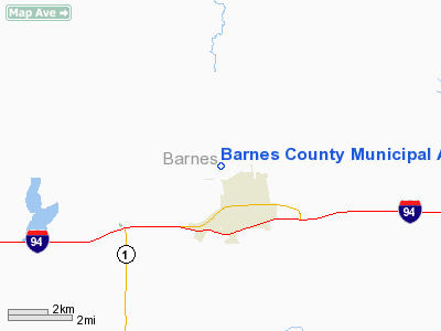
Barnes County Muni Airport |
Location & QuickFacts
| FAA Information Effective: | 2008-09-25 |
| Airport Identifier: | 6D8 |
| Airport Status: | Operational |
| Longitude/Latitude: | 098-01-03.4540W/46-56-27.6280N
-98.017626/46.941008 (Estimated) |
| Elevation: | 1400 ft / 426.72 m (Surveyed) |
| Land: | 330 acres |
| From nearest city: | 1 nautical miles NW of Valley City, ND |
| Location: | Barnes County, ND |
| Magnetic Variation: | 07E (1985) |
Owner & Manager
| Ownership: | Publicly owned |
| Owner: | City Of Valley City
DENNIS HELLAND, CHMN ARPT AUTH, PHONE 701-796-7841. |
| Address: | 605 North Central Ave
Valley City, ND 58072 |
| Phone number: | 701-845-0881 |
| Manager: | Larry Lindemann |
| Address: | Box 96
Valley City, ND 58072 |
| Phone number: | 701-845-2587
ADDL CONTACT JARED LINDEMANN 701-845-2100 OR CELL 793-0626 |
Airport Operations and Facilities
| Airport Use: | Open to public |
| Wind indicator: | Yes |
| Segmented Circle: | Yes |
| Control Tower: | No |
| Lighting Schedule: | DUSK-DAWN
MIRL RY 13/31 PRESET ON MED INTST; TO INCR INTST AND ACTVT PAPI & REIL RYS 13 & 31 - CTAF. |
| Beacon Color: | Clear-Green (lighted land airport) |
| Landing fee charge: | No |
| Sectional chart: | Twin Cities |
| Region: | AGL - Great Lakes |
| Boundary ARTCC: | ZMP - Minneapolis |
| Tie-in FSS: | GFK - Grand Forks |
| FSS on Airport: | No |
| FSS Toll Free: | 1-800-WX-BRIEF |
| NOTAMs Facility: | GFK (NOTAM-d service avaliable) |
| Federal Agreements: | NGY3 |
Airport Communications
| CTAF: | 122.800 |
| Unicom: | 122.800 |
Airport Services
| Fuel available: | 100LLA
SELF-SERVICE 24 HOUR CREDIT CARD FUEL AVBL. |
| Airframe Repair: | MAJOR |
| Power Plant Repair: | MAJOR |
| Bottled Oxygen: | NONE |
| Bulk Oxygen: | NONE |
Runway Information
Runway 05/23
| Dimension: | 2700 x 100 ft / 823.0 x 30.5 m |
| Surface: | TURF, Good Condition |
| |
Runway 05 |
Runway 23 |
| Longitude: | 098-01-17.3540W | 098-00-44.8550W |
| Latitude: | 46-56-12.4280N | 46-56-26.9270N |
| Alignment: | 56 | 127 |
| Traffic Pattern: | Left | Left |
| Runway End Identifier: | No | No |
| Centerline Lights: | No | No |
| Touchdown Lights: | No | No |
| Obstruction: | 60 ft pole, 1400.0 ft from runway, 200 ft left of centerline, 23:1 slope to clear | , 50:1 slope to clear |
|
Runway 08/26
| Dimension: | 2700 x 100 ft / 823.0 x 30.5 m |
| Surface: | TURF, Good Condition |
| |
Runway 08 |
Runway 26 |
| Longitude: | 098-01-16.3540W | 098-00-37.8550W |
| Latitude: | 46-56-21.9280N | 46-56-21.9270N |
| Elevation: | 0.00 ft | 1383.00 ft |
| Alignment: | 90 | 127 |
| Traffic Pattern: | Left | Left |
| Runway End Identifier: | No | No |
| Centerline Lights: | No | No |
| Touchdown Lights: | No | No |
| Obstruction: | 30 ft trees, 750.0 ft from runway, 25:1 slope to clear | , 50:1 slope to clear |
|
Runway 13/31
| Dimension: | 4202 x 75 ft / 1280.8 x 22.9 m |
| Surface: | ASPH-TRTD, Good Condition |
| Surface Treatment: | Aggregate Friction Seal Coat |
| Weight Limit: | Single wheel: 12500 lbs. |
| Edge Lights: | Medium |
| |
Runway 13 |
Runway 31 |
| Longitude: | 098-01-20.8670W | 098-00-37.3070W |
| Latitude: | 46-56-50.6550N | 46-56-21.8350N |
| Elevation: | 1400.00 ft | 1383.00 ft |
| Alignment: | 127 | 127 |
| Traffic Pattern: | Left | Left |
| Markings: | Non-precision instrument, Fair Condition | Non-precision instrument, Fair Condition |
| Crossing Height: | 31.00 ft | 26.00 ft |
| VASI: | 2-light PAPI on left side | 2-light PAPI on left side |
| Visual Glide Angle: | 3.00° | 3.00° |
| Runway End Identifier: | Yes | Yes |
| Centerline Lights: | No | No |
| Touchdown Lights: | No | No |
| Obstruction: | 35 ft hill, 1620.0 ft from runway, 40:1 slope to clear | 25 ft tree, 770.0 ft from runway, 150 ft left of centerline, 22:1 slope to clear |
|
Runway 17/35
| Dimension: | 3300 x 100 ft / 1005.8 x 30.5 m |
| Surface: | TURF, Good Condition |
| |
Runway 17 |
Runway 35 |
| Longitude: | 098-01-15.8540W | 098-01-15.8540W |
| Latitude: | 46-56-44.4280N | 46-56-11.4280N |
| Alignment: | 127 | 127 |
| Traffic Pattern: | Left | Left |
| Runway End Identifier: | No | No |
| Centerline Lights: | No | No |
| Touchdown Lights: | No | No |
| Obstruction: | 27 ft hill, 1200.0 ft from runway, 44:1 slope to clear | 60 ft tree, 1200.0 ft from runway, 20:1 slope to clear |
|
Radio Navigation Aids
| ID |
Type |
Name |
Ch |
Freq |
Var |
Dist |
| VCY | NDB | Valley City | | 382.00 | 07E | 5.7 nm |
| GWR | NDB | Gwinner | | 278.00 | 07E | 45.8 nm |
| AA | NDB | Kenie | | 365.00 | 06E | 49.5 nm |
| JMS | VOR/DME | Jamestown | 092X | 114.50 | 10E | 27.1 nm |
| FAR | VORTAC | Fargo | 109X | 116.20 | 09E | 49.3 nm |
Remarks
- RWYS 05/23 08/26 17/35 CLSD WINTER MONTHS DUE TO LACK OF SNOW REMOVAL
- RYS 05/23; 08/26 & 17/35 MARKED WITH DALGT BNDRY MARKERS & NIGHT TIME REFLECTOR POSTS EVERY 400 FT.
- CONFIRM SNOW REMOVAL & WINTER CONDITIONS DURING NOV-MAR, CALL 701-845-2587.
Images and information placed above are from
http://www.airport-data.com/airport/6D8/
We thank them for the data!
| General Info
|
| Country |
United States
|
| State |
NORTH DAKOTA
|
| FAA ID |
6D8
|
| Latitude |
46-56-27.628N
|
| Longitude |
098-01-03.454W
|
| Elevation |
1400 feet
|
| Near City |
VALLEY CITY
|
We don't guarantee the information is fresh and accurate. The data may
be wrong or outdated.
For more up-to-date information please refer to other sources.
|
|


