 |
|
Location & QuickFacts
| FAA Information Effective: | 2008-09-25 |
| Airport Identifier: | ASY |
| Airport Status: | Operational |
| Longitude/Latitude: | 099-21-09.4110W/46-01-25.9060N
-99.352614/46.023863 (Estimated) |
| Elevation: | 2032 ft / 619.35 m (Estimated) |
| Land: | 90 acres |
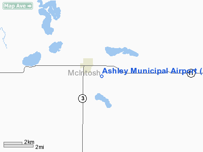
| From nearest city: | 1 nautical miles SE of Ashley, ND |
| Location: | Mc Intosh County, ND |
| Magnetic Variation: | 08E (1985) |
Owner & Manager
| Ownership: | Publicly owned |
| Owner: | Ashley Muni Apt Auth |
| Address: | P.o. Box 155
Ashley, ND 58413 |
| Phone number: | 701-288-3445 |
| Manager: | Stanley Schnabel |
| Address: | Box 155
Ashley, ND 58413 |
| Phone number: | 701-288-3445
ADNL PHONE 701-288-3675. |
Airport Operations and Facilities
| Airport Use: | Open to public |
| Wind indicator: | Yes |
| Segmented Circle: | No |
| Control Tower: | No |
| Lighting Schedule: | DUSK-DAWN
LIRL RY 14/32 OPER DUSK-0000, AFT 0000 ACTVT - CTAF. |
| Beacon Color: | Clear-Green (lighted land airport) |
| Landing fee charge: | No |
| Sectional chart: | Twin Cities |
| Region: | AGL - Great Lakes |
| Boundary ARTCC: | ZMP - Minneapolis |
| Tie-in FSS: | GFK - Grand Forks |
| FSS on Airport: | No |
| FSS Toll Free: | 1-800-WX-BRIEF |
| NOTAMs Facility: | GFK (NOTAM-d service avaliable) |
Airport Communications
Airport Services
| Fuel available: | 100LL
FOR FUEL CTC AMGR 701-288-3445/3675 HOME OR CITY POLICE PAGER AT HOSPITAL 701-288-3433. |
| Airframe Repair: | NONE |
| Power Plant Repair: | NONE |
| Bottled Oxygen: | NONE |
| Bulk Oxygen: | NONE |
Runway Information
Runway 08/26
| Dimension: | 2825 x 150 ft / 861.1 x 45.7 m |
| Surface: | TURF, Fair Condition
50 FT CNTR TURF SFC CLUMPY & POSSIBLE ANIMAL HOLES & ANT MOUNDS. |
| Weight Limit: | Single wheel: 5000 lbs. |
| |
Runway 08 |
Runway 26 |
| Longitude: | 099-21-18.8200W | 099-20-38.7800W |
| Latitude: | 46-01-36.0800N | 46-01-36.0800N |
| Elevation: | 2015.00 ft | 2027.00 ft |
| Traffic Pattern: | Left | Left |
| Runway End Identifier: | No | No |
| Centerline Lights: | No | No |
| Touchdown Lights: | No | No |
| Obstruction: | 20 ft bldg, 775.0 ft from runway, 100 ft right of centerline, 38:1 slope to clear | 60 ft trees, 1300.0 ft from runway, 150 ft right of centerline, 21:1 slope to clear |
|
Runway 14/32
| Dimension: | 4300 x 60 ft / 1310.6 x 18.3 m |
| Surface: | ASPH, Fair Condition
50 FT CNTR TURF SFC CLUMPY & POSSIBLE ANIMAL HOLES & ANT MOUNDS. |
| Weight Limit: | Single wheel: 6000 lbs. |
| Edge Lights: | Low |
| |
Runway 14 |
Runway 32 |
| Longitude: | 099-21-25.0400W | 099-20-55.5000W |
| Latitude: | 46-01-42.1300N | 46-01-05.0000N |
| Elevation: | 2015.00 ft | 2030.00 ft |
| Traffic Pattern: | Left | Left |
| Markings: | None,
RY 14 /32 HAS NO VISIBLE MARKINGS AND NO TWY MARKINGS. | None, |
| Obstruction: | 15 ft road, 770.0 ft from runway, 180 ft right of centerline, 38:1 slope to clear | , 50:1 slope to clear |
|
Radio Navigation Aids
| ID |
Type |
Name |
Ch |
Freq |
Var |
Dist |
Remarks
- WATERFOWL ON & INVOF ARPT APR-NOV.
- CONFIRM SNOW REMOVAL WITH AMGR; CALL 701-288-3445/3675 OR CALL CITY AT (701) 288-3347/3096.
- RY 08/26 CLSD WINTER MONTHS DUE TO LACK OF SNOW REMOVAL.
- WATERFOWL POSSIBLE DUE TO LAKE 100 FT OUTBOUND APR-NOV.
Images and information placed above are from
http://www.airport-data.com/airport/ASY/
We thank them for the data!
| General Info
|
| Country |
United States
|
| State |
NORTH DAKOTA
|
| FAA ID |
ASY
|
| Latitude |
46-01-25.906N
|
| Longitude |
099-21-09.411W
|
| Elevation |
2032 feet
|
| Near City |
ASHLEY
|
We don't guarantee the information is fresh and accurate. The data may
be wrong or outdated.
For more up-to-date information please refer to other sources.
|
|


