 |
|
| Arthur Airport |
| IATA: none – ICAO: none – FAA LID: 1A2 |
| Summary |
| Airport type |
Public |
| Owner |
Arthur Airport Authority |
| Serves |
Arthur, North Dakota |
| Elevation AMSL |
973 ft / 297 m |
| Coordinates |
47°06′40″N 097°12′26″W / 47.11111°N 97.20722°W / 47.11111; -97.20722 |
| Runways |
| Direction |
Length |
Surface |
| ft |
m |
| 17/35 |
3,100 |
945 |
Turf |
| Statistics (2007) |
| Aircraft operations |
510 |
| Based aircraft |
3 |
| Source: Federal Aviation Administration |
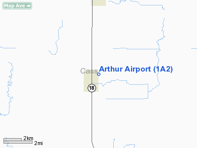
Arthur Airport (FAA LID: 1A2) is a public airport located one mile (2 km) northeast of the central business district of Arthur, a city in Cass County, North Dakota, United States. It is owned by the Arthur Airport Authority.
Facilities and aircraft
Arthur Airport covers an area of 10 acres (4 ha) and has one runway designated 17/35 with a 3,100 by 85 ft (945 by 26 m) turf surface. For the 12-month period ending July 31, 2007, the airport had 510 aircraft operations, an average of 43 per month: 98% general aviation and 2% air taxi.
The above content comes from Wikipedia and is published under free licenses – click here to read more.
Location & QuickFacts
| FAA Information Effective: | 2008-09-25 |
| Airport Identifier: | 1A2 |
| Airport Status: | Operational |
| Longitude/Latitude: | 097-12-26.3140W/47-06-39.9160N
-97.207309/47.111088 (Estimated) |
| Elevation: | 973 ft / 296.57 m (Estimated) |
| Land: | 10 acres |
| From nearest city: | 1 nautical miles NE of Arthur, ND |
| Location: | Cass County, ND |
| Magnetic Variation: | 06E (1985) |
Owner & Manager
| Ownership: | Publicly owned |
| Owner: | Arthur Arpt Auth |
| Address: | Box 145
Arthur, ND 58006 |
| Phone number: | 701-967-8312 |
| Manager: | Rick Burgum
CHAIRMAN ARPT AUTH. |
| Address: | Box 145
Arthur, ND 58006 |
| Phone number: | 701-371-0504
ADL MGR PHONE 701-371-0504 OR KEVIN SKUNES 701-261-0112 |
Airport Operations and Facilities
| Airport Use: | Open to public |
| Wind indicator: | No |
| Segmented Circle: | No |
| Control Tower: | No |
| Landing fee charge: | No |
| Sectional chart: | Twin Cities |
| Region: | AGL - Great Lakes |
| Boundary ARTCC: | ZMP - Minneapolis |
| Tie-in FSS: | GFK - Grand Forks |
| FSS on Airport: | No |
| FSS Toll Free: | 1-800-WX-BRIEF |
| NOTAMs Facility: | GFK (NOTAM-d service avaliable) |
Airport Communications
Airport Services
| Airframe Repair: | NONE |
| Power Plant Repair: | NONE |
| Bottled Oxygen: | NONE |
| Bulk Oxygen: | NONE |
Runway Information
Runway 17/35
| Dimension: | 3100 x 85 ft / 944.9 x 25.9 m |
| Surface: | TURF, Good Condition |
| |
Runway 17 |
Runway 35 |
| Longitude: | 097-12-30.3100W | 097-12-30.3100W |
| Latitude: | 47-06-59.5100N | 47-06-28.9100N |
| Elevation: | 973.00 ft | 973.00 ft |
| Traffic Pattern: | Left | Left |
| Obstruction: | , 50:1 slope to clear | 17 ft road, 30.0 ft from runway, 1:1 slope to clear |
|
Radio Navigation Aids
| ID |
Type |
Name |
Ch |
Freq |
Var |
Dist |
| AA | NDB | Kenie | | 365.00 | 06E | 17.2 nm |
| VCY | NDB | Valley City | | 382.00 | 07E | 32.2 nm |
| CKN | NDB | Crookston | | 400.00 | 07E | 49.9 nm |
| FAR | VORTAC | Fargo | 109X | 116.20 | 09E | 26.0 nm |
Remarks
- NO SNOW REMOVAL AVAILABLE; CFM WINTER CONDS PRIOR TO USE WITH AMGR - CALL 701-371-0504 OR 967-8312.
- 50 FT TREES 125 FT L & R OF CNTRLN; 600 FT INBOUND FM THLD.
Images and information placed above are from
http://www.airport-data.com/airport/1A2/
We thank them for the data!
| General Info
|
| Country |
United States
|
| State |
NORTH DAKOTA
|
| FAA ID |
1A2
|
| Latitude |
47-06-39.916N
|
| Longitude |
097-12-26.314W
|
| Elevation |
973 feet
|
| Near City |
ARTHUR
|
We don't guarantee the information is fresh and accurate. The data may
be wrong or outdated.
For more up-to-date information please refer to other sources.
|
|


