|
|
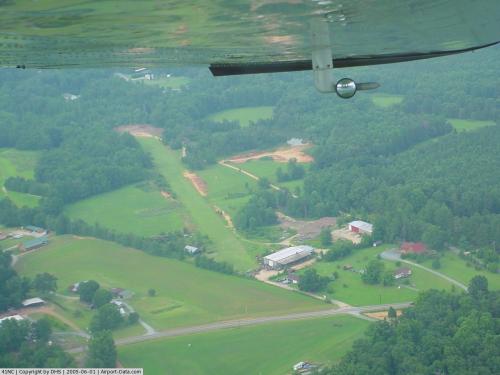 |
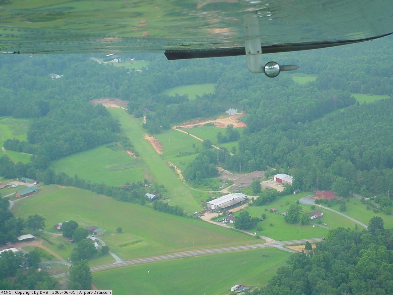
(Click on the photo to enlarge) |
Location & QuickFacts
| FAA Information Effective: | 2008-09-25 |
| Airport Identifier: | 41NC |
| Airport Status: | Operational |
| Longitude/Latitude: | 080-31-19.2000W/35-31-18.5000N
-80.522000/35.521806 (Estimated) |
| Elevation: | 794 ft / 242.01 m (Estimated) |
| Land: | 7 acres |
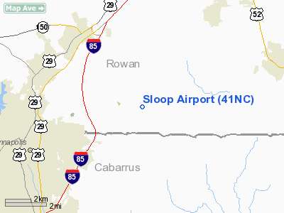
| From nearest city: | 7 nautical miles E of Kannapolis, NC |
| Location: | Rowan County, NC |
| Magnetic Variation: | 06W (1995) |
Owner & Manager
| Ownership: | Privately owned |
| Owner: | Danny H. Sloop |
| Address: | 6070 Old Beatty Ford Road
Rockwell, NC 28138-7634 |
| Phone number: | 704-857-9573 |
| Manager: | Danny H. Sloop |
| Address: | 6070 Old Beatty Ford Road
Rockwell, NC 28138-7634 |
| Phone number: | 704-558-4010 |
Airport Operations and Facilities
| Airport Use: | Private |
| Wind indicator: | Yes |
| Segmented Circle: | No |
| Control Tower: | No |
| Sectional chart: | Charlotte |
| Region: | ASO - Southern |
| Boundary ARTCC: | ZTL - Atlanta |
| Tie-in FSS: | RDU - Raleigh |
| FSS on Airport: | No |
| FSS Toll Free: | 1-800-WX-BRIEF |
Runway Information
Runway 04/22
| Dimension: | 2000 x 100 ft / 609.6 x 30.5 m |
| Surface: | TURF, |
| |
Runway 04 |
Runway 22 |
| Traffic Pattern: | Right | Left |
| Obstruction: | 25 ft pline, 300.0 ft from runway | |
|
Radio Navigation Aids
| ID |
Type |
Name |
Ch |
Freq |
Var |
Dist |
| RU | NDB | Rovdy | | 275.00 | 06W | 12.8 nm |
| SEN | NDB | Swearing/dcmsnd | | 260.00 | 06W | 19.0 nm |
| VU | NDB | Aller | | 346.00 | 06W | 21.7 nm |
| DVZ | NDB | Davie | | 354.00 | 06W | 23.8 nm |
| IZN | NDB | Lincolnton | | 432.00 | 06W | 27.6 nm |
| VW | NDB | Temky | | 280.00 | 05W | 30.6 nm |
| CQJ | NDB | City Lake | | 266.00 | 08W | 34.1 nm |
| TWL | NDB | Wesley | | 204.00 | 06W | 35.4 nm |
| AFP | NDB | Anson County | | 283.00 | 07W | 36.9 nm |
| GHJ | NDB | Stonia | | 260.00 | 06W | 36.9 nm |
| HK | NDB | Tawba | | 332.00 | 06W | 41.5 nm |
| UKF | NDB | Wilki | | 209.00 | 06W | 45.3 nm |
| UZ | NDB | Rally | | 227.00 | 05W | 46.9 nm |
| PYG | NDB | Pageland | | 270.00 | 06W | 47.6 nm |
| ZEF | NDB | Zephyr | | 326.00 | 05W | 48.6 nm |
| CLT | VOR/DME | Charlotte | 097X | 115.00 | 05W | 29.0 nm |
| BZM | VOR/DME | Barretts Mountain | 045X | 110.80 | 06W | 40.8 nm |
| FML | VORTAC | Fort Mill | 071X | 112.40 | 02W | 38.4 nm |
| GSO | VORTAC | Greensboro | 109X | 116.20 | 03W | 41.2 nm |
| LIB | VORTAC | Liberty | 077X | 113.00 | 03W | 47.7 nm |
| SDZ | VORTAC | Sandhills | 055X | 111.80 | 03W | 49.3 nm |
| CLT | VOT | Charlotte | | 112.00 | | 27.5 nm |
| HKY | VOT | Hickory Regional | | 110.00 | | 44.4 nm |
Remarks
- 200 FT TOWER 0.5 MILE SOUTH OF ARPT.
- PRVDD VFR/PVT USE; ALL TFC PATS CONDUCTED TO SOUTHEAST TO AVOID CONFLICT WITH WILHELM ARPT.
Images and information placed above are from
http://www.airport-data.com/airport/41NC/
We thank them for the data!
| General Info
|
| Country |
United States
|
| State |
NORTH CAROLINA
|
| FAA ID |
41NC
|
| Latitude |
35-31-18.500N
|
| Longitude |
080-31-19.200W
|
| Elevation |
794 feet
|
| Near City |
KANNAPOLIS
|
We don't guarantee the information is fresh and accurate. The data may
be wrong or outdated.
For more up-to-date information please refer to other sources.
|
|