 |
|
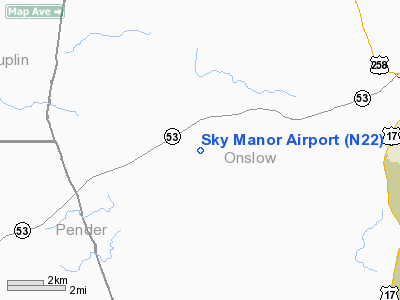
Location & QuickFacts
| FAA Information Effective: | 2008-09-25 |
| Airport Identifier: | N22 |
| Airport Status: | Operational |
| Longitude/Latitude: | 077-35-31.8950W/34-43-00.5960N
-77.592193/34.716832 (Estimated) |
| Elevation: | 60 ft / 18.29 m (Estimated) |
| Land: | 25 acres |
| From nearest city: | 8 nautical miles W of Jacksonville, NC |
| Location: | Onslow County, NC |
| Magnetic Variation: | 08W (1985) |
Owner & Manager
| Ownership: | Privately owned |
| Owner: | A.v. Jones |
| Address: | P.o. Box 863
Jacksonville, NC 28540 |
| Phone number: | 910-455-1112 |
| Manager: | A V Jones & Bobby Gurganus |
| Address: | P.o. Box 863
Jacksonville, NC 28540 |
| Phone number: | 910-455-6241
ARPT PHONE 910-455-6241. |
Airport Operations and Facilities
| Airport Use: | Open to public |
| Wind indicator: | Yes |
| Segmented Circle: | No |
| Control Tower: | No |
| Landing fee charge: | No |
| Sectional chart: | Charlotte |
| Region: | ASO - Southern |
| Boundary ARTCC: | ZDC - Washington |
| Tie-in FSS: | RDU - Raleigh |
| FSS on Airport: | No |
| FSS Toll Free: | 1-800-WX-BRIEF |
| NOTAMs Facility: | RDU (NOTAM-d service avaliable) |
Airport Communications
Airport Services
| Bottled Oxygen: | NONE |
| Bulk Oxygen: | NONE |
Runway Information
Runway 08/26
| Dimension: | 3610 x 85 ft / 1100.3 x 25.9 m |
| Surface: | TURF, Fair Condition
AREAS OF STANDING WATER ON RWY AFTER RAINS. WEST HALF OF RWY EXTREMELY SOFT WHEN WET. |
| |
Runway 08 |
Runway 26 |
| Traffic Pattern: | Left | Left |
| Displaced threshold: | 595.00 ft | 0.00 ft |
| Obstruction: | 58 ft trees, 200.0 ft from runway, 130 ft left of centerline, 3:1 slope to clear
APCH SLOPE 16:1 TO DSPLCD THLD. | 56 ft trees, 68.0 ft from runway, 103 ft left of centerline, 1:1 slope to clear |
|
Radio Navigation Aids
| ID |
Type |
Name |
Ch |
Freq |
Var |
Dist |
| NCA | NDB | New River | | 356.00 | 08W | 8.0 nm |
| ACZ | NDB | Pendy | | 379.00 | 09W | 20.3 nm |
| DKA | NDB | Kenan | | 332.00 | 07W | 26.8 nm |
| CLB | NDB | Carolina Beach | | 216.00 | 04W | 41.0 nm |
| CTZ | NDB | Clinton | | 412.00 | 08W | 41.1 nm |
| MRH | NDB | Morehead | | 269.00 | 08W | 46.0 nm |
| TGQ | NDB | Elizabethtown | | 398.00 | 08W | 47.1 nm |
| DIW | NDB/DME | Dixon | 107X | 198.00 | 08W | 11.3 nm |
| NCA | TACAN | New River | 101X | | 08W | 7.5 nm |
| NJM | TACAN | Bogue Mcalf | 067X | | 08W | 27.9 nm |
| NKT | TACAN | Cherry Point | 075X | | 09W | 37.1 nm |
| GSB | TACAN | Seymour Johnson | 112X | | 08W | 41.6 nm |
| EWN | VOR/DME | New Bern | 083X | 113.60 | 08W | 34.4 nm |
| ILM | VORTAC | Wilmington | 117X | 117.00 | 07W | 26.0 nm |
| ISO | VORTAC | Kinston | 033X | 109.60 | 05W | 39.4 nm |
Remarks
- ADDITIONAL OBS - PVT ROAD PARALLELS RWY ON SOUTH SIDE 20 FT FROM RWY EDGE, +30 FT HGR LCTD 200 FT WEST OF RWY 26 THLD & 100 FT RIGHT OF CNTRLN, +80 FT TREES ALONG NORTH SIDE OF RWY EDGE FROM RWY 08 THLD TO TERM AREA, +66 FT TREES 200 FT FROM RWY 26 THLD. ACROSS APCH.
- RY 26 HAS 66 FT TREES 50 FT LEFT OF CNTRLN & 100 FT FROM THLD.
- BE ALERT DEER IN THE VCNTY OF ARPT.
- TKOF AND LNDGS IN STRONG CROSSWINDS NOT RECOMMENDED DUE TO SEVERE DRAFTS FROM TREES.
- VFR WEATHER CONDITIONS ONLY.
Images and information placed above are from
http://www.airport-data.com/airport/N22/
We thank them for the data!
| General Info
|
| Country |
United States
|
| State |
NORTH CAROLINA
|
| FAA ID |
N22
|
| Latitude |
34-43-00.596N
|
| Longitude |
077-35-31.895W
|
| Elevation |
60 feet
|
| Near City |
JACKSONVILLE
|
We don't guarantee the information is fresh and accurate. The data may
be wrong or outdated.
For more up-to-date information please refer to other sources.
|
|


