 |
|
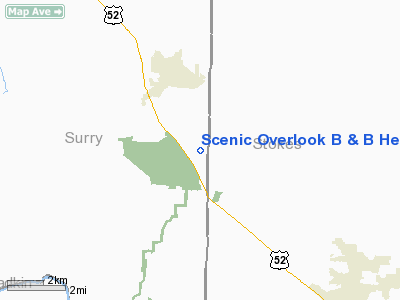
Scenic Overlook B & B Heliport |
Location & QuickFacts
| FAA Information Effective: | 2008-09-25 |
| Airport Identifier: | 65NC |
| Airport Status: | Operational |
| Longitude/Latitude: | 080-27-15.0000W/36-20-54.0000N
-80.454167/36.348333 (Estimated) |
| Elevation: | 1050 ft / 320.04 m (Estimated) |
| Land: | 0 acres |
| From nearest city: | 5 nautical miles S of Pilot Mountain, NC |
| Location: | Surry County, NC |
| Magnetic Variation: | 07W (2000) |
Owner & Manager
| Ownership: | Privately owned |
| Owner: | Alan Steinbicker |
| Address: | 144 Scenic Overlook Lane
Pinnacle, NC 27043 |
| Phone number: | 336-368-9491 |
| Manager: | Alan Steinbicker |
| Address: | 144 Scenic Overlook Lane
Pinnacle, NC 27043 |
| Phone number: | 336-368-9491 |
Airport Operations and Facilities
| Airport Use: | Private |
| Segmented Circle: | No |
| Control Tower: | No |
| Sectional chart: | Cincinnati |
| Region: | ASO - Southern |
| Boundary ARTCC: | ZTL - Atlanta |
| Tie-in FSS: | RDU - Raleigh |
| FSS Toll Free: | 1-800-WX-BRIEF |
Runway Information
Helipad H1
| Dimension: | 200 x 100 ft / 61.0 x 30.5 m |
| Surface: | TURF, |
| |
Runway H1 |
Runway |
| Traffic Pattern: | Left | Left |
|
Radio Navigation Aids
| ID |
Type |
Name |
Ch |
Freq |
Var |
Dist |
| OQA | FAN MARKER | Rockingham County | | | | 30.6 nm |
| AZW | NDB | Mount Airy | | 223.00 | 07W | 4.6 nm |
| ZEF | NDB | Zephyr | | 326.00 | 05W | 13.2 nm |
| DVZ | NDB | Davie | | 354.00 | 06W | 26.1 nm |
| UV | NDB | Bales | | 396.00 | 07W | 29.7 nm |
| HLX | NDB | Hillsville | | 269.00 | 06W | 30.6 nm |
| SIF | NDB | Slammer | | 423.00 | 07W | 33.5 nm |
| UKF | NDB | Wilki | | 209.00 | 06W | 34.3 nm |
| SEN | NDB | Swearing/dcmsnd | | 260.00 | 06W | 35.0 nm |
| RU | NDB | Rovdy | | 275.00 | 06W | 37.0 nm |
| JU | NDB | Ashee | | 410.00 | 07W | 42.3 nm |
| VW | NDB | Temky | | 280.00 | 05W | 45.5 nm |
| CQJ | NDB | City Lake | | 266.00 | 08W | 47.6 nm |
| HB | NDB | Himun | | 361.00 | 08W | 47.7 nm |
| BZM | VOR/DME | Barretts Mountain | 045X | 110.80 | 06W | 47.8 nm |
| GSO | VORTAC | Greensboro | 109X | 116.20 | 03W | 29.5 nm |
| PSK | VORTAC | Pulaski | 115X | 116.80 | 06W | 46.2 nm |
Remarks
- PRVDD VFR OPNS, PVT USE, ALL APCH/DEP ROUTES FROM 270 TO 320 DEGS, AREA IS MKD, WIND INDICATOR IS MAINTAINED.
Images and information placed above are from
http://www.airport-data.com/airport/65NC/
We thank them for the data!
| General Info
|
| Country |
United States
|
| State |
NORTH CAROLINA
|
| FAA ID |
65NC
|
| Latitude |
36-20-54.000N
|
| Longitude |
080-27-15.000W
|
| Elevation |
1050 feet
|
| Near City |
PILOT MOUNTAIN
|
We don't guarantee the information is fresh and accurate. The data may
be wrong or outdated.
For more up-to-date information please refer to other sources.
|
|


