 |
|
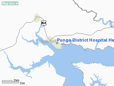
Pungo District Hospital Heliport |
Location & QuickFacts
| FAA Information Effective: | 2008-09-25 |
| Airport Identifier: | NC89 |
| Airport Status: | Operational |
| Longitude/Latitude: | 076-37-01.7540W/35-32-34.5950N
-76.617154/35.542943 (Estimated) |
| Elevation: | 11 ft / 3.35 m (Estimated) |
| Land: | 0 acres |
| From nearest city: | 0 nautical miles N of Belhaven, NC |
| Location: | Beaufort County, NC |
| Magnetic Variation: | 09W (1985) |
Owner & Manager
| Ownership: | Privately owned |
| Owner: | Pungo Dist Hospital Corp |
| Address: | 202 East Water St
Belhaven, NC 27810-1450 |
| Phone number: | 252-943-2211 |
| Manager: | Dale Fawver |
| Address: | 202 East Water St
Belhaven, NC 27810-1450 |
| Phone number: | 252-943-2211 |
Airport Operations and Facilities
| Airport Use: | Private
MEDICAL. |
| Wind indicator: | Yes |
| Segmented Circle: | No |
| Control Tower: | No |
| Landing fee charge: | No |
| Sectional chart: | Charlotte |
| Region: | ASO - Southern |
| Boundary ARTCC: | ZDC - Washington |
| Tie-in FSS: | RDU - Raleigh |
| FSS on Airport: | No |
| FSS Toll Free: | 1-800-WX-BRIEF |
Airport Services
| Airframe Repair: | NONE |
| Power Plant Repair: | NONE |
Runway Information
Helipad H1
| Dimension: | 50 x 50 ft / 15.2 x 15.2 m |
| Surface: | CONC, |
| |
Runway H1 |
Runway |
| Traffic Pattern: | Left | Left |
|
Radio Navigation Aids
| ID |
Type |
Name |
Ch |
Freq |
Var |
Dist |
| PGV | FAN MARKER | Belvoir | | | 06W | 37.9 nm |
| HI | MARINE NDB | Hatteras Inlet Station/dcm | | 1.00 | 09W | 49.0 nm |
| PMZ | NDB | Plymouth | | 221.00 | 10W | 17.5 nm |
| RNW | NDB | Chocowinity | | 388.00 | 07W | 24.0 nm |
| EDE | NDB | Edenton | | 265.00 | 10W | 29.1 nm |
| MCZ | NDB | Williamston | | 336.00 | 09W | 33.3 nm |
| AQE | NDB | Alwood | | 230.00 | 09W | 38.2 nm |
| LLW | NDB | Woodville | | 254.00 | 10W | 46.0 nm |
| MRH | NDB | Morehead | | 269.00 | 08W | 48.8 nm |
| OUC | NDB/DME | Pamlico/dcmsnd | 034X | 404.00 | 09W | 40.1 nm |
| NKT | TACAN | Cherry Point | 075X | | 09W | 40.5 nm |
| EWN | VOR/DME | New Bern | 083X | 113.60 | 08W | 35.2 nm |
| ECG | VOR/DME | Elizabeth City | 072X | 112.50 | 07W | 48.0 nm |
| ISO | VORTAC | Kinston | 033X | 109.60 | 05W | 47.2 nm |
Remarks
- E111: ALL OPNS ARE CONDUCTED IN VFR WX CONDS; LNDG AREA IS LTD TO PVT USE; THE PROPONENT COORDINATES THE USE OF HELI WITH GADO; RALEIGH-DURHAM NC.
Images and information placed above are from
http://www.airport-data.com/airport/NC89/
We thank them for the data!
| General Info
|
| Country |
United States
|
| State |
NORTH CAROLINA
|
| FAA ID |
NC89
|
| Latitude |
35-32-34.595N
|
| Longitude |
076-37-01.754W
|
| Elevation |
11 feet
|
| Near City |
BELHAVEN
|
We don't guarantee the information is fresh and accurate. The data may
be wrong or outdated.
For more up-to-date information please refer to other sources.
|
|


