 |
|
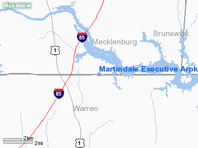
Martindale Executive Arpk Airport |
Location & QuickFacts
| FAA Information Effective: | 2008-09-25 |
| Airport Identifier: | 70NC |
| Airport Status: | Operational |
| Longitude/Latitude: | 078-08-52.9790W/36-32-40.5220N
-78.148050/36.544589 (Estimated) |
| Elevation: | 300 ft / 91.44 m (Estimated) |
| Land: | 0 acres |
| From nearest city: | 1 nautical miles NE of Paschall, NC |
| Location: | Mecklenburg County, NC |
| Magnetic Variation: | 08W (1985) |
Owner & Manager
| Ownership: | Privately owned |
| Owner: | Algie I. Stephens |
| Address: | 319 Chapanoke Rd Suite 106
Raleigh, NC 27603 |
| Phone number: | 919-779-8649 |
| Address: |
|
Airport Operations and Facilities
| Airport Use: | Private |
| Wind indicator: | No |
| Segmented Circle: | No |
| Control Tower: | No |
| Landing fee charge: | No |
| Sectional chart: | Washington |
| Region: | ASO - Southern |
| Boundary ARTCC: | ZDC - Washington |
| Tie-in FSS: | RDU - Raleigh |
| FSS on Airport: | No |
| FSS Toll Free: | 1-800-WX-BRIEF |
Airport Services
| Airframe Repair: | NONE |
| Power Plant Repair: | NONE |
Runway Information
Runway 09/27
| Dimension: | 3000 x 75 ft / 914.4 x 22.9 m |
| Surface: | TURF, |
| |
Runway 09 |
Runway 27 |
| Traffic Pattern: | Left | Left |
|
Radio Navigation Aids
| ID |
Type |
Name |
Ch |
Freq |
Var |
Dist |
| AEA | NDB | Jones | | 373.00 | 09W | 6.2 nm |
| MBV | NDB | Mecklenburg/dcmsnd | | 356.00 | 08W | 9.9 nm |
| RZZ | NDB | Rapids | | 407.00 | 08W | 22.1 nm |
| HXO | NDB | Huntsboro | | 271.00 | 07W | 27.1 nm |
| ELQ | NDB | Emporia | | 261.00 | 10W | 35.2 nm |
| BKT | NDB | Blackstone | | 326.00 | 09W | 35.4 nm |
| PTB | NDB | Petersburg | | 284.00 | 08W | 44.7 nm |
| LE | NDB | Leevy | | 350.00 | 07W | 46.4 nm |
| ETC | NDB | Tarboro | | 257.00 | 08W | 46.8 nm |
| RW | NDB | Jambe | | 235.00 | 09W | 47.5 nm |
| HUR | NDB | Person | | 220.00 | 08W | 48.2 nm |
| ASJ | NDB | Ahoskie | | 415.00 | 10W | 49.3 nm |
| LVL | VORTAC | Lawrenceville | 076X | 112.90 | 08W | 20.2 nm |
| TYI | VORTAC | Tar River | 125X | 117.80 | 05W | 40.4 nm |
| SBV | VORTAC | South Boston | 041X | 110.40 | 05W | 42.5 nm |
Images and information placed above are from
http://www.airport-data.com/airport/70NC/
We thank them for the data!
| General Info
|
| Country |
United States
|
| State |
NORTH CAROLINA
|
| FAA ID |
70NC
|
| Latitude |
36-32-40.522N
|
| Longitude |
078-08-52.979W
|
| Elevation |
300 feet
|
| Near City |
PASCHALL
|
We don't guarantee the information is fresh and accurate. The data may
be wrong or outdated.
For more up-to-date information please refer to other sources.
|
|


