 |
|
Location & QuickFacts
| FAA Information Effective: | 2008-09-25 |
| Airport Identifier: | NR01 |
| Airport Status: | Operational |
| Longitude/Latitude: | 075-41-37.0000W/36-04-19.0000N
-75.693611/36.071944 (Estimated) |
| Elevation: | 10 ft / 3.05 m (Estimated) |
| Land: | 0 acres |
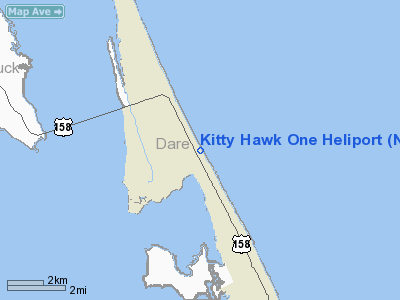
| From nearest city: | 2 nautical miles E of Kitty Hawk, NC |
| Location: | Alamance County, NC |
| Magnetic Variation: | () |
Owner & Manager
| Ownership: | Privately owned |
| Owner: | Philip Timbrell |
| Address: | 507 Muller Lane
Newport News, VA 23606 |
| Phone number: | 757-218-2728 |
| Manager: | Philip Timbrell |
| Address: | 507 Muller Lane
Newport News, VA 23606 |
| Phone number: | 757-218-2728 |
Airport Operations and Facilities
| Airport Use: | Private |
| Wind indicator: | Yes |
| Control Tower: | No |
| Sectional chart: | Washington |
| Region: | ASO - Southern |
| Boundary ARTCC: | ZDC - Washington |
| Tie-in FSS: | RDU - Raleigh |
| FSS Toll Free: | 1-800-WX-BRIEF |
Runway Information
Helipad H1
| Dimension: | 30 x 30 ft / 9.1 x 9.1 m |
| Surface: | WOOD, |
| |
Runway H1 |
Runway |
| Traffic Pattern: | Left | Left |
|
Radio Navigation Aids
| ID |
Type |
Name |
Ch |
Freq |
Var |
Dist |
| MQI | NDB | Manteo | | 370.00 | 09W | 9.4 nm |
| LLW | NDB | Woodville | | 254.00 | 10W | 31.5 nm |
| EDE | NDB | Edenton | | 265.00 | 10W | 42.5 nm |
| EY | NDB | Chesi | | 233.00 | 09W | 46.0 nm |
| NTU | TACAN | Oceana | 113X | | 10W | 48.2 nm |
| RBX | VOR/DME | Wright Brothers | 053X | 111.60 | 08W | 9.1 nm |
| ECG | VOR/DME | Elizabeth City | 072X | 112.50 | 07W | 25.9 nm |
Remarks
- 50 FT PLINE 300 FT W OF PAD.
- PRVDD VFR OPNS; PVT USE; AREA IS MARKED; ALL APCHS FM 060 TO 070 DEGREES USING ONE STATUTORY MILE CORRIDOR; ALL DEP FM 240 TO 250 DEGREES OUT TO ONE STATUTORY MILE; WIND INDICATOR IS MAINTAINED; AND COMPLY W/14CFR 91.119 ECT.
Images and information placed above are from
http://www.airport-data.com/airport/NR01/
We thank them for the data!
|
|


