 |
|
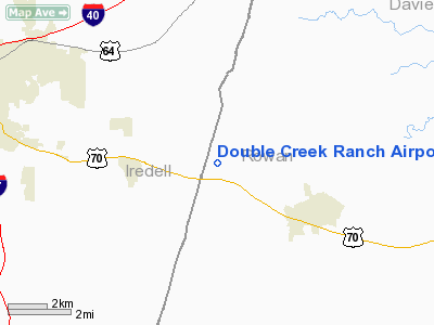
Double Creek Ranch Airport |
Location & QuickFacts
| FAA Information Effective: | 2008-09-25 |
| Airport Identifier: | 0NC8 |
| Airport Status: | Operational |
| Longitude/Latitude: | 080-44-07.2480W/35-45-20.5030N
-80.735347/35.755695 (Estimated) |
| Elevation: | 830 ft / 252.98 m (Estimated) |
| Land: | 0 acres |
| From nearest city: | 4 nautical miles NW of Cleveland, NC |
| Location: | Rowan County, NC |
| Magnetic Variation: | 05W (1985) |
Owner & Manager
| Ownership: | Privately owned |
| Owner: | Shaver Wood Products |
| Address: | 14440 Statesville Rd
Cleveland, NC 27013-8791 |
| Phone number: | 704-278-9291 |
| Manager: | Richard W. Shaver |
| Address: | 14440 Statesville Rd
Cleveland, NC 27013-8791 |
| Phone number: | 704-278-4433 |
Airport Operations and Facilities
| Airport Use: | Private |
| Wind indicator: | Yes |
| Segmented Circle: | No |
| Control Tower: | No |
| Landing fee charge: | No |
| Sectional chart: | Charlotte |
| Region: | ASO - Southern |
| Boundary ARTCC: | ZTL - Atlanta |
| Tie-in FSS: | RDU - Raleigh |
| FSS on Airport: | No |
| FSS Toll Free: | 1-800-WX-BRIEF |
Runway Information
Runway 03/21
| Dimension: | 2300 x 100 ft / 701.0 x 30.5 m |
| Surface: | TURF, |
| |
Runway 03 |
Runway 21 |
| Traffic Pattern: | Left | Left |
|
Radio Navigation Aids
| ID |
Type |
Name |
Ch |
Freq |
Var |
Dist |
| MRN | FAN MARKER | Lenoir | | | 03W | 43.4 nm |
| RU | NDB | Rovdy | | 275.00 | 06W | 12.1 nm |
| VW | NDB | Temky | | 280.00 | 05W | 16.1 nm |
| DVZ | NDB | Davie | | 354.00 | 06W | 16.6 nm |
| SEN | NDB | Swearing/dcmsnd | | 260.00 | 06W | 21.4 nm |
| IZN | NDB | Lincolnton | | 432.00 | 06W | 21.6 nm |
| UKF | NDB | Wilki | | 209.00 | 06W | 27.8 nm |
| HK | NDB | Tawba | | 332.00 | 06W | 27.9 nm |
| ZEF | NDB | Zephyr | | 326.00 | 05W | 33.5 nm |
| VU | NDB | Aller | | 346.00 | 06W | 35.8 nm |
| AZW | NDB | Mount Airy | | 223.00 | 07W | 38.8 nm |
| GHJ | NDB | Stonia | | 260.00 | 06W | 39.7 nm |
| CQJ | NDB | City Lake | | 266.00 | 08W | 42.5 nm |
| FIQ | NDB | Fiddlers | | 391.00 | 07W | 45.8 nm |
| TWL | NDB | Wesley | | 204.00 | 06W | 48.3 nm |
| JU | NDB | Ashee | | 410.00 | 07W | 49.7 nm |
| BZM | VOR/DME | Barretts Mountain | 045X | 110.80 | 06W | 25.5 nm |
| CLT | VOR/DME | Charlotte | 097X | 115.00 | 05W | 35.6 nm |
| GSO | VORTAC | Greensboro | 109X | 116.20 | 03W | 40.9 nm |
| FML | VORTAC | Fort Mill | 071X | 112.40 | 02W | 47.3 nm |
| HKY | VOT | Hickory Regional | | 110.00 | | 32.0 nm |
| CLT | VOT | Charlotte | | 112.00 | | 34.0 nm |
Remarks
Images and information placed above are from
http://www.airport-data.com/airport/0NC8/
We thank them for the data!
| General Info
|
| Country |
United States
|
| State |
NORTH CAROLINA
|
| FAA ID |
0NC8
|
| Latitude |
35-45-20.503N
|
| Longitude |
080-44-07.248W
|
| Elevation |
830 feet
|
| Near City |
CLEVELAND
|
We don't guarantee the information is fresh and accurate. The data may
be wrong or outdated.
For more up-to-date information please refer to other sources.
|
|


