 |
|
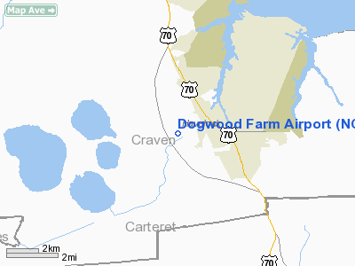
Location & QuickFacts
| FAA Information Effective: | 2008-09-25 |
| Airport Identifier: | NC87 |
| Airport Status: | Operational |
| Longitude/Latitude: | 076-56-33.7960W/34-52-54.5760N
-76.942721/34.881827 (Estimated) |
| Elevation: | 26 ft / 7.92 m (Estimated) |
| Land: | 0 acres |
| From nearest city: | 3 nautical miles NW of Havelock, NC |
| Location: | Craven County, NC |
| Magnetic Variation: | 08W (1985) |
Owner & Manager
| Ownership: | Privately owned |
| Owner: | Hubert C. Pulley |
| Address: | 201 Pulley Road
Havelock, NC 28532-2527 |
| Phone number: | 252-671-2695 |
| Manager: | Hubert C. Pulley |
| Address: | 201 Pulley Road
Havelock, NC 28532-2527 |
| Phone number: | 252-671-2695 |
Airport Operations and Facilities
| Airport Use: | Private |
| Wind indicator: | No |
| Segmented Circle: | No |
| Control Tower: | No |
| Landing fee charge: | No |
| Sectional chart: | Charlotte |
| Region: | ASO - Southern |
| Boundary ARTCC: | ZDC - Washington |
| Tie-in FSS: | RDU - Raleigh |
| FSS on Airport: | No |
| FSS Toll Free: | 1-800-WX-BRIEF |
Runway Information
Runway 01/19
| Dimension: | 1400 x 125 ft / 426.7 x 38.1 m |
| Surface: | TURF, |
| |
Runway 01 |
Runway 19 |
| Traffic Pattern: | Left | Left |
|
Radio Navigation Aids
| ID |
Type |
Name |
Ch |
Freq |
Var |
Dist |
| MRH | NDB | Morehead | | 269.00 | 08W | 16.5 nm |
| NCA | NDB | New River | | 356.00 | 08W | 25.9 nm |
| RNW | NDB | Chocowinity | | 388.00 | 07W | 38.6 nm |
| DKA | NDB | Kenan | | 332.00 | 07W | 49.4 nm |
| DIW | NDB/DME | Dixon | 107X | 198.00 | 08W | 31.5 nm |
| OUC | NDB/DME | Pamlico/dcmsnd | 034X | 404.00 | 09W | 49.1 nm |
| NKT | TACAN | Cherry Point | 075X | | 09W | 3.6 nm |
| NJM | TACAN | Bogue Mcalf | 067X | | 08W | 12.3 nm |
| NCA | TACAN | New River | 101X | | 08W | 26.7 nm |
| EWN | VOR/DME | New Bern | 083X | 113.60 | 08W | 12.6 nm |
| ISO | VORTAC | Kinston | 033X | 109.60 | 05W | 42.2 nm |
Remarks
- VFR PERSONAL USE; 2-WAY RADIO COMS ESTAB WITH CHERRY PT ATCT PRIOR TO DEPG OR ENTERING THE ARPT TFC AREA. INGRESS/EGRESS ROUTES ESTABLISHED & COORD WITH ATCT.
Images and information placed above are from
http://www.airport-data.com/airport/NC87/
We thank them for the data!
| General Info
|
| Country |
United States
|
| State |
NORTH CAROLINA
|
| FAA ID |
NC87
|
| Latitude |
34-52-54.576N
|
| Longitude |
076-56-33.796W
|
| Elevation |
26 feet
|
| Near City |
HAVELOCK
|
We don't guarantee the information is fresh and accurate. The data may
be wrong or outdated.
For more up-to-date information please refer to other sources.
|
|


