 |
|
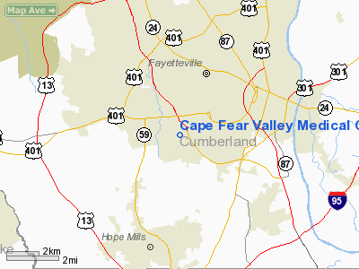
Cape Fear Valley Medical Center Heliport |
Location & QuickFacts
| FAA Information Effective: | 2008-09-25 |
| Airport Identifier: | NC83 |
| Airport Status: | Operational |
| Longitude/Latitude: | 078-56-14.0980W/35-02-00.5890N
-78.937249/35.033497 (Estimated) |
| Elevation: | 213 ft / 64.92 m (Estimated) |
| Land: | 0 acres |
| From nearest city: | 3 nautical miles SW of Fayetteville, NC |
| Location: | Cumberland County, NC |
| Magnetic Variation: | 07W (1985) |
Owner & Manager
| Ownership: | Privately owned |
| Owner: | Cape Fear Valley Medical Center |
| Address: | Po Box 2000
Fayetteville, NC 28302 |
| Phone number: | 910-323-6151 |
| Manager: | William Avenel |
| Address: | 1638 Owen Drive
Fayetteville, NC 28304 |
| Phone number: | 910-609-6700 |
Airport Operations and Facilities
| Airport Use: | Private
MEDICAL. |
| Wind indicator: | Yes |
| Segmented Circle: | No |
| Control Tower: | No |
| Lighting Schedule: | DUSK-DAWN |
| Beacon Color: | Clear (unlighted land airport) |
| Landing fee charge: | No |
| Sectional chart: | Charlotte |
| Region: | ASO - Southern |
| Boundary ARTCC: | ZDC - Washington |
| Tie-in FSS: | RDU - Raleigh |
| FSS on Airport: | No |
| FSS Toll Free: | 1-800-WX-BRIEF |
Runway Information
Helipad H1
| Dimension: | 90 x 90 ft / 27.4 x 27.4 m |
| Surface: | CONC, |
| |
Runway H1 |
Runway |
| Traffic Pattern: | Left | Left |
|
Radio Navigation Aids
| ID |
Type |
Name |
Ch |
Freq |
Var |
Dist |
| FGP | NDB | Fort Bragg | | 393.00 | 07W | 8.8 nm |
| POB | NDB | Pope | | 338.00 | 07W | 11.7 nm |
| EEJ | NDB | Lee County/dcmsnd | | 428.00 | 07W | 24.8 nm |
| RSY | NDB | Robeson | | 359.00 | 08W | 26.0 nm |
| HFF | NDB | Mackall | | 278.00 | 06W | 27.0 nm |
| HQT | NDB | Harnett | | 417.00 | 08W | 27.3 nm |
| CTZ | NDB | Clinton | | 412.00 | 08W | 28.5 nm |
| TT | NDB | Leeco | | 406.00 | 08W | 29.6 nm |
| ME | NDB | Maxtn | | 257.00 | 08W | 30.8 nm |
| JB | NDB | Jigel | | 384.00 | 08W | 30.9 nm |
| JN | NDB | Jurly | | 263.00 | 09W | 36.5 nm |
| TGQ | NDB | Elizabethtown | | 398.00 | 08W | 36.8 nm |
| RCZ | NDB | Roscoe | | 375.00 | 07W | 38.8 nm |
| DLC | NDB | Dillon | | 274.00 | 05W | 41.0 nm |
| EUU | NDB | Jnall | | 251.00 | 07W | 44.8 nm |
| BES | NDB | Bennettsville | | 230.00 | 07W | 46.5 nm |
| CPC | NDB | Camp | | 227.00 | 07W | 47.1 nm |
| CQW | NDB | Cheraw | | 409.00 | 05W | 49.0 nm |
| ACZ | NDB | Pendy | | 379.00 | 09W | 49.8 nm |
| POB | TACAN | Pope | 085X | | 07W | 8.6 nm |
| LBT | VOR | Lumberton | | 110.00 | 08W | 26.1 nm |
| FAY | VOR/DME | Fayetteville | 025X | 108.80 | 04W | 4.2 nm |
| SDZ | VORTAC | Sandhills | 055X | 111.80 | 03W | 33.8 nm |
Remarks
- OPNS LIMITED TO VFR WX CONDITIONS; LANDING AREA LIMITED TO PRIVATE USE; USE OF HELIPORT COORDINATED WITH GENERAL AVIATION DISTRICT OFFICE RALEIGH NC.
Images and information placed above are from
http://www.airport-data.com/airport/NC83/
We thank them for the data!
| General Info
|
| Country |
United States
|
| State |
NORTH CAROLINA
|
| FAA ID |
NC83
|
| Latitude |
35-02-00.589N
|
| Longitude |
078-56-14.098W
|
| Elevation |
213 feet
|
| Near City |
FAYETTEVILLE
|
We don't guarantee the information is fresh and accurate. The data may
be wrong or outdated.
For more up-to-date information please refer to other sources.
|
|


