 |
|
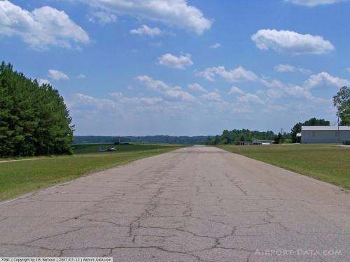 |
(Click on the photo to enlarge) |
Location & QuickFacts
| FAA Information Effective: | 2008-09-25 |
| Airport Identifier: | 79NC |
| Airport Status: | Operational |
| Longitude/Latitude: | 078-16-54.9790W/36-08-03.5390N
-78.281939/36.134316 (Estimated) |
| Elevation: | 366 ft / 111.56 m (Surveyed) |
| Land: | 38 acres |
| From nearest city: | 3 nautical miles NE of Louisburg, NC |
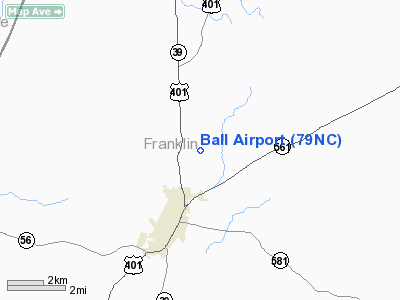
| Location: | Franklin County, NC |
| Magnetic Variation: | 07W (1985) |
Owner & Manager
| Ownership: | Privately owned |
| Owner: | Betty Ball |
| Address: | 694 Moulton Road
Louisburg, NC 27549 |
| Phone number: | 919-496-3584 |
| Manager: | Betty Ball |
| Address: | 694 Moulton Road
Louisburg, NC 27549 |
| Phone number: | 919-496-3584
OR 919-496-1320. |
Airport Operations and Facilities
| Airport Use: | Private |
| Wind indicator: | Yes |
| Segmented Circle: | No |
| Control Tower: | No |
| Lighting Schedule: | PHONE REQ |
| Sectional chart: | Washington |
| Region: | ASO - Southern |
| Boundary ARTCC: | ZDC - Washington |
| Tie-in FSS: | RDU - Raleigh |
| FSS on Airport: | No |
| FSS Toll Free: | 1-800-WX-BRIEF |
Airport Communications
Airport Services
| Fuel available: | 100LLMOGAS |
| Airframe Repair: | MAJOR |
| Power Plant Repair: | MAJOR |
Runway Information
Runway 18/36
| Dimension: | 2459 x 40 ft / 749.5 x 12.2 m
741' TURF OVERRUN SOUTH END OF RUNWAY. |
| Surface: | ASPH, Fair Condition
POT HOLES & GRAVEL FIRST 450' SOUTH END. |
| Edge Lights: | Low |
| |
Runway 18 |
Runway 36 |
| Traffic Pattern: | Left | Left |
| Markings: | Nonstandard, | Nonstandard, |
| Runway End Identifier: | No | No |
| Touchdown Lights: | No | No |
|
Radio Navigation Aids
| ID |
Type |
Name |
Ch |
Freq |
Var |
Dist |
| HXO | NDB | Huntsboro | | 271.00 | 07W | 19.1 nm |
| LE | NDB | Leevy | | 350.00 | 07W | 24.7 nm |
| RW | NDB | Jambe | | 235.00 | 09W | 26.9 nm |
| AEA | NDB | Jones | | 373.00 | 09W | 30.9 nm |
| EUU | NDB | Jnall | | 251.00 | 07W | 31.9 nm |
| RZZ | NDB | Rapids | | 407.00 | 08W | 33.3 nm |
| MBV | NDB | Mecklenburg/dcmsnd | | 356.00 | 08W | 35.3 nm |
| ETC | NDB | Tarboro | | 257.00 | 08W | 37.7 nm |
| HUR | NDB | Person | | 220.00 | 08W | 38.5 nm |
| JN | NDB | Jurly | | 263.00 | 09W | 40.2 nm |
| JYN | NDB | Wayne | | 208.00 | 08W | 41.0 nm |
| HQT | NDB | Harnett | | 417.00 | 08W | 46.3 nm |
| RDU | VORTAC | Raleigh/durham | 119X | 117.20 | 04W | 29.0 nm |
| TYI | VORTAC | Tar River | 125X | 117.80 | 05W | 29.6 nm |
| LVL | VORTAC | Lawrenceville | 076X | 112.90 | 08W | 45.0 nm |
| SBV | VORTAC | South Boston | 041X | 110.40 | 05W | 48.1 nm |
Remarks
- GLIDER OPNS AT ARPT.
- PVT USE; VFR ONLY.
Images and information placed above are from
http://www.airport-data.com/airport/79NC/
We thank them for the data!
| General Info
|
| Country |
United States
|
| State |
NORTH CAROLINA
|
| FAA ID |
79NC
|
| Latitude |
36-08-03.539N
|
| Longitude |
078-16-54.979W
|
| Elevation |
366 feet
|
| Near City |
LOUISBURG
|
We don't guarantee the information is fresh and accurate. The data may
be wrong or outdated.
For more up-to-date information please refer to other sources.
|
|


