 |
|
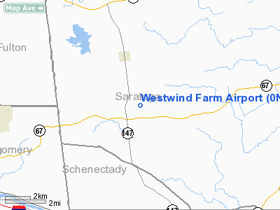
Location & QuickFacts
| FAA Information Effective: | 2008-09-25 |
| Airport Identifier: | 0NK2 |
| Airport Status: | Operational |
| Longitude/Latitude: | 074-00-58.4560W/42-59-00.2700N
-74.016238/42.983408 (Estimated) |
| Elevation: | 800 ft / 243.84 m (Estimated) |
| Land: | 100 acres |
| From nearest city: | 1 nautical miles S of Charlton, NY |
| Location: | Saratoga County, NY |
| Magnetic Variation: | 14W (1980) |
Owner & Manager
| Ownership: | Privately owned |
| Owner: | Charles Mothon |
| Address: | 1342 Sacandaga Rd
Galway, NY 12074 |
| Phone number: | 518-882-9522 |
| Manager: | Charles Mothon |
| Address: | 1342 Sacandaga Rd
Galway, NY 12074 |
| Phone number: | 518-882-6945 |
Airport Operations and Facilities
| Airport Use: | Private |
| Wind indicator: | Yes |
| Segmented Circle: | No |
| Control Tower: | No |
| Landing fee charge: | No |
| Sectional chart: | New York |
| Region: | AEA - Eastern |
| Boundary ARTCC: | ZBW - Boston |
| Tie-in FSS: | BTV - Burlington |
| FSS on Airport: | No |
| FSS Toll Free: | 1-800-WX-BRIEF |
Runway Information
Runway 10/28
| Dimension: | 3000 x 100 ft / 914.4 x 30.5 m |
| Surface: | TURF, |
| |
Runway 10 |
Runway 28 |
| Traffic Pattern: | Left | Right |
| Displaced threshold: | 500.00 ft | 0.00 ft |
| Obstruction: | 20 ft pline, 100.0 ft from runway | |
|
Radio Navigation Aids
| ID |
Type |
Name |
Ch |
Freq |
Var |
Dist |
| PSF | FAN MARKER | Abyss | | | 13W | 47.6 nm |
| HEU | NDB | Hunter | | 356.00 | 14W | 8.6 nm |
| JJH | NDB | Johnstown | | 523.00 | 14W | 13.9 nm |
| PFH | NDB | Philmont | | 272.00 | 13W | 45.8 nm |
| DXT | NDB | Dalton | | 370.00 | 15W | 48.4 nm |
| CAM | VOR/DME | Cambridge | 097X | 115.00 | 14W | 29.6 nm |
| ALB | VORTAC | Albany | 100X | 115.30 | 13W | 17.0 nm |
| GFL | VORTAC | Glens Falls | 039X | 110.20 | 14W | 27.9 nm |
| ALB | VOT | Albany County | | 108.20 | | 16.8 nm |
Remarks
- OWNER DESIRES ARPT NOT BE CHARTED.
- PROVIDED ALL PILOTS USING RUNWAY ARE MADE AWARE OF CONDITIONS & OBSTACLES.
Images and information placed above are from
http://www.airport-data.com/airport/0NK2/
We thank them for the data!
| General Info
|
| Country |
United States
|
| State |
NEW YORK
|
| FAA ID |
0NK2
|
| Latitude |
42-59-00.270N
|
| Longitude |
074-00-58.456W
|
| Elevation |
800 feet
|
| Near City |
CHARLTON
|
We don't guarantee the information is fresh and accurate. The data may
be wrong or outdated.
For more up-to-date information please refer to other sources.
|
|


