 |
|
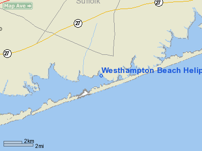
Westhampton Beach Heliport |
Location & QuickFacts
| FAA Information Effective: | 2008-09-25 |
| Airport Identifier: | 5NK3 |
| Airport Status: | Operational |
| Longitude/Latitude: | 072-39-46.3400W/40-48-08.3500N
-72.662872/40.802319 (Estimated) |
| Elevation: | 5 ft / 1.52 m (Estimated) |
| Land: | 1 acres |
| From nearest city: | 3 nautical miles SW of Westhampton Beach, NY |
| Location: | Suffolk County, NY |
| Magnetic Variation: | 14W (1995) |
Owner & Manager
| Ownership: | Privately owned |
| Owner: | Sandlin Partners |
| Address: | 3003 Portofino Isle D-3
Coconut Creek, FL 33066 |
| Phone number: | 954-973-6579 |
| Manager: | Buddy Cury |
| Address: | 7 Wintergreen Way
Quogue, NY 11959 |
| Phone number: | 516-653-6542 |
Airport Operations and Facilities
| Airport Use: | Private |
| Wind indicator: | Yes |
| Segmented Circle: | No |
| Control Tower: | No |
| Lighting Schedule: | DUSK-DAWN |
| Sectional chart: | New York |
| Region: | AEA - Eastern |
| Boundary ARTCC: | ZBW - Boston |
| Tie-in FSS: | ISP - New York |
| FSS Toll Free: | 1-800-WX-BRIEF |
Runway Information
Helipad H1
| Dimension: | 84 x 78 ft / 25.6 x 23.8 m |
| Surface: | ASPH-DIRT, |
| |
Runway H1 |
Runway |
| Traffic Pattern: | Left | Left |
|
Radio Navigation Aids
| ID |
Type |
Name |
Ch |
Freq |
Var |
Dist |
| OP | NDB | Old Field Point Light | | 316.00 | 13W | 23.2 nm |
| BBN | NDB | Babylon | | 275.00 | 14W | 33.8 nm |
| MMK | NDB | Meriden | | 238.00 | 14W | 43.2 nm |
| TBY | NDB | Waterbury | | 257.00 | 14W | 48.8 nm |
| FOK | TACAN | Suffolk Co | 047X | | 13W | 2.6 nm |
| CCC | VOR/DME | Calverton | 119X | 117.20 | 13W | 9.8 nm |
| DPK | VOR/DME | Deer Park | 124X | 117.70 | 12W | 29.2 nm |
| HVN | VOR/DME | New Haven | 035X | 109.80 | 13W | 29.4 nm |
| BDR | VOR/DME | Bridgeport | 25X | 108.80 | 12W | 30.0 nm |
| MAD | VOR/DME | Madison | 041X | 110.40 | 13W | 30.8 nm |
| GON | VOR/DME | Groton | 45Y | 110.85 | 14W | 42.1 nm |
| HTO | VORTAC | Hampton | 083X | 113.60 | 13W | 17.2 nm |
| ISP | VOT | Long Island Mac Arthur | | 109.40 | | 19.7 nm |
| BDR | VOT | Bridgeport | | 109.25 | | 30.1 nm |
| GON | VOT | Groton | | 110.25 | | 41.9 nm |
Remarks
- APCH FM THE SOUTH OVER THE BAY.
- PRVDD VFR ONLY, CLEAR 8:1 INGRESS/EGRESS, MKGS FOR INGRESS/EGRESS PLACED ON PAD, PROVISIONS MADE FOR PERSONS/PROPERTY ON GND.
Images and information placed above are from
http://www.airport-data.com/airport/5NK3/
We thank them for the data!
| General Info
|
| Country |
United States
|
| State |
NEW YORK
|
| FAA ID |
5NK3
|
| Latitude |
40-48-08.350N
|
| Longitude |
072-39-46.340W
|
| Elevation |
5 feet
|
| Near City |
WESTHAMPTON BEACH
|
We don't guarantee the information is fresh and accurate. The data may
be wrong or outdated.
For more up-to-date information please refer to other sources.
|
|


