 |
|
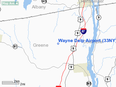
Location & QuickFacts
| FAA Information Effective: | 2008-09-25 |
| Airport Identifier: | 33NY |
| Airport Status: | Operational |
| Longitude/Latitude: | 073-51-58.4560W/42-23-58.2990N
-73.866238/42.399527 (Estimated) |
| Elevation: | 800 ft / 243.84 m (Estimated) |
| Land: | 0 acres |
| From nearest city: | 3 nautical miles NW of West Coxsackie, NY |
| Location: | Greene County, NY |
| Magnetic Variation: | 14W (1990) |
Owner & Manager
| Ownership: | Privately owned |
| Owner: | Wayne Delp |
| Address: | Rd 1 Haas Hill Road
West Coxsackie, NY 12192 |
| Phone number: | 518-731-8473 |
| Manager: | Wayne Delp |
| Address: | Rd 1 Haas Road
West Coxsackie, NY 12192 |
| Phone number: | 516-731-8473 |
Airport Operations and Facilities
| Airport Use: | Private |
| Wind indicator: | Yes |
| Segmented Circle: | No |
| Control Tower: | No |
| Sectional chart: | New York |
| Region: | AEA - Eastern |
| Boundary ARTCC: | ZBW - Boston |
| Tie-in FSS: | BTV - Burlington |
| FSS on Airport: | No |
| FSS Toll Free: | 1-800-WX-BRIEF |
Runway Information
Runway 17/35
| Dimension: | 3000 x 100 ft / 914.4 x 30.5 m |
| Surface: | TURF, |
| |
Runway 17 |
Runway 35 |
| Traffic Pattern: | Left | Left |
| Obstruction: | 200 ft tower, 1250.0 ft from runway | |
|
Radio Navigation Aids
| ID |
Type |
Name |
Ch |
Freq |
Var |
Dist |
| GBR | FAN MARKER | Sheffield | | | 13W | 27.7 nm |
| PSF | FAN MARKER | Abyss | | | 13W | 29.2 nm |
| PFH | NDB | Philmont | | 272.00 | 13W | 10.9 nm |
| GBR | NDB | Great Barrington | | 395.00 | 14W | 24.3 nm |
| HEU | NDB | Hunter | | 356.00 | 14W | 27.4 nm |
| DXT | NDB | Dalton | | 370.00 | 15W | 31.2 nm |
| JJH | NDB | Johnstown | | 523.00 | 14W | 41.5 nm |
| PO | NDB | Meier | | 403.00 | 12W | 49.7 nm |
| PWL | VOR/DME | Pawling | 090X | 114.30 | 12W | 39.7 nm |
| CTR | VOR/DME | Chester | 098X | 115.10 | 13W | 41.2 nm |
| CAM | VOR/DME | Cambridge | 097X | 115.00 | 14W | 42.5 nm |
| IGN | VOR/DME | Kingston | 123X | 117.60 | 12W | 44.2 nm |
| ALB | VORTAC | Albany | 100X | 115.30 | 13W | 21.1 nm |
| ALB | VOT | Albany County | | 108.20 | | 20.7 nm |
Remarks
- VFR; DAYLIGHT USE ONLY; TRAFFIC PATTERNS WEST OF ARPT.
Images and information placed above are from
http://www.airport-data.com/airport/33NY/
We thank them for the data!
| General Info
|
| Country |
United States
|
| State |
NEW YORK
|
| FAA ID |
33NY
|
| Latitude |
42-23-58.299N
|
| Longitude |
073-51-58.456W
|
| Elevation |
800 feet
|
| Near City |
WEST COXSACKIE
|
We don't guarantee the information is fresh and accurate. The data may
be wrong or outdated.
For more up-to-date information please refer to other sources.
|
|


