 |
|
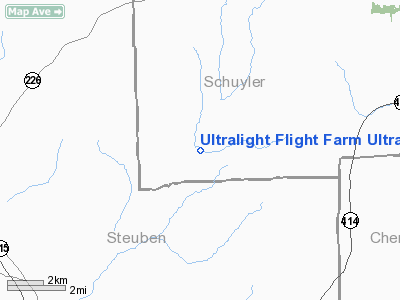
Ultralight Flight Farm Ultralight Airport |
Location & QuickFacts
| FAA Information Effective: | 2008-09-25 |
| Airport Identifier: | NK89 |
| Airport Status: | Operational |
| Longitude/Latitude: | 077-03-28.8850W/42-17-30.2660N
-77.058024/42.291741 (Estimated) |
| Elevation: | 1200 ft / 365.76 m (Estimated) |
| Land: | 55 acres |
| From nearest city: | 1 nautical miles NE of Monterey, NY |
| Location: | Schuyler County, NY |
| Magnetic Variation: | 11W (1985) |
Owner & Manager
| Ownership: | Privately owned |
| Owner: | William E. & Barbara L. Lock |
| Address: | 183 Wygant Road
Horseheads, NY 14845 |
| Phone number: | 607-739-0178 |
| Address: |
|
| Phone number: | 607-962-8361
ARPT PHONE (SUMMERS) |
Airport Operations and Facilities
| Airport Use: | Private |
| Wind indicator: | Yes |
| Segmented Circle: | No |
| Control Tower: | No |
| Landing fee charge: | No |
| Sectional chart: | Detroit |
| Region: | AEA - Eastern |
| Boundary ARTCC: | ZNY - New York |
| Tie-in FSS: | BUF - Buffalo |
| FSS on Airport: | No |
| FSS Toll Free: | 1-800-WX-BRIEF |
Airport Communications
Runway Information
Runway 10/28
| Dimension: | 1550 x 90 ft / 472.4 x 27.4 m |
| Surface: | TURF, |
| |
Runway 10 |
Runway 28 |
| Traffic Pattern: | Left | Left |
|
Runway 13/31
| Dimension: | 1800 x 85 ft / 548.6 x 25.9 m |
| Surface: | TURF, |
| |
Runway 13 |
Runway 31 |
| Traffic Pattern: | Left | Left |
| Displaced threshold: | 0.00 ft | 300.00 ft |
|
Runway 18/36
| Dimension: | 1400 x 85 ft / 426.7 x 25.9 m |
| Surface: | TURF, |
| |
Runway 18 |
Runway 36 |
| Traffic Pattern: | Left | Left |
| Displaced threshold: | 0.00 ft | 300.00 ft |
|
Radio Navigation Aids
| ID |
Type |
Name |
Ch |
Freq |
Var |
Dist |
| ALP | NDB | Alpine | | 245.00 | 12W | 13.5 nm |
| PYA | NDB | Penn Yan | | 260.00 | 12W | 21.2 nm |
| EL | NDB | Halos | | 269.00 | 09W | 39.7 nm |
| ULW | VOR/DME | Elmira | 033Y | 109.65 | 12W | 12.0 nm |
| ITH | VOR/DME | Ithaca | 055X | 111.80 | 10W | 29.2 nm |
| SFK | VOR/DME | Stonyfork | 023X | 108.60 | 08W | 39.3 nm |
| GEE | VOR/DME | Geneseo | 019X | 108.20 | 09W | 44.2 nm |
| CFB | VORTAC | Binghamton | 059X | 112.20 | 10W | 41.8 nm |
| ELZ | VORTAC | Wellsville | 051X | 111.40 | 09W | 43.7 nm |
Images and information placed above are from
http://www.airport-data.com/airport/NK89/
We thank them for the data!
| General Info
|
| Country |
United States
|
| State |
NEW YORK
|
| FAA ID |
NK89
|
| Latitude |
42-17-30.266N
|
| Longitude |
077-03-28.885W
|
| Elevation |
1200 feet
|
| Near City |
MONTEREY
|
We don't guarantee the information is fresh and accurate. The data may
be wrong or outdated.
For more up-to-date information please refer to other sources.
|
|


