 |
|
Location & QuickFacts
| FAA Information Effective: | 2008-09-25 |
| Airport Identifier: | NK23 |
| Airport Status: | Operational |
| Longitude/Latitude: | 074-28-11.0000W/41-32-55.2000N
-74.469722/41.548667 (Estimated) |
| Elevation: | 961 ft / 292.91 m (Estimated) |
| Land: | 0 acres |
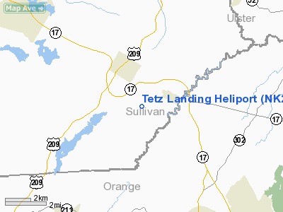
| From nearest city: | 2 nautical miles N of Bloomingburg, NY |
| Location: | Orange County, NY |
| Magnetic Variation: | () |
Owner & Manager
| Ownership: | Privately owned |
| Owner: | Gary Tetz |
| Address: | Po Box 428
Bloomingburg, NY 12721 |
| Phone number: | 845-733-1071 |
| Manager: | Gary Tetz |
| Address: | Po Box 428
Bloomingburg, NY 12721 |
| Phone number: | 845-742-5154 |
Airport Operations and Facilities
| Airport Use: | Private |
| Wind indicator: | Yes |
| Control Tower: | No |
| Sectional chart: | New York |
| Region: | AEA - Eastern |
| Boundary ARTCC: | ZBW - Boston |
| Tie-in FSS: | ISP - New York |
| FSS Toll Free: | 1-800-WX-BRIEF |
Runway Information
Helipad H1
| Dimension: | 50 x 50 ft / 15.2 x 15.2 m |
| Surface: | CONC, |
| |
Runway H1 |
Runway |
| Traffic Pattern: | Left | Left |
|
Radio Navigation Aids
| ID |
Type |
Name |
Ch |
Freq |
Var |
Dist |
| SKU | FAN MARKER | Stanwyck | | | 12W | 19.2 nm |
| SW | NDB | Neely | | 335.00 | 14W | 11.5 nm |
| SKU | NDB | Stanwyck | | 261.00 | 12W | 19.2 nm |
| MS | NDB | Monga | | 359.00 | 12W | 21.9 nm |
| PO | NDB | Meier | | 403.00 | 12W | 22.8 nm |
| PNJ | NDB | Paterson | | 347.00 | 12W | 39.0 nm |
| CAT | NDB | Chatham | | 254.00 | 11W | 48.6 nm |
| HUO | VOR/DME | Huguenot | 108X | 116.10 | 11W | 10.0 nm |
| IGN | VOR/DME | Kingston | 123X | 117.60 | 12W | 29.9 nm |
| STW | VOR/DME | Stillwater | 033X | 109.60 | 11W | 37.8 nm |
| PWL | VOR/DME | Pawling | 090X | 114.30 | 12W | 41.2 nm |
| CMK | VOR/DME | Carmel | 113X | 116.60 | 12W | 43.2 nm |
| DNY | VOR/DME | De Lancey | 058X | 112.10 | 11W | 43.7 nm |
| TEB | VOR/DME | Teterboro | 021X | 108.40 | 11W | 45.9 nm |
| BWZ | VOR/DME | Broadway | 089X | 114.20 | 11W | 47.8 nm |
| HNK | VOR/DME | Hancock | 115X | 116.80 | 11W | 48.9 nm |
| SAX | VORTAC | Sparta | 104X | 115.70 | 11W | 29.1 nm |
| LHY | VORTAC | Lake Henry | 045X | 110.80 | 10W | 45.8 nm |
Remarks
- PRVDD VFR/PVT USE; TKOF/ LDG AREA MKD; WIND INDICATOR MAINTAINED; AND COORDINATE ALL ACTIVITIES WITH WURTSBORO-SULLIVAN CO ARPT TO AVOID TRFC PATTERNS.
Images and information placed above are from
http://www.airport-data.com/airport/NK23/
We thank them for the data!
| General Info
|
| Country |
United States
|
| State |
NEW YORK
|
| FAA ID |
NK23
|
| Latitude |
42-55-17.251N
|
| Longitude |
075-24-50.619W
|
| Elevation |
1400 feet
|
| Near City |
WATERVILLE
|
We don't guarantee the information is fresh and accurate. The data may
be wrong or outdated.
For more up-to-date information please refer to other sources.
|
|


