 |
|
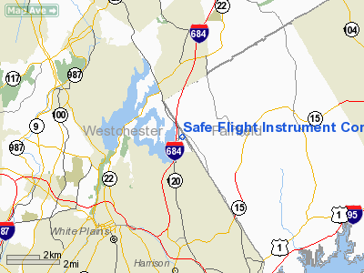
Safe Flight Instrument Corp. Heliport |
Location & QuickFacts
| FAA Information Effective: | 2008-09-25 |
| Airport Identifier: | NK84 |
| Airport Status: | Operational |
| Longitude/Latitude: | 073-42-48.0000W/41-04-52.0000N
-73.713333/41.081111 (Estimated) |
| Elevation: | 415 ft / 126.49 m (Estimated) |
| Land: | 0 acres |
| From nearest city: | 4 nautical miles NE of White Plains, NY |
| Location: | Westchester County, NY |
| Magnetic Variation: | 13W (1985) |
Owner & Manager
| Ownership: | Privately owned |
| Owner: | Safe Flight Instrument Corp. |
| Address: | New King Street
White Plains, NY 10602 |
| Phone number: | 914-946-9500 |
| Manager: | John J. Taroli |
| Address: | New King Street
White Plains, NY 10602 |
| Phone number: | 914-946-9500 |
Airport Operations and Facilities
| Airport Use: | Private |
| Wind indicator: | Yes |
| Segmented Circle: | No |
| Control Tower: | No |
| Landing fee charge: | No |
| Sectional chart: | New York |
| Region: | AEA - Eastern |
| Boundary ARTCC: | ZBW - Boston |
| Responsible ARTCC: | ZNY - New York |
| Tie-in FSS: | ISP - New York |
| FSS on Airport: | No |
| FSS Toll Free: | 1-800-WX-BRIEF |
Runway Information
Helipad H1
| Dimension: | 40 x 36 ft / 12.2 x 11.0 m |
| Surface: | CONC, |
| |
Runway H1 |
Runway |
| Traffic Pattern: | Left | Left |
|
Radio Navigation Aids
| ID |
Type |
Name |
Ch |
Freq |
Var |
Dist |
| SKU | FAN MARKER | Stanwyck | | | 12W | 30.8 nm |
| EWR | FAN MARKER | Maryann | | | 11W | 31.3 nm |
| PNJ | NDB | Paterson | | 347.00 | 12W | 21.4 nm |
| OP | NDB | Old Field Point Light | | 316.00 | 13W | 27.7 nm |
| BBN | NDB | Babylon | | 275.00 | 14W | 28.8 nm |
| SKU | NDB | Stanwyck | | 261.00 | 12W | 30.8 nm |
| OGY | NDB | Bridge | | 414.00 | 12W | 31.8 nm |
| PO | NDB | Meier | | 403.00 | 12W | 31.8 nm |
| SW | NDB | Neely | | 335.00 | 14W | 33.6 nm |
| TBY | NDB | Waterbury | | 257.00 | 14W | 37.2 nm |
| CAT | NDB | Chatham | | 254.00 | 11W | 38.4 nm |
| MMK | NDB | Meriden | | 238.00 | 14W | 47.6 nm |
| CMK | VOR/DME | Carmel | 113X | 116.60 | 12W | 13.4 nm |
| LGA | VOR/DME | La Guardia | 078X | 113.10 | 12W | 19.1 nm |
| TEB | VOR/DME | Teterboro | 021X | 108.40 | 11W | 21.1 nm |
| DPK | VOR/DME | Deer Park | 124X | 117.70 | 12W | 25.5 nm |
| JFK | VOR/DME | Kennedy | 106X | 115.90 | 12W | 27.1 nm |
| BDR | VOR/DME | Bridgeport | 25X | 108.80 | 12W | 27.1 nm |
| CRI | VOR/DME | Canarsie | 070X | 112.30 | 11W | 29.3 nm |
| IGN | VOR/DME | Kingston | 123X | 117.60 | 12W | 35.5 nm |
| HVN | VOR/DME | New Haven | 035X | 109.80 | 13W | 39.0 nm |
| PWL | VOR/DME | Pawling | 090X | 114.30 | 12W | 41.7 nm |
| CCC | VOR/DME | Calverton | 119X | 117.20 | 13W | 42.5 nm |
| HUO | VOR/DME | Huguenot | 108X | 116.10 | 11W | 44.3 nm |
| MAD | VOR/DME | Madison | 041X | 110.40 | 13W | 48.3 nm |
| SAX | VORTAC | Sparta | 104X | 115.70 | 11W | 37.4 nm |
| JFK | VOT | Kennedy | | 115.10 | | 27.0 nm |
| BDR | VOT | Bridgeport | | 109.25 | | 27.0 nm |
| ISP | VOT | Long Island Mac Arthur | | 109.40 | | 33.1 nm |
Remarks
- CONTACT IS MADE WITH WESTCHESTER ATCT PRIOR TO START OF OPERATIONS.
Images and information placed above are from
http://www.airport-data.com/airport/NK84/
We thank them for the data!
| General Info
|
| Country |
United States
|
| State |
NEW YORK
|
| FAA ID |
NK84
|
| Latitude |
41-04-52.000N
|
| Longitude |
073-42-48.000W
|
| Elevation |
415 feet
|
| Near City |
WHITE PLAINS
|
We don't guarantee the information is fresh and accurate. The data may
be wrong or outdated.
For more up-to-date information please refer to other sources.
|
|


