 |
|
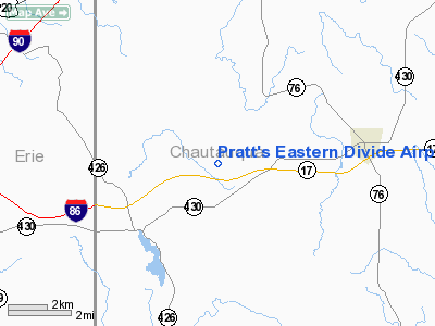
Pratt's Eastern Divide Airport |
Location & QuickFacts
| FAA Information Effective: | 2008-09-25 |
| Airport Identifier: | D88 |
| Airport Status: | Operational |
| Longitude/Latitude: | 079-41-09.1720W/42-09-00.2030N
-79.685881/42.150056 (Estimated) |
| Elevation: | 1640 ft / 499.87 m (Estimated) |
| Land: | 230 acres |
| From nearest city: | 4 nautical miles W of Sherman, NY |
| Location: | Chautauqua County, NY |
| Magnetic Variation: | 09W (1985) |
Owner & Manager
| Ownership: | Privately owned |
| Owner: | Norman F. Pratt |
| Address: | 9651 Hazen Rd
Sherman, NY 14781 |
| Phone number: | 716-761-6649 |
| Manager: | Norman F. Pratt
AMGR RESIDENCE LOCATED AT ARPT. |
| Address: | Rd 1, Hazen Rd
Sherman, NY 14781 |
| Phone number: | 716-761-6649 |
Airport Operations and Facilities
| Airport Use: | Open to public |
| Wind indicator: | Yes |
| Segmented Circle: | No |
| Control Tower: | No |
| Landing fee charge: | No |
| Sectional chart: | Detroit |
| Region: | AEA - Eastern |
| Boundary ARTCC: | ZOB - Cleveland |
| Tie-in FSS: | BUF - Buffalo |
| FSS on Airport: | No |
| FSS Toll Free: | 1-800-WX-BRIEF |
| NOTAMs Facility: | BUF (NOTAM-d service avaliable) |
Airport Communications
Airport Services
Runway Information
Runway 08/26
| Dimension: | 2600 x 75 ft / 792.5 x 22.9 m |
| Surface: | TURF, Fair Condition |
| |
Runway 08 |
Runway 26 |
| Traffic Pattern: | Left | Left |
| Obstruction: | 48 ft tree, 123 ft right of centerline | 35 ft trees, 190.0 ft from runway, 85 ft right of centerline, 5:1 slope to clear |
|
Radio Navigation Aids
| ID |
Type |
Name |
Ch |
Freq |
Var |
Dist |
| ORJ | NDB | Corry | | 258.00 | 09W | 14.4 nm |
| CQD | NDB | Cascade | | 372.00 | 08W | 18.8 nm |
| FKL | VOR | Franklin | | 109.60 | 06W | 43.4 nm |
| JHW | VOR/DME | Jamestown | 094X | 114.70 | 07W | 25.3 nm |
| DKK | VORTAC | Dunkirk | 109X | 116.20 | 07W | 27.5 nm |
| ERI | VORTAC | Erie | 031X | 109.40 | 06W | 28.2 nm |
| TDT | VORTAC | Tidioute | 123X | 117.60 | 09W | 28.9 nm |
Remarks
- ULTRALGT ON & INVOF ARPT.
Images and information placed above are from
http://www.airport-data.com/airport/D88/
We thank them for the data!
| General Info
|
| Country |
United States
|
| State |
NEW YORK
|
| FAA ID |
D88
|
| Latitude |
42-09-00.203N
|
| Longitude |
079-41-09.172W
|
| Elevation |
1640 feet
|
| Near City |
SHERMAN
|
We don't guarantee the information is fresh and accurate. The data may
be wrong or outdated.
For more up-to-date information please refer to other sources.
|
|


