 |
|
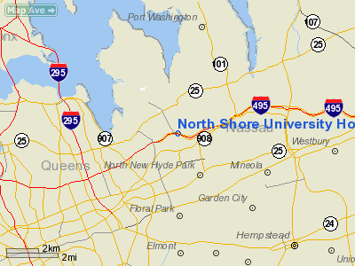
North Shore University Hospital Nr 2 Heliport |
Location & QuickFacts
| FAA Information Effective: | 2008-09-25 |
| Airport Identifier: | 6NK3 |
| Airport Status: | Operational |
| Longitude/Latitude: | 073-42-19.0000W/40-46-10.0000N
-73.705278/40.769444 (Estimated) |
| Elevation: | 200 ft / 60.96 m (Estimated) |
| Land: | 0 acres |
| From nearest city: | 1 nautical miles S of Manhasset, NY |
| Location: | Nassau County, NY |
| Magnetic Variation: | 13W (1995) |
Owner & Manager
| Ownership: | Privately owned |
| Owner: | North Shore University Hospital |
| Address: | 300 Community Dr
Manhasset, NY 11030 |
| Phone number: | 516-562-4050 |
| Manager: | John Gallagher |
| Address: | 300 Community Dr
Manhasset, NY 11030 |
| Phone number: | 516-562-4050 |
Airport Operations and Facilities
| Airport Use: | Private |
| Wind indicator: | Yes |
| Segmented Circle: | No |
| Control Tower: | No |
| Lighting Schedule: | DUSK-DAWN |
| Sectional chart: | New York |
| Region: | AEA - Eastern |
| Boundary ARTCC: | ZNY - New York |
| Tie-in FSS: | ISP - New York |
| FSS Toll Free: | 1-800-WX-BRIEF |
Runway Information
Helipad H1
| Dimension: | 40 x 40 ft / 12.2 x 12.2 m |
| Surface: | ASPH, |
| |
Runway H1 |
Runway |
| Traffic Pattern: | Left | Left |
|
Radio Navigation Aids
| ID |
Type |
Name |
Ch |
Freq |
Var |
Dist |
| EWR | FAN MARKER | Maryann | | | 11W | 22.3 nm |
| SKU | FAN MARKER | Stanwyck | | | 12W | 48.1 nm |
| OGY | NDB | Bridge | | 414.00 | 12W | 14.6 nm |
| BBN | NDB | Babylon | | 275.00 | 14W | 15.7 nm |
| PNJ | NDB | Paterson | | 347.00 | 12W | 22.9 nm |
| OP | NDB | Old Field Point Light | | 316.00 | 13W | 29.4 nm |
| CAT | NDB | Chatham | | 254.00 | 11W | 33.0 nm |
| SKU | NDB | Stanwyck | | 261.00 | 12W | 48.1 nm |
| SW | NDB | Neely | | 335.00 | 14W | 49.1 nm |
| PO | NDB | Meier | | 403.00 | 12W | 49.8 nm |
| FOK | TACAN | Suffolk Co | 047X | | 13W | 49.0 nm |
| LGA | VOR/DME | La Guardia | 078X | 113.10 | 12W | 7.9 nm |
| JFK | VOR/DME | Kennedy | 106X | 115.90 | 12W | 8.7 nm |
| CRI | VOR/DME | Canarsie | 070X | 112.30 | 11W | 12.8 nm |
| TEB | VOR/DME | Teterboro | 021X | 108.40 | 11W | 16.9 nm |
| DPK | VOR/DME | Deer Park | 124X | 117.70 | 12W | 18.3 nm |
| CMK | VOR/DME | Carmel | 113X | 116.60 | 12W | 31.2 nm |
| COL | VOR/DME | Colts Neck | 101X | 115.40 | 11W | 34.5 nm |
| BDR | VOR/DME | Bridgeport | 25X | 108.80 | 12W | 35.3 nm |
| CCC | VOR/DME | Calverton | 119X | 117.20 | 13W | 42.3 nm |
| HVN | VOR/DME | New Haven | 035X | 109.80 | 13W | 47.5 nm |
| SBJ | VOR/DME | Solberg | 076X | 112.90 | 10W | 48.6 nm |
| SAX | VORTAC | Sparta | 104X | 115.70 | 11W | 41.9 nm |
| RBV | VORTAC | Robbinsville | 085X | 113.80 | 10W | 49.7 nm |
| JFK | VOT | Kennedy | | 115.10 | | 8.8 nm |
| ISP | VOT | Long Island Mac Arthur | | 109.40 | | 27.8 nm |
| BDR | VOT | Bridgeport | | 109.25 | | 35.3 nm |
Remarks
- SEE AIRSPACE LETTER DTD 13 NOV 1997 FOR CONDITIONS.
Images and information placed above are from
http://www.airport-data.com/airport/6NK3/
We thank them for the data!
| General Info
|
| Country |
United States
|
| State |
NEW YORK
|
| FAA ID |
6NK3
|
| Latitude |
40-46-10.000N
|
| Longitude |
073-42-19.000W
|
| Elevation |
200 feet
|
| Near City |
MANHASSET
|
We don't guarantee the information is fresh and accurate. The data may
be wrong or outdated.
For more up-to-date information please refer to other sources.
|
|


