 |
|
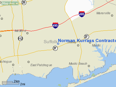
Norman Kurrass Contractor Heliport |
Location & QuickFacts
| FAA Information Effective: | 2008-09-25 |
| Airport Identifier: | 9NY5 |
| Airport Status: | Operational |
| Longitude/Latitude: | 072-55-00.3760W/40-48-01.3540N
-72.916771/40.800376 (Estimated) |
| Elevation: | 30 ft / 9.14 m (Estimated) |
| Land: | 0 acres |
| From nearest city: | 4 nautical miles E of Patchogue, NY |
| Location: | Suffolk County, NY |
| Magnetic Variation: | 14W (1985) |
Owner & Manager
| Ownership: | Privately owned |
| Owner: | Norman Kurrass |
| Address: | 445 Americus Ave Box 2015
East Patchoque, NY 11772 |
| Phone number: | 516-286-9022 |
| Address: |
|
Airport Operations and Facilities
| Airport Use: | Private |
| Wind indicator: | Yes |
| Segmented Circle: | No |
| Control Tower: | No |
| Landing fee charge: | No |
| Sectional chart: | New York |
| Region: | AEA - Eastern |
| Boundary ARTCC: | ZBW - Boston |
| Responsible ARTCC: | ZNY - New York |
| Tie-in FSS: | ISP - New York |
| FSS on Airport: | No |
| FSS Toll Free: | 1-800-WX-BRIEF |
Airport Services
| Airframe Repair: | NONE |
| Power Plant Repair: | NONE |
Runway Information
Helipad H1
| Dimension: | 150 x 100 ft / 45.7 x 30.5 m |
| Surface: | CONC, |
| |
Runway H1 |
Runway |
| Traffic Pattern: | Left | Left |
| Centerline Lights: | No | |
|
Radio Navigation Aids
| ID |
Type |
Name |
Ch |
Freq |
Var |
Dist |
| OP | NDB | Old Field Point Light | | 316.00 | 13W | 14.0 nm |
| BBN | NDB | Babylon | | 275.00 | 14W | 22.6 nm |
| MMK | NDB | Meriden | | 238.00 | 14W | 42.9 nm |
| TBY | NDB | Waterbury | | 257.00 | 14W | 45.0 nm |
| OGY | NDB | Bridge | | 414.00 | 12W | 46.2 nm |
| FOK | TACAN | Suffolk Co | 047X | | 13W | 13.2 nm |
| CCC | VOR/DME | Calverton | 119X | 117.20 | 13W | 9.4 nm |
| DPK | VOR/DME | Deer Park | 124X | 117.70 | 12W | 17.6 nm |
| BDR | VOR/DME | Bridgeport | 25X | 108.80 | 12W | 23.6 nm |
| HVN | VOR/DME | New Haven | 035X | 109.80 | 13W | 27.8 nm |
| MAD | VOR/DME | Madison | 041X | 110.40 | 13W | 32.5 nm |
| JFK | VOR/DME | Kennedy | 106X | 115.90 | 12W | 40.2 nm |
| CMK | VOR/DME | Carmel | 113X | 116.60 | 12W | 41.7 nm |
| LGA | VOR/DME | La Guardia | 078X | 113.10 | 12W | 43.7 nm |
| CRI | VOR/DME | Canarsie | 070X | 112.30 | 11W | 46.0 nm |
| HTO | VORTAC | Hampton | 083X | 113.60 | 13W | 28.2 nm |
| ISP | VOT | Long Island Mac Arthur | | 109.40 | | 8.1 nm |
| BDR | VOT | Bridgeport | | 109.25 | | 23.7 nm |
| JFK | VOT | Kennedy | | 115.10 | | 40.5 nm |
Images and information placed above are from
http://www.airport-data.com/airport/9NY5/
We thank them for the data!
| General Info
|
| Country |
United States
|
| State |
NEW YORK
|
| FAA ID |
9NY5
|
| Latitude |
40-48-01.354N
|
| Longitude |
072-55-00.376W
|
| Elevation |
30 feet
|
| Near City |
PATCHOGUE
|
We don't guarantee the information is fresh and accurate. The data may
be wrong or outdated.
For more up-to-date information please refer to other sources.
|
|


