 |
|
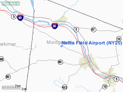
Location & QuickFacts
| FAA Information Effective: | 2008-09-25 |
| Airport Identifier: | NY20 |
| Airport Status: | Operational |
| Longitude/Latitude: | 074-40-43.5200W/42-57-30.2590N
-74.678756/42.958405 (Estimated) |
| Elevation: | 700 ft / 213.36 m (Estimated) |
| Land: | 20 acres |
| From nearest city: | 3 nautical miles NW of Fort Plain, NY |
| Location: | Montgomery County, NY |
| Magnetic Variation: | 13W (1985) |
Owner & Manager
| Ownership: | Privately owned |
| Owner: | Gorge Valentine, Jr. |
| Address: | 83 West 8th
Harrison, NY 13339 |
| Phone number: | 518-493-2456 |
| Manager: | John R. Nellis |
| Address: | Rfd 1,
Fort Plain, NY 13339 |
| Phone number: | 518-568-2188 |
Airport Operations and Facilities
| Airport Use: | Private |
| Wind indicator: | Yes |
| Segmented Circle: | No |
| Control Tower: | No |
| Landing fee charge: | No |
| Sectional chart: | New York |
| Region: | AEA - Eastern |
| Boundary ARTCC: | ZBW - Boston |
| Tie-in FSS: | BUF - Buffalo |
| FSS on Airport: | No |
| FSS Toll Free: | 1-800-WX-BRIEF |
Airport Communications
Airport Services
| Bottled Oxygen: | NONE |
| Bulk Oxygen: | NONE |
Runway Information
Runway 13/32
| Dimension: | 2750 x 20 ft / 838.2 x 6.1 m |
| Surface: | ASPH, |
| Weight Limit: | Single wheel: 15000 lbs. |
| |
Runway 13 |
Runway 32 |
| Traffic Pattern: | Left | Left |
| Markings: | Nonstandard, Poor Condition | Nonstandard, Poor Condition |
| Displaced threshold: | 0.00 ft | 475.00 ft |
| Runway End Identifier: | No | No |
| Centerline Lights: | No | No |
| Touchdown Lights: | No | No |
| Obstruction: | 34 ft pline, 1360.0 ft from runway, 34:1 slope to clear
2' ROAD 35' FROM THR. | 31 ft pline, 300.0 ft from runway, 100 ft right of centerline, 3:1 slope to clear
4' ROAD 25' FROM THR. |
|
Radio Navigation Aids
| ID |
Type |
Name |
Ch |
Freq |
Var |
Dist |
| JJH | NDB | Johnstown | | 523.00 | 14W | 15.4 nm |
| CJY | NDB | Clay | | 275.00 | 12W | 26.4 nm |
| HEU | NDB | Hunter | | 356.00 | 14W | 33.4 nm |
| BK | NDB | Plein | | 329.00 | 12W | 38.7 nm |
| GSS | TACAN | Griffiss | 057X | | 12W | 36.1 nm |
| RKA | VOR/DME | Rockdale | 073X | 112.60 | 11W | 38.6 nm |
| DNY | VOR/DME | De Lancey | 058X | 112.10 | 11W | 48.5 nm |
| UCA | VORTAC | Utica | 049X | 111.20 | 12W | 21.7 nm |
| ALB | VORTAC | Albany | 100X | 115.30 | 13W | 40.6 nm |
| ALB | VOT | Albany County | | 108.20 | | 39.9 nm |
Remarks
Images and information placed above are from
http://www.airport-data.com/airport/NY20/
We thank them for the data!
| General Info
|
| Country |
United States
|
| State |
NEW YORK
|
| FAA ID |
NY20
|
| Latitude |
42-57-30.259N
|
| Longitude |
074-40-43.520W
|
| Elevation |
700 feet
|
| Near City |
FORT PLAIN
|
We don't guarantee the information is fresh and accurate. The data may
be wrong or outdated.
For more up-to-date information please refer to other sources.
|
|


